Toggle navigation
LMEC Home
Exhibitions
Georeferencing
Tools for Teachers
Collections
My Favorites
Sign Up / Log In
Search
Search the map portal
Map Collection
Map Collection
Map Sets
Search
Search
Search for
Search In
All Fields
Creator
Title
Subject
Place
Search All Digital Collections
Advanced Search
1037 Results
My Search
Start Over
More Like
commonwealth:n8710p94g
Remove constraint More Like: commonwealth:n8710p94g
Filter your Search
Place
North and Central America
1,033
United States
1,028
Suffolk (county)
1,012
Boston
1,011
Massachusetts
702
Roxbury
53
South End
45
Downtown Boston
40
more
Place
»
Topic
Boston (Mass.)--Maps
740
City planning--Massachusetts--Boston--Maps
365
Urban renewal--Massachusetts--Boston--Maps
234
Real property--Massachusetts--Boston--Maps
130
Land use--Massachusetts--Boston--Maps
97
Buildings--Massachusetts--Boston--Maps
84
Landowners--Massachusetts--Boston--Maps
75
Local transit--Massachusetts--Boston--Maps
57
more
Topic
»
Date
Date range begin
–
Date range end
Current results range from
1743
to
2023
View distribution
Creator
Boston Redevelopment Authority
356
Geo. H. Walker & Co
27
Boynton, George W., d. 1884
21
Sampson, Davenport & Co
21
Sampson, Murdock & Co
20
Bromley, George Washington
18
Bromley, Walter Scott
17
Lufkin, Richard F. (Richard Friend)
17
more
Creator
»
Format
Maps/Atlases
1,037
Manuscripts
9
Prints
1
Georeferenced
Yes
100
No
937
Collection
Boston and New England Maps
857
Urban Maps
763
Norman B. Leventhal Map & Education Center Collection
615
Boston Redevelopment Authority Collection
404
American Revolutionary War-Era Maps
25
Mapping Boston Collection
20
Massachusetts Real Estate Atlases
12
William L. Clements Library Collection
10
more
Collection
»
Available to use
No known restrictions
969
Creative Commons license
34
Search Constraints
Sort by relevance
relevance
title
date (asc)
date (desc)
Number of results to display per page
100 per page
10
per page
20
per page
50
per page
100
per page
View results as:
grid view
map view
Search Results
1.
The Boston Public Libraries
2.
Boston Public Library
3.
Sketch map of Boston and the Public Library system
4.
Sketch map of Boston and the Public Library system
5.
Sketch map of Boston and the Public Library system
6.
Back Bay study
7.
1975 general land use plan
8.
Boston proper
9.
Boston public schools and police reporting areas
10.
Boston thorofare plan existing routes and proposals
11.
Boston University, Charles River campus master plan
12.
Boston urban wilds
13.
Campus High School urban renewal area Mass. r- : locality map blighted areas
14.
Campus High School urban renewal area Mass. r- : locality map important features
15.
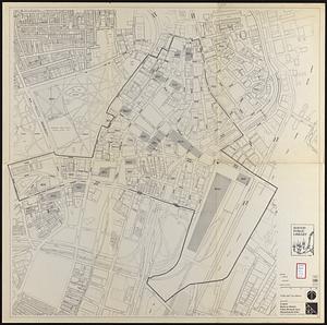
Central business district project no Mass r- : existing land use
16.
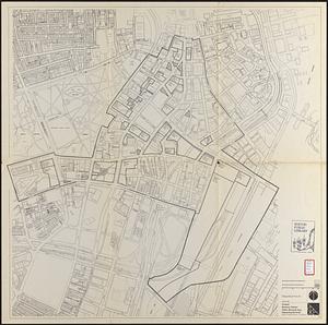
Central business district project no Mass r- : existing building condition
17.
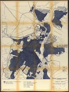
Central business district project no Mass r- : locality map 2
18.
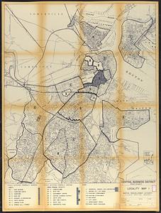
Central business district project no Mass r- : locality map 1
19.
Central business district urban renewal area Massachusetts r-82 : pedestrian circulation
20.
Central business district urban renewal area Massachusetts r-82 : vehicular circulation
21.
Central business district urban renewal area Massachusetts r-82 : disposition parcels
22.
Central business district urban renewal area Massachusetts r-82 : acquisition plan
23.
Central business district urban renewal area Massachusetts r-82 : street adjustments
24.
Central business district urban renewal area Massachusetts r-82 : zoning plan
25.
Central business district urban renewal area Massachusetts r-82 : illustrative site plan
26.
Central business district urban renewal area, Massachusetts r-82 : illustrative site plan
27.
Central business district urban renewal area, Massachusetts r-82 : illustrative site plan
28.
Central business district urban renewal area Massachusetts r-82 : disposition parcels
29.
Central business district urban renewal area Massachusetts r-82 : illustrative site plan
30.
Central business district urban renewal area Massachusetts r-82 : zoning
31.
Central business district urban renewal area Massachusetts r-82 : proposed land use
32.
Central business district urban renewal area Massachusetts r-82 : property map
33.
Central business district urban renewal area Massachusetts r-82 A,B,C : disposition parcels
34.
Central business district urban renewal area Massachusetts r-82 A,B,C : proposed land use
35.
Central business district urban renewal area Massachusetts r-82 A,B,C : zoning
36.
Central business district urban renewal area r-82 : parcel acquisition map
37.
Central business district urban renewal area r-82 : existing land use
38.
Central business district urban renewal area r-82 : building deficiencies
39.
Charlestown renewal area : location map
40.
Charlestown renewal area : blighted areas
41.
City of Boston zoning map
42.
Conceptual plan
43.
Conceptual plan
44.
Contract documents for the Waterfront Park, Boston, Massachusetts : planting plan
45.
Cultural facilities conceptual plan
46.
Disposition parcel plan, central area
47.
Downtown and neighborhood cultural facilities
48.
Downtown Boston
49.
Downtown existing buildings conditions
50.
Downtown project no. Mass. r-46 : existing and proposed community facilities
51.
Downtown project no. Mass. r-46 : proposed circulation and boundary adjustments
52.
Downtown project no. Mass. r-46 : existing land use
53.
Downtown Waterfront Faneuil Hall renewal area : locality map 1
54.
Downtown waterfront-Faneuil Hall project urban renewal area Massachusetts R-77 : illustrative site plan
55.
Downtown waterfront-Faneuil Hall project urban renewal area Massachusetts R-77 : illustrative site plan
56.
Downtown waterfront-Faneuil Hall project urban renewal area Massachusetts R-77 : existing and proposed zoning
57.
Downtown waterfront-Faneuil Hall project urban renewal area Massachusetts R-77 : existing and proposed zoning
58.
Downtown Waterfront-Faneuil Hall renewal area : existing land use
59.
Downtown Waterfront-Faneuil Hall renewal area : building conditions
60.
Downtown Waterfront-Faneuil Hall renewal area : locality map 2
61.
Downtown waterfront-Faneuil Hall urban area Massachusetts R-77 : existing and proposed zoning
62.
Downtown waterfront-Faneuil Hall urban area Massachusetts R-77 : proposed land use
63.
Downtown waterfront-Faneuil Hall urban renewal area Massachusetts R-77 : proposed land use
64.
Downtown waterfront-Faneuil Hall urban renewal area Massachusetts R-77 : proposed land use
65.
Downtown waterfront-Faneuil Hall urban renewal area Massachusetts R-77 : proposed land use
66.
Downtown waterfront-Faneuil Hall urban renewal area Massachusetts R-77 : street adjustments
67.
Downtown waterfront-Faneuil Hall urban renewal area Massachusetts R-77 : property
68.
Downtown waterfront-Faneuil Hall urban renewal area Massachusetts R-77 : property
69.
Fenway urban renewal area, Massachusetts R-115 : illustrative site plan
70.
Illustrative re-use site plan for the regional core
71.
Index to planning districts
72.
Inner belt, Southwest Expressway
73.
Locality map
74.
Marketplace Center : topographical survey plan
75.
Mass pike air rights study
76.
Midtown area plan for the public realm
77.
Midtown improvement area
78.
NASA Electronic Research Center : evaluation of proposed sites in Boston
79.
Neighborhood boundaries 1980
80.
North Harvard project area : locality map
81.
Off-street parking inventory within Boston proper
82.
Open space management program index map
83.
Parcel D-10
84.
Park Plaza : illustrative site plan
85.
Park Plaza : illustrative site plan showing alternate apartment building configuration
86.
Park Plaza traffic improvements & grade level controls
87.
Park Plaza urban renewal area : environmental deficiencies and blighting influences map
88.
Park Plaza urban renewal area : map no. 4 building deficiencies map
89.
Park Plaza urban renewal area : map no. 5 ownership data map
90.
Park Plaza urban renewal area : map no. 2 land use map (existing)
91.
Park Plaza urban renewal area : map no. 1 boundary map
92.
Park Plaza urban renewal area : map no. 6 land disposal map
93.
Plan of the route of pipes from Jamaica Pond, in Roxbury to the reservoir, in Boston
94.
Port facilities at Boston, MA
95.
Public open space city of Boston
96.
Relationship between selected recreation sites and public transportation facilities Boston metropolitan area 1971
97.
Report on improvements to the Boston main drainage system
98.
Report on the alternate master highway plan for the Boston metropolitan area
99.
South Cove project no Mass r- : locality map 2
100.
South Cove project no Mass r- : locality map 1
‹ Prev
Next ›
1
2
3
4
5
…
10
11