Downtown waterfront-Faneuil Hall urban area Massachusetts R-77 : proposed land use
Item Information
- Title:
- Downtown waterfront-Faneuil Hall urban area Massachusetts R-77 : proposed land use
- Description:
-
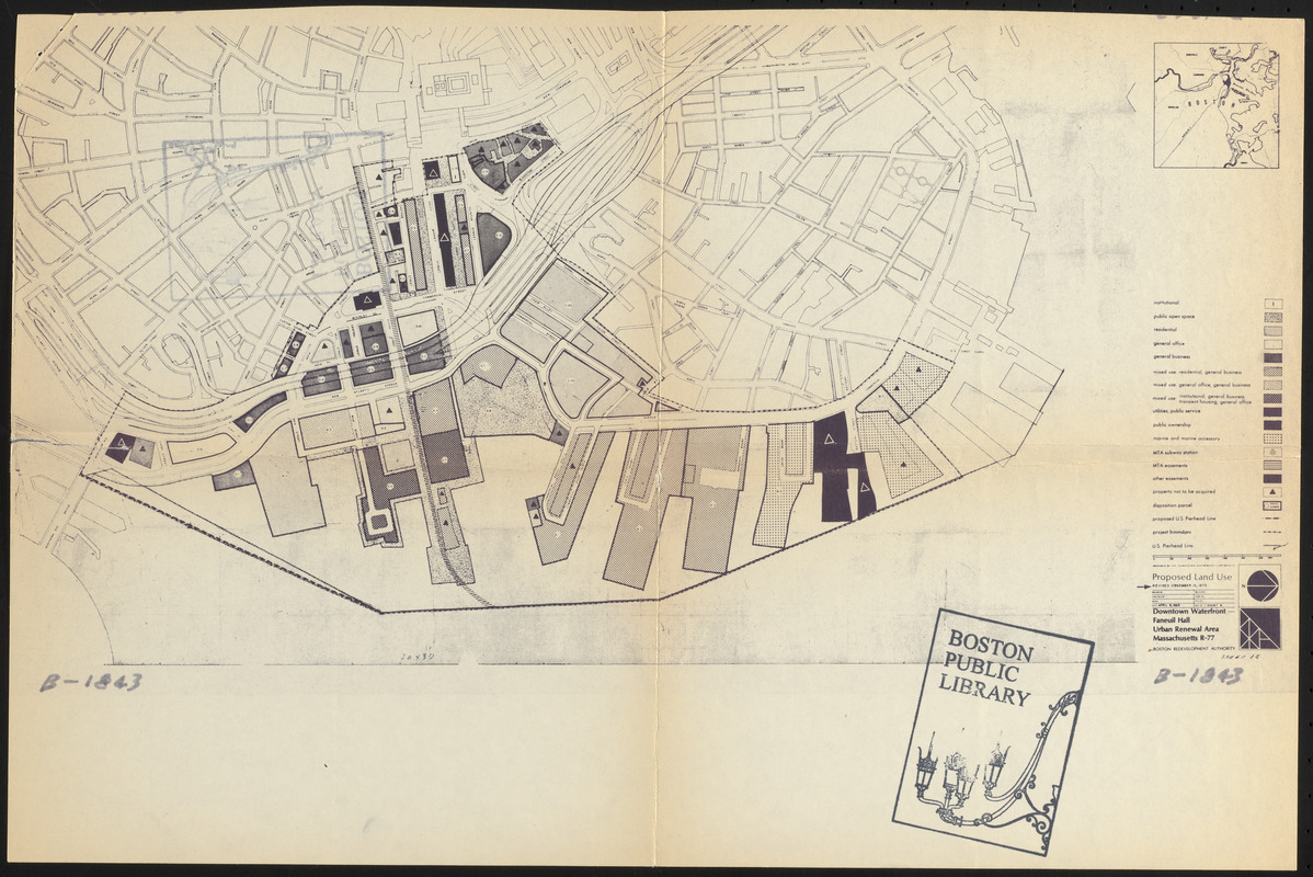
Accompanies a plan dated April 15, 1964, amended April 8, 1965, that includes proposed urban renewal action, property to be acquired, proposed land use, building requirements and other controls, redeveloper's obligations, rehabilitation and modification and termination.
- Cartographer:
- Boston Redevelopment Authority
- Date:
-
April 8, 1965
- Format:
-
Maps/Atlases
- Location:
-
Boston Public Library
Central Library in Copley Square - Collection (local):
-
Boston Public Library Collection
- Subjects:
-
Real property--Massachusetts--Boston--Maps
Waterfronts--Massachusetts--Boston--Maps
Land use--Massachusetts--Boston--Maps
City planning--Massachusetts--Boston--Maps
Boston (Mass.)--Maps
Faneuil Hall (Boston, Mass.)
- Places:
-
Suffolk (county)Boston
- Extent:
- 1 map ; 23 x 46 cm, on sheet 31 x 46 cm
- Terms of Use:
-
No known copyright restrictions.
No known restrictions on use.
- Publisher:
-
[Boston] :
Boston Revelopment Authority
- Scale:
-
Scale approximately 1:6,200
- Language:
-
English
- Catalog Record:
-
http://bpl.bibliocommons.com/item/show/1014701075
- Identifier:
-
06_01_017183A
- Call #:
-
BRA/4582 MAP 2
- Barcode:
-
mq6311441


