Toggle navigation
LMEC Home
Exhibitions
Georeferencing
Tools for Teachers
Collections
My Favorites
Sign Up / Log In
Search
Search the map portal
Map Collection
Map Collection
Map Sets
Search
Search
Search for
Search In
All Fields
Creator
Title
Subject
Place
Search All Digital Collections
Advanced Search
8399 Results
My Search
Start Over
More Like
commonwealth:m900r828c
Remove constraint More Like: commonwealth:m900r828c
Filter your Search
Place
North and Central America
5,148
United States
3,836
Suffolk (county)
1,258
Boston
1,231
Europe
963
Canada
427
Massachusetts
282
France
269
more
Place
»
Topic
Boston (Mass.)--Maps
741
United States--Maps
270
Real property--Massachusetts--Boston--Maps
252
City planning--Massachusetts--Boston--Maps
194
Landowners--Massachusetts--Boston--Maps
169
Massachusetts--Maps
163
Urban renewal--Massachusetts--Boston--Maps
106
North America--Maps--Early works to 1800
103
more
Topic
»
Date
Date range begin
–
Date range end
Current results range from
1482
to
2023
View distribution
Creator
United States. Hydrographic Office
357
Boston Redevelopment Authority
199
O.H. Bailey & Co
148
Des Barres, Joseph F. W. (Joseph Frederick Wallet), 1722-1824
124
United States. Post Office Dept
120
Ptolemy, 2nd cent
100
Walling, Henry Francis, 1825-1888
94
Bromley, George Washington
86
more
Creator
»
Format
Maps/Atlases
8,340
Manuscripts
215
Prints
51
Books
36
Objects/Artifacts
10
Drawings/Illustrations
8
Posters
4
Georeferenced
Yes
885
No
7,514
Collection
Norman B. Leventhal Map Center Collection
8,192
Boston and New England Maps
2,352
Urban Maps
2,087
Maritime Charts and Atlases
750
American Revolutionary War-Era Maps
638
Boston Redevelopment Authority Collection
233
Massachusetts Real Estate Atlases
38
Mapping Boston Collection
20
more
Collection
»
Available to use
No known restrictions
8,177
Creative Commons license
69
Search Constraints
Sort by relevance
relevance
title
date (asc)
date (desc)
Number of results to display per page
100 per page
10
per page
20
per page
50
per page
100
per page
View results as:
grid view
map view
Search Results
101.
Plan of Church St. district, showing estates and buildings : as proposed to be taken by the city of Boston under the Act of the...
102.
Plan of estate, nos 1043 to 1059 Washington Street, Boston, belonging to the heirs of the late William Brigham : to be sold by...
103.
Plan of Fort Hill showing street improvements as adopted by the city council : 1869
104.
Plan of Gray's Wharf, to be sold at public auction, on the premises, on Thursday April 28th 1870 at 12 o'clock noon
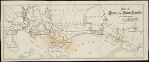
105.
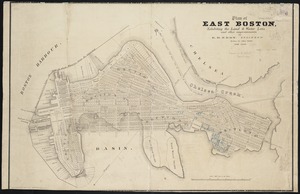
Plan of land & wharves belonging to Mill Pond Wharf Co. near Bartons Point
106.
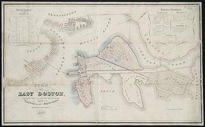
Plan of land on Bedford and Avon Streets belonging to the proprietors of the Second Church in Boston : to be sold by public...
107.
Plan of lands on the Back Bay belonging to the Boston Water Power Co., the Commonwealth and other parthies [i.e. parties],...
108.
[Plan of lots in Chinatown (Boston), between Avery and Eliot Streets, and Tremont Street and Harrison Avenue]
109.
Plan of Public library lot
110.
Plan of real estate on Cambridge Street near Bowdoin Square, belonging to the heirs of the late Deacon Moses : to be sold by...
111.
[Plan of real estate on Pearl Street, Boston]
112.
Plan of store lots near Haymarket Square : belonging to the estate of Josiah Quincy Jr. : to be sold by public auction on...
113.
Plan of the Coffin Estate, corner of Summer and Chauncy Streets : to be sold by public auction on Wednesday April 26th 1856 at...
114.
Plan of the estate on the southerly corner of Washington and Franklin Streets : to be sold by public auction on Saturday June...
115.
Plan of the estates nos. 246 to 252 Congress corner of Purchase Street and nos. 59 to 69 Purchase Street : to be sold by public...
116.
Plan of the Hutchinson Estate on the corner of Hanover & Clark Streets : to be sold by public auction on Monday Feby. 20th 1871...
117.
Plan of the South Cove
118.
Plan of two lots of valuable land in Washington Village, South Boston : to be sold at Public Auction, on Wednesday April 22d...
119.
A rough and inaccurate sketch of the streets of Boston as they are supposed to have been first laid out & the owners of the...
120.
Atlas of Dorchester, West Roxbury and Brighton, city of Boston
121.
Atlas of Suffolk, county, vol. 7th, late town of Brighton, now ward 19 of Boston, Massachusetts : from actual survey & official...
122.
Atlas of the city of Boston : Brighton : from actual surveys and official plans
123.
Atlas of the city of Boston : Charlestown : from actual surveys and official plans
124.
Atlas of the city of Boston : Charlestown and Brighton, volume six : from actual surveys and official records
125.
Atlas of the city of Boston : Charlestown, Mass. : volume ten : from actual surveys and official plans
126.
Atlas of the city of Boston : Dorchester : from actual surveys and official plans
127.
Atlas of the city of Boston : Dorchester : from actual surveys and official plans
128.
Atlas of the city of Boston : Dorchester : from actual surveys and official plans
129.
Atlas of the city of Boston : Dorchester : volume three : from actual surveys and official records
130.
Atlas of the city of Boston : Dorchester, Mass., vol. 5 : from actual surveys and official plans
131.
Atlas of the city of Boston : Dorchester, Mass., vol. 5 : from actual surveys and official plans
132.
Atlas of the city of Boston : Dorchester, Mass., vol. 5 : from actual surveys and official plans
133.
Atlas of the city of Boston : Roxbury : from actual surveys and official plans
134.
Atlas of the city of Boston : Roxbury : from actual surveys and official plans
135.
Atlas of the city of Boston : Roxbury : from actual surveys and official plans
136.
Atlas of the city of Boston : Roxbury : volume two : from actual surveys and official records
137.
Atlas of the city of Boston : Roxbury, Mass. : volume four : from actual surveys and official records
138.
Atlas of the city of Boston : Roxbury, Mass. : volume three : from actual surveys and official records
139.
Atlas of the city of Boston : South Boston : from actual surveys and official plans
140.
Atlas of the city of Boston : South Boston : from actual surveys and official plans
141.
Atlas of the city of Boston : South Boston : from actual surveys and official plans
142.
Atlas of the city of Boston : volume 6 : West Roxbury : from actual surveys and official plans
143.
Atlas of the city of Boston : volume 6 : West Roxbury : from actual surveys and official plans
144.
Atlas of the city of Boston : volume 7: Brighton : from actual surveys and official plans
145.
Atlas of the city of Boston : ward 25, Brighton : from actual surveys and official plans
146.
Atlas of the city of Boston : ward 26, Hyde Park : from actual surveys and official plans
147.
Atlas of the city of Boston : wards 25 & 26, Brighton : from actual surveys and official plans
148.
Atlas of the city of Boston : West Roxbury : from actual surveys and official plans
149.
Atlas of the city of Boston : West Roxbury : from actual surveys and official plans
150.
Atlas of the city of Boston : West Roxbury : volume five : from actual surveys and official records
151.
Atlas of the city of Boston, volume eight, South Boston, Mass. : from actual surveys and official plans
152.
Atlas of the city of Boston, volume five, Dorchester Mass. : from actual surveys and official plans
153.
Atlas of the city of Boston, volume seven, Brighton, Mass. : from actual surveys and official plans
154.
Atlas of the city of Boston, West Roxbury, Mass., volume six : from actual surveys and official plans
155.
Atlas of the city of Medford, Middlesex County, Mass. ; Atlas of the town of Hyde Park, Norfolk County, Mass. ; Atlas of the...
156.
Atlas of the county of Suffolk, Massachusetts : vol. 2nd late city of Roxbury, now wards 13-14 and 15, city of Boston
157.
Atlas of the county of Suffolk, Massachusetts : vol. 3rd including Boston and Dorchester : from actual surveys and official...
158.
Atlas of the county of Suffolk, Massachusetts : vol. 5th, West Roxbury, now ward 17, Boston : from actual survey & official...
159.
Atlas of the county of Suffolk, Massachusetts : vol. 6th including the late city of Charlestown, now wards 20,21 and 22, city...
160.
Boylston Street : Fenway to Massachusetts Avenue
161.
Copies of plans of various parts of Brookline and Roxbury
162.
Plan of 82 building lots, in the town of Brighton, comprising 48 acres of the Parkman Farm next the estate of Saml. Bigelow...
163.
Plan of city lands and streets s.w. of Dover St : prepared from new surveys
164.
Plan of house lots in Boston belonging to Otis H. Weed
165.
Plan of land and street layout in Boston, Mass., Hyde Park : prepared for the Stoney Brook Land Trust
166.
[Plan of real estate in Charlestown, showing park laid out]
167.
Plan of region west of Back Bay Park, Boston, Mass. : proposed improvements
168.
Plan of the estate of the late Joseph Head Esq. to be sold at auction, Oct. 8th 1841
169.
[Plan of the land at Prince Street and Snowhill Street, Boston]
170.
Real estate on Milk & Oliver Sts. belonging to the Boston Mang. Co. & Merrimack Mang. Co. to be sold on Friday, March 15th 1844...
171.
Insurance map of Boston vol. 3 (South & East Boston)
172.
A plan of a survey of Noddles Island
173.
Plan of Boston Land Co's land in Boston & Revere
174.
Plan of East Boston : exhibiting the land & water lots and other improvements
175.
Plan of East Boston
176.
Plan of East Boston showing the land and water lots sold and unsold : also all buildings and other improvements
177.
Plan of estate of the Boston Land Co. and surroundings
178.
Plan of Orient Heights, Boston, Mass
179.
Plan of property of the National Dock & Warehouse Co. East Boston
180.
Preliminary plan for Wood Island Park, East Boston
181.
West Wood Island Park, East Boston district
182.
Central business district urban renewal area Massachusetts r-82 : acquisition plan
183.
Central business district urban renewal area Massachusetts r-82 : property map
184.
Downtown waterfront-Faneuil Hall urban area Massachusetts R-77 : existing and proposed zoning
185.
Downtown waterfront-Faneuil Hall urban area Massachusetts R-77 : proposed land use
186.
Downtown waterfront-Faneuil Hall urban renewal area Massachusetts R-77 : property
187.
Downtown waterfront-Faneuil Hall urban renewal area Massachusetts R-77 : property
188.
Park Plaza urban renewal area : environmental deficiencies and blighting influences map
189.
Park Plaza urban renewal area : map no. 5 ownership data map
190.
Park Plaza urban renewal area : map no. 6 land disposal map
191.
South Station development study : parcel plan
192.
Waterfront land inventory South Boston : CRP port study
193.
Atlas of Dorchester, West Roxbury, and Brighton, City of Boston
194.
Atlas of the city of Boston : West Roxbury
195.
Atlas of the city of Boston : Dorchester
196.
Atlas of the city of Boston : Dorchester
197.
Atlas of the city of Boston : Dorchester, Mass., vol. 5
198.
Atlas of the city of Boston : South Boston
199.
Atlas of the city of Boston : volume 7, Brighton
200.
Atlas of the city of Boston : vol. 5, West Roxbury
‹ Prev
Next ›
1
2
3
4
5
6
…
83
84


![Plan of lands on the Back Bay belonging to the Boston Water Power Co., the Commonwealth and other parthies [i.e. parties], showing the system of streets, grades and sewers as laid out and recommended by the Back Bay Commissioners](https://bpldcassets.blob.core.windows.net/derivatives/images/commonwealth:1257bb305/image_thumbnail_300.jpg)
![[Plan of lots in Chinatown (Boston), between Avery and Eliot Streets, and Tremont Street and Harrison Avenue]](https://bpldcassets.blob.core.windows.net/derivatives/images/commonwealth:cj82kz565/image_thumbnail_300.jpg)


![[Plan of real estate on Pearl Street, Boston]](https://bpldcassets.blob.core.windows.net/derivatives/images/commonwealth:9s161d705/image_thumbnail_300.jpg)


![[Plan of real estate in Charlestown, showing park laid out]](https://bpldcassets.blob.core.windows.net/derivatives/images/commonwealth:1257bb01q/image_thumbnail_300.jpg)


![[Plan of the land at Prince Street and Snowhill Street, Boston]](https://bpldcassets.blob.core.windows.net/derivatives/images/commonwealth:4m90f3650/image_thumbnail_300.jpg)