Atlas of the city of Medford, Middlesex County, Mass. ; Atlas of the town of Hyde Park, Norfolk County, Mass. ; Atlas of the town of Wellesley, Norfolk County, Mass.

Item Information
- Title:
- Atlas of the city of Medford, Middlesex County, Mass. ; Atlas of the town of Hyde Park, Norfolk County, Mass. ; Atlas of the town of Wellesley, Norfolk County, Mass.
- Title (alt.):
-
Atlas of the town of Hyde Park, Norfolk County, Mass.
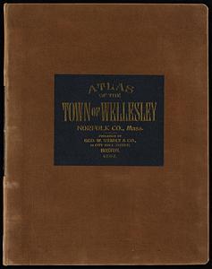
Atlas of the town of Wellesley, Norfolk County, Mass.
Medford, Wellesley, Hyde Park
Plan of the town of Medford ... surveyed in 1830
Plan of the town of Medford ... surveyed in 1794
- Publisher:
- Geo. W. Stadly & Co.
- Date:
-
1897–1899
- Format:
-
Maps/Atlases
- Location:
-
Boston Public Library
Norman B. Leventhal Map & Education Center - Collection (local):
-
Norman B. Leventhal Map & Education Center Collection
- Subjects:
-
Medford (Mass.)--Maps
Real property--Massachusetts--Medford--Maps
Landowners--Massachusetts--Medford--Maps
Hyde Park (Boston, Mass.)--Maps
Real property--Massachusetts--Boston--Maps
Landowners--Massachusetts--Boston--Maps
Wellesley (Mass.)--Maps
Real property--Massachusetts--Wellesley--Maps
Landowners--Massachusetts--Wellesley--Maps
- Places:
-
MassachusettsMiddlesex (county)Medford
MassachusettsSuffolk (county)Boston
MassachusettsNorfolk (county)Wellesley
- Extent:
- 3 atlases in 1 v. ([4], 22 [i.e. 44] leaves, [4] p., 12 leaves (double), [4] p., [1], 19 leaves (double)) : maps (some col.) ; 58 cm.
- Terms of Use:
-
No known copyright restrictions.
No known restrictions on use.
- Publisher:
-
Boston :
Geo. W. Stadly & Co.
- Language:
-
English
- Notes:
-
Three separately published atlases bound together in 1 volume.
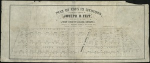
Maps show building materials (brick, stone, frame), stables, water lines, sewers, house-numbers, names of property owners, and square footage/acreage.
Includes numerous manuscript annotations, and two zoning maps of Wellesley pasted to fly leaf.
Includes street indexes and index maps for each atlas.
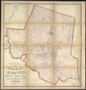
Medford atlas double sheets numbered 20 and 21 contain facsimiles: Map of the town of Medford, Middlesex County, Mass. / surveyed by order of the town, under the direction of H.F. Walling, Supt. of the State Map. Boston, 1855 -- A plan of the town of Medford in the county of Middlesex and Commonwealth of Massachusetts / surveyed 1794 by Peter Tufts, Jun'r (original in Archives of the Commonwealth. Maps and Plans. 1794 series. Vol. 1, n. 16, register no. 1191) -- A plan of the town of Medford in the county of Middlesex / surveyed in 1830 by John Sparrell (original in Archives of the Commonwealth, Maps and Plans. 1830 series. Vol. 3, n. 10, register no. 2032).
Wellesley atlas leaf 19: Reproduction (not in fac-simile) of a part of the Map of the town of Needham, Norfolk Co. Mass. / Henry F. Walling, 1856.
- Identifier:
-
06_01_018522
- Call #:
-
G1234.M53 G46 1898x
- Barcode:
-
39999059016103