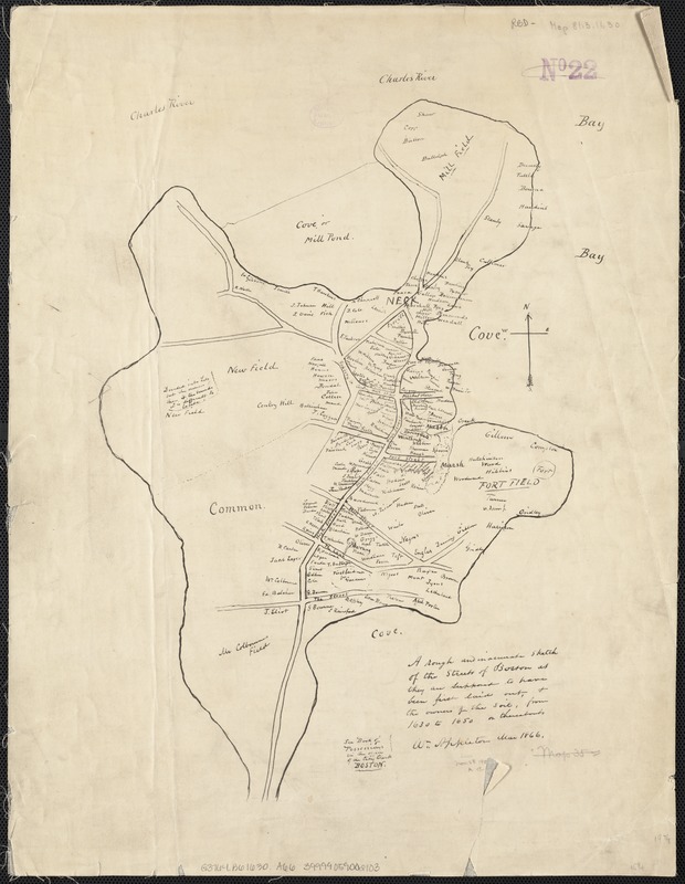
A rough and inaccurate sketch of the streets of Boston as they are supposed to have been first laid out & the owners of the soil, from 1630 to 1650 or thereabouts
Item Information
- Title:
- A rough and inaccurate sketch of the streets of Boston as they are supposed to have been first laid out & the owners of the soil, from 1630 to 1650 or thereabouts
- Creator:
- Appleton, William.
- Name on Item:
-
Wm. Appleton.
- Date:
-
[1866]
- Format:
-
Maps/Atlases
Manuscripts
- Location:
-
Boston Public Library
Norman B. Leventhal Map & Education Center - Collection (local):
-
Norman B. Leventhal Map & Education Center Collection
- Subjects:
-
Real property--Massachusetts--Boston--Maps
Land tenure--Massachusetts--Boston--Maps
Boston (Mass.)--Maps
Boston (Mass.)--History--Colonial period, ca. 1600-1775--Maps
- Places:
-
MassachusettsSuffolk (county)Boston
- Extent:
- 1 ms. map ; on sheet 51 x 39 cm.
- Terms of Use:
-
No known copyright restrictions.
No known restrictions on use.
- Scale:
-
Not drawn to scale.
- Language:
-
English
- Notes:
-
See Book of Possessions in the office of the City Clerk Boston.
- Notes (date):
-
This date is inferred.
- Identifier:
-
06_01_003781
- Call #:
-
G3764.B6 1630 .A66
- Barcode:
-
39999059002103


