Toggle navigation
LMEC Home
Exhibitions
Georeferencing
Tools for Teachers
Collections
My Favorites
Sign Up / Log In
Search
Search the map portal
Map Collection
Map Collection
Map Sets
Search
Search
Search for
Search In
All Fields
Creator
Title
Subject
Place
Search All Digital Collections
Advanced Search
8724 Results
My Search
Start Over
More Like
commonwealth:js956m375
Remove constraint More Like: commonwealth:js956m375
Filter your Search
Place
North and Central America
5,955
United States
4,862
Massachusetts
2,079
Europe
1,396
Suffolk (county)
1,046
Boston
1,019
Canada
478
Asia
438
more
Place
»
Topic
Boston (Mass.)--Maps
586
United States--Maps
294
Real property--Massachusetts--Boston--Maps
175
Massachusetts--Maps
162
Landowners--Massachusetts--Boston--Maps
133
New England--Maps
107
North America--Maps--Early works to 1800
103
Europe--Maps
79
more
Topic
»
Date
Date range begin
–
Date range end
Current results range from
1482
to
2023
View distribution
Creator
United States. Hydrographic Office
595
O.H. Bailey & Co
148
Des Barres, Joseph F. W. (Joseph Frederick Wallet), 1722-1824
123
United States. Post Office Dept
120
Ptolemy, 2nd cent
100
Walling, Henry Francis, 1825-1888
94
Geological Survey (U.S.)
86
Jefferys, Thomas, -1771
85
more
Creator
»
Format
Maps/Atlases
8,664
Manuscripts
215
Prints
56
Books
36
Objects/Artifacts
10
Drawings/Illustrations
8
Posters
5
Georeferenced
Yes
869
No
7,855
Collection
Norman B. Leventhal Map & Education Center Collection
8,694
Boston and New England Maps
2,233
Urban Maps
2,023
Maritime Charts and Atlases
1,083
American Revolutionary War-Era Maps
646
Boston Redevelopment Authority Collection
87
Maps from AAS
14
William L. Clements Library Collection
12
more
Collection
»
Available to use
No known restrictions
8,552
Creative Commons license
47
Search Constraints
Sort by relevance
relevance
title
date (asc)
date (desc)
Number of results to display per page
20 per page
10
per page
20
per page
50
per page
100
per page
View results as:
grid view
map view
Search Results
41.
A map of the lakes & Hudsons Bay
42.
A map of the lakes & Hudsons Bay
43.
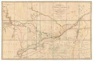
A map of the province of upper Canada, describing all the new settlements, townships, &c. with the countries adjacent, from...
44.
Posts of the Hudson's Bay Company 1790
45.
Proposed division line for Upper and Lower Canada
46.
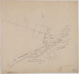
Sketch of a route from Yorktown on Lake Ontario to Penatangasheen on Lake Huron - Upper Canada
47.
Sketch of a route from Yorktown on Lake Ontario to Penatangasheen on Lake Huron - Upper Canada
48.
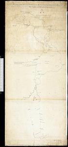
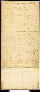
Sketch of the seven dangerous rappids with their true channel : also the appearance the river makes at those places between...
49.
An accurate map of Canada, with the adjacent countries; exhibiting the late seat of war between the English & French in those...
50.
America Septentrionalis : a Domino d'Anville in Galliis edita nune in Anglia Coloniss in Interiorem Virginiam deductis nec non...
51.
The British governments in Nth. America : laid down agreeable to the proclamation of Octr. 7, 1763
52.
Canada
53.
Carte des pays connus sous le nom de Canada, : dans laquelle sont distinguées les possessions françoises, et angl?
54.
Carte du Golphe de St. Laurent et pays voisins pour servir à l'histoire générale des voyages
55.
A General map of North America; : from the latest observations
56.
L'Isle de Terre-Neuve, l'Acadie, ou la Nouvelle Ecosse, : l'Isle St. Jean et la partie orientale du Canada
57.
Karte von den seen in Canada
58.
A map of New England, and Nova Scotia; with part of New York, Canada, and New Britain & the adjacent islands of New Found Land...
59.
A Map of that part of America which was the principal seat of war in 1756
60.
A Map of the British dominions in North America as settled by the late treaty of Peace 1763
‹ Prev
Next ›
1
2
3
4
5
6
7
…
436
437