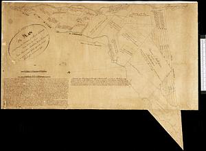
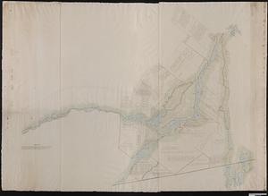
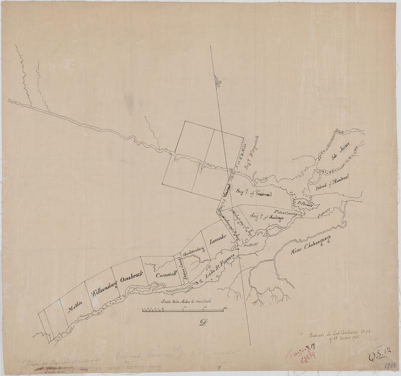
Proposed division line for Upper and Lower Canada
This map is also available in American Revolutionary Geographies Online (ARGO), a collections portal especially built for material relating to the American Revolutionary War Era. Visit ARGO to learn more about this item and explore the historical geography of North America in the late eighteenth century.
Item Information
- Title:
- Proposed division line for Upper and Lower Canada
- Title (alt.):
-
Sketch of the Montreal and the Lunenburg districts showing the proposed divisions of Quebec into two separate provinces
- Date:
-
[1788]
- Format:
-
Maps/Atlases
- Genre:
-
Manuscript maps
- Location:
- Library and Archives Canada
- Collection (local):
-
Library and Archives Canada Collection
- Subjects:
-
Ontario--Maps
Canada--History--1763-1791
Ottawa River (Québec and Ont.)--Maps
Townships--Québec (Province)--Maps
Seigneuries--Québec (Province)--Maps
Québec (Province)--Maps
- Places:
-
CanadaOntario (province)
CanadaQuebec (province)
CanadaOttawa (river)
- Extent:
- 1 manuscript map : hand color ; 40 x 46 cm
- Terms of Use:
-
Copyright expired. Contact host institution to download image.
Contact host institution for more information.
- Place of origin:
-
[Québec]
- Language:
-
English
- Catalog Record:
-
Catalog record
- Notes (date):
-
This date is inferred.
- Identifier:
-
e010775324
- Barcode:
-
4155622