Toggle navigation
LMEC Home
Exhibitions
Georeferencing
Tools for Teachers
Collections
My Favorites
Sign Up / Log In
Search
Search the map portal
Map Collection
Map Collection
Map Sets
Search
Search
Search for
Search In
All Fields
Creator
Title
Subject
Place
Search All Digital Collections
Advanced Search
8573 Results
My Search
Start Over
More Like
commonwealth:ht24zz618
Remove constraint More Like: commonwealth:ht24zz618
Filter your Search
Place
North and Central America
5,868
United States
4,792
Massachusetts
2,054
Europe
1,359
Suffolk (county)
1,057
Boston
1,030
Canada
448
Asia
422
more
Place
»
Topic
Boston (Mass.)--Maps
577
United States--Maps
273
Real property--Massachusetts--Boston--Maps
175
Massachusetts--Maps
160
Landowners--Massachusetts--Boston--Maps
132
North America--Maps--Early works to 1800
103
New England--Maps
99
City planning--Massachusetts--Boston--Maps
89
more
Topic
»
Date
Date range begin
–
Date range end
Current results range from
1482
to
2023
View distribution
Creator
United States. Hydrographic Office
594
O.H. Bailey & Co
148
Des Barres, Joseph F. W. (Joseph Frederick Wallet), 1722-1824
123
United States. Post Office Dept
120
Ptolemy, 2nd cent
100
Walling, Henry Francis, 1825-1888
94
Boston Redevelopment Authority
88
Geological Survey (U.S.)
86
more
Creator
»
Format
Maps/Atlases
8,514
Manuscripts
215
Prints
56
Books
36
Objects/Artifacts
10
Drawings/Illustrations
8
Posters
4
Georeferenced
Yes
869
No
7,704
Collection
Norman B. Leventhal Map & Education Center Collection
8,550
Boston and New England Maps
2,227
Urban Maps
1,959
Maritime Charts and Atlases
1,081
American Revolutionary War-Era Maps
616
Boston Redevelopment Authority Collection
110
Available to use
No known restrictions
8,432
Creative Commons license
46
Search Constraints
Sort by relevance
relevance
title
date (asc)
date (desc)
Number of results to display per page
50 per page
10
per page
20
per page
50
per page
100
per page
View results as:
grid view
map view
Search Results
1.
Area plan as of May 1962
2.
Back Bay park
3.
Back Bay view of the world
4.
Boylston Street improvements
5.
John Hancock office and parking garage complex, Boston, Massachusetts
6.
Outline map and view of the Prudential Center area
7.
Plan accompanying the proposal made to the City of Boston by the Commissioners on Boston Harbor and the Back Bay Octr. 20, 1854...
8.
Plan of Back Bay and vicinity : prepared from surveys made under the direction of Simon Greenleaf, Joel Giles, Ezra Lincoln,...
9.
Plan of Back Bay showing improvements on streets and estates
10.
[Plan of boundary lines in Roxbury and the City of Boston]
11.
Plan of house lots & other lands offered for sale by the Boston Water Power Company
12.
Plan of land on West Chester Park and Huntington Ave. belonging to the Boston Water Power Co
13.
Plan of lands belonging to the Boston Water Power Company
14.
Plan of lands belonging to the Boston Water Power Company and the Commonwealth, on the Back Bay, showing part of the city...
15.
Plan of lands on the Back Bay belonging to the Boston Water Power Co., the Commonwealth and other parthies [i.e. parties],...
16.
Plan of lands on the Back Bay, belonging to the Boston Water Power Co., the Commonwealth, and other parties, showing the system...
17.
[Plan of lots on Falmouth Street, Boston]
18.
Plan of Public Garden : showing proposed arrangement of lots thereon
19.
Plan of the receiving basin showing certain avenues and lines of release
20.
Plan presented to the honble. the State Commissioners for the improvement of the Back Bay
21.
Profile of Huntington Avenue/St. James Avenue from Harcourt Street to Berkeley Street
22.
Proposed improvement of Back Bay
23.
Study of plan for the extension of Commonwealth Avenue on the line of Beacon Street
24.
Fire insurance district atlas : showing the fire insurance districts of the city of Boston : as established by the State...
25.
Insurance map of Boston : volume 2
26.
Insurance map of Boston : volume 2
27.
Insurance map of Boston : volume 1
28.
Insurance map of Boston vol. 3 (South & East Boston)
29.
Insurance map of Charlestown : portions of Roxbury (now annexed to Boston) and Cambridge : 1868 : corrected Nov. 1871
30.
Insurance map of Charlestown : portions of Roxbury (now annexed to Boston) and Cambridge
31.
Insurance maps of Boston volume 4 : comprising portions of Charlestown, East Cambridge, Cambridge Port, Old Cambridge & Somerville
32.
Insurance maps of Boston volume one
33.
Insurance maps of Boston volume two
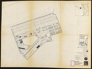
34.
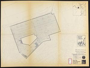
Back Bay project no. Mass R-47
35.
Back Bay project no. Mass. R-47 : police signal system, fire alarm system and M.T.A. facilities
36.
Back Bay study
37.
Back Bay study landscape plan
38.
Back Bay urban renewal area r-47 : existing land use
39.
Back Bay urban renewal area r-47 : land use plan
40.
Back Bay urban renewal area r-47 : building conditions
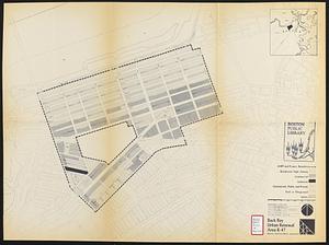
41.
Back Bay urban renewal area r-47 : existing land use
42.
Back Bay urban renewal area r-47 : building conditions
43.
Back Bay urban renewal area r-47 : community facilities & circulation plan
44.
Back Bay urban renewal area r-47 : land use plan
45.
Back Bay urban renewal area r-47 : existing circulation
46.
Back Bay urban renewal area r-47 : proposed land use
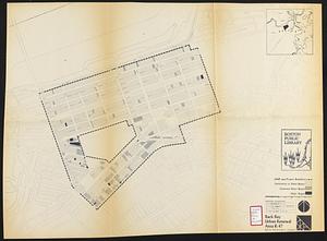
47.
Back Bay urban renewal area r-47 : existing land use
48.
Back Bay urban renewal area r-47 : building conditions
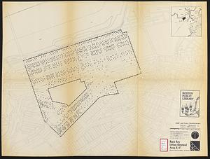
49.
Back Bay urban renewal area r-47 : existing population density
50.
Back Bay urban renewal area r-47 : proposed treatment and title 1 projects
‹ Prev
Next ›
1
2
3
4
5
…
171
172


![[Plan of boundary lines in Roxbury and the City of Boston]](https://bpldcassets.blob.core.windows.net/derivatives/images/commonwealth:1257bb127/image_thumbnail_300.jpg)


![Plan of lands on the Back Bay belonging to the Boston Water Power Co., the Commonwealth and other parthies [i.e. parties], showing the system of streets, grades and sewers as laid out and recommended by the Back Bay Commissioners](https://bpldcassets.blob.core.windows.net/derivatives/images/commonwealth:1257bb305/image_thumbnail_300.jpg)

![[Plan of lots on Falmouth Street, Boston]](https://bpldcassets.blob.core.windows.net/derivatives/images/commonwealth:1257bb32q/image_thumbnail_300.jpg)