Toggle navigation
LMEC Home
Exhibitions
Georeferencing
Tools for Teachers
Collections
My Favorites
Sign Up / Log In
Search
Search the map portal
Map Collection
Map Collection
Map Sets
Search
Search
Search for
Search In
All Fields
Creator
Title
Subject
Place
Search All Digital Collections
Advanced Search
857 Results
My Search
Start Over
More Like
commonwealth:d7920269f
Remove constraint More Like: commonwealth:d7920269f
Filter your Search
Place
North and Central America
804
United States
644
New York
131
New England
130
Canada
86
New Jersey
79
North America
69
Massachusetts
49
more
Place
»
Topic
United States--History--Revolution, 1775-1783--Maps
330
New England--Maps
127
North America--Maps--Early works to 1800
59
Railroads--New England--Maps
50
United States--Maps--Early works to 1800
44
New Jersey--Maps
40
Canada--Maps--Early works to 1800
38
New York (State)--Maps
35
more
Topic
»
Date
Date range begin
–
Date range end
Current results range from
1623
to
2015
View distribution
Creator
Faden, William, 1749-1836
21
Robert Sayer and John Bennett (Firm)
19
Jefferys, Thomas, -1771
18
Clinton, Henry, Sir, 1738?-1795
17
Bellin, Jacques Nicolas, 1703-1772
16
Gibson, J. (John), active 1750-1792
14
Hills, John, active 1777-1819
14
Montrésor, John, 1736-1799
14
more
Creator
»
Format
Maps/Atlases
850
Manuscripts
9
Drawings/Illustrations
5
Paintings
3
Ephemera
1
Objects/Artifacts
1
Prints
1
Georeferenced
Yes
35
No
822
Collection
American Revolutionary War-Era Maps
673
MacLean Collection Map Library
379
William L. Clements Library Collection
310
Norman B. Leventhal Map & Education Center Collection
132
Boston and New England Maps
83
American Antiquarian Society Collection
19
David Judkins Weaver Papers
4
Sidney R. Knafel Map Collection at Phillips Academy
4
more
Collection
»
Available to use
No known restrictions
134
Creative Commons license
8
Search Constraints
Sort by relevance
relevance
title
date (asc)
date (desc)
Number of results to display per page
20 per page
10
per page
20
per page
50
per page
100
per page
View results as:
grid view
map view
Search Results
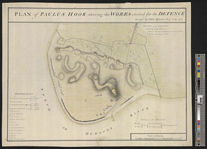
341.
Plan of Paulus Hook shewing the works erected for its defence
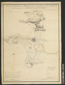
342.
Plan of Paulus Hook shewing the works erected for its defence and the country adjacent in the province of East Jersey
343.
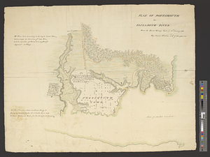
Plan of Portsmouth on Elizabeth River : from an exact survey made ye. 21st January 1781
344.
Plan of Princess Ann and Norfolk counties
345.
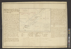
Plan of Rhode-Island
346.
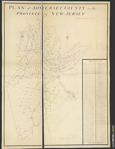
Plan of Somerset County in the province of New Jersey : copied from the original by Lieut. I. Hills, asst. engr
347.
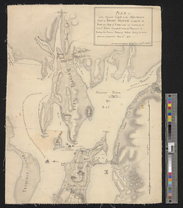
A plan of St. Mary's Harbour in the province of East Florida with the proposed post for the defence of it and the inland...
348.
Plan of the adjacent coast to the northern part of Rhode Island, to express the route of a body of troops under the command of...
349.
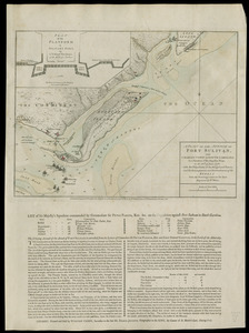
A plan of the attack of Fort Sulivan, near Charles Town in South Carolina : by a squadron of His Majesty's ships, on the 28th....
350.
A plan of the attack of Fort Sulivan near Charles Town in South Carolina by a squadron of his majesty's ships on the 28 June...
351.
A plan of the attack of Fort Sullivan near Charles Town in South Carolina by a squadron of his majesty's ships on the 28th of...
352.
A plan of the attack of Fort Sullivan, near Charles Town in South Carolina, by a squadron of his majesty's ships on the 28th of...
353.
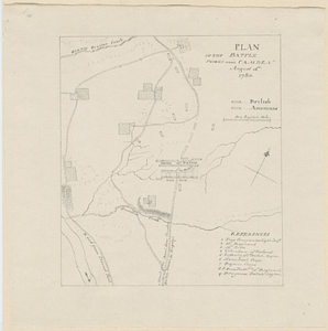
Plan of the battle fought near Camden August 16th 1780
354.
Plan of the Battle of Gum Swamp alias Sutton Wood, on the 16th August 1780 between the royal army, 1600, commanded by Lieut:...
355.
Plan of the bay of Saldanha on the S.W. coast of Africa shewing the opperations [sic] of the squadron of Commodore Johnstone,...
356.
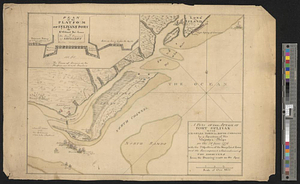
Plan of the British attack on Mud Island, Pennsylvania
357.
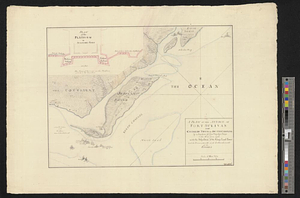
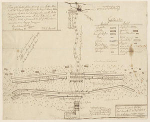
Plan of the decent [sic] and action of the 29th Decr. 1778, near the town of Savannah; by his majestys forces, under the...
358.
A plan of the entrance of Chesapeak Bay, with James and York Rivers : wherein are shown the respective positions (in the...
359.
A plan of the environs of Brooklyn showing the position of the rebel lines and defences on the 27th of August 1776
360.
Plan of the environs of Halifax in Nova Scotia with the temporary works constructed for the protection of the town, and His...
‹ Prev
Next ›
1
2
…
14
15
16
17
18
19
20
21
22
…
42
43
![A plan of St. Mary's Harbour in the province of East Florida with the proposed post for the defence of it and the inland navigation to St. Jones [sic] River](https://bpldcassets.blob.core.windows.net/derivatives/metadata/commonwealth-oai:cv43st68h/image_thumbnail_300.jpg)
![Plan of the bay of Saldanha on the S.W. coast of Africa shewing the opperations [sic] of the squadron of Commodore Johnstone, in the attack upon the five Dutch East India ships on the morning of July 21st: AD: 1781](https://bpldcassets.blob.core.windows.net/derivatives/metadata/commonwealth-oai:7d27dp94q/image_thumbnail_300.jpg)
![Plan of the decent [sic] and action of the 29th Decr. 1778, near the town of Savannah; by his majestys forces, under the command of Lt. Colol. Campbell of the 71st Regt. foot](https://bpldcassets.blob.core.windows.net/derivatives/metadata/commonwealth-oai:qj72t576b/image_thumbnail_300.jpg)