Toggle navigation
LMEC Home
Exhibitions
Georeferencing
Tools for Teachers
Collections
My Favorites
Sign Up / Log In
Search
Search the map portal
Map Collection
Map Collection
Map Sets
Search
Search
Search for
Search In
All Fields
Creator
Title
Subject
Place
Search All Digital Collections
Advanced Search
8695 Results
My Search
Start Over
More Like
commonwealth:cj82kp39v
Remove constraint More Like: commonwealth:cj82kp39v
Filter your Search
Place
North and Central America
5,926
United States
4,844
Massachusetts
2,079
Europe
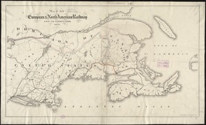
1,396
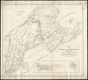
Suffolk (county)
1,046
Boston
1,019
Canada
449
Asia
438
more
Place
»
Topic
Boston (Mass.)--Maps
586
United States--Maps
282
Real property--Massachusetts--Boston--Maps
175
Massachusetts--Maps
162
Landowners--Massachusetts--Boston--Maps
133
New England--Maps
103
North America--Maps--Early works to 1800
103
Europe--Maps
79
more
Topic
»
Date
Date range begin
–
Date range end
Current results range from
1482
to
2023
View distribution
Creator
United States. Hydrographic Office
595
O.H. Bailey & Co
148
Des Barres, Joseph F. W. (Joseph Frederick Wallet), 1722-1824
123
United States. Post Office Dept
120
Ptolemy, 2nd cent
100
Walling, Henry Francis, 1825-1888
94
Geological Survey (U.S.)
86
Jefferys, Thomas, -1771
85
more
Creator
»
Format
Maps/Atlases
8,635
Manuscripts
215
Prints
56
Books
36
Objects/Artifacts
10
Drawings/Illustrations
8
Posters
5
Georeferenced
Yes
869
No
7,826
Collection
Norman B. Leventhal Map & Education Center Collection
8,694
Boston and New England Maps
2,232
Urban Maps
2,023
Maritime Charts and Atlases
1,083
American Revolutionary War-Era Maps
616
Boston Redevelopment Authority Collection
87
Sidney R. Knafel Map Collection at Phillips Academy
1
Available to use
No known restrictions
8,552
Creative Commons license
47
Search Constraints
Sort by relevance
relevance
title
date (asc)
date (desc)
Number of results to display per page
20 per page
10
per page
20
per page
50
per page
100
per page
View results as:
grid view
map view
Search Results
21.
Transportation map of New York
22.
ABC pathfinder railway guide map : eastern division
23.
Boston Clinton Fitchburg and Mansfield Framingham Lowell Railroads, and connections
24.
Diagram of rail roads diverging from Boston : showing the depots and distances
25.
Ensign, Bridgman & Fanning's rail road map of the United States, showing the depots & stations
26.
G. Woolworth Colton's railroad, township & distance map of New England : with adjacent portions of New York, Canada & New...
27.
Lloyd's railroad, telegraph & express map of the Eastern States to accompany Lloyd's railroad, telegraph & express map of the...
28.
Map first division railway mail service
29.
Map of New England : with adjacent portions of New York & Canada
30.
Map of New England exhibiting the rail road and telegraphic lines now in operation
31.
Map of New England with adjacent portions of New York & Canada
32.
Map of New England with adjacent portions of New York & Canada
33.
Map of New England with adjacent portions of New York & Canada
34.
Map of the Boston & Maine Railroad, showing its relative position & connection with other railroads
35.
Map of the Boston and Northwestern, Massachusetts Central, and Boston and Poughkeepsie Railroads and their connections
36.
Map of the Boston, Concord, Montreal & White Mountains Railroad and its principal connections
37.
Map of the Eastern Railroad and principal connections
38.
Map of the Eastern Railroad and principal connections
39.
Map of the European & North American Railway and its connections
40.
Map of the European and North American Railway, showing its connection with the railways of the United States & Canada; made by...
‹ Prev
Next ›
1
2
3
4
5
6
…
434
435