Toggle navigation
LMEC Home
Exhibitions
Georeferencing
Tools for Teachers
Collections
My Favorites
Sign Up / Log In
Search
Search the map portal
Map Collection
Map Collection
Map Sets
Search
Search
Search for
Search In
All Fields
Creator
Title
Subject
Place
Search All Digital Collections
Advanced Search
8871 Results
My Search
Start Over
More Like
commonwealth:9s161h94c
Remove constraint More Like: commonwealth:9s161h94c
Filter your Search
Place
North and Central America
6,102
United States
5,018
Massachusetts
2,134
Europe
1,396
Suffolk (county)
1,217
Boston
1,190
Canada
449
Asia
438
more
Place
»
Topic
Boston (Mass.)--Maps
752
United States--Maps
282
Real property--Massachusetts--Boston--Maps
195
Massachusetts--Maps
166
City planning--Massachusetts--Boston--Maps
163
Landowners--Massachusetts--Boston--Maps
142
New England--Maps
104
North America--Maps--Early works to 1800
103
more
Topic
»
Date
Date range begin
–
Date range end
Current results range from
1482
to
2023
View distribution
Creator
United States. Hydrographic Office
595
Boston Redevelopment Authority
166
O.H. Bailey & Co
148
Des Barres, Joseph F. W. (Joseph Frederick Wallet), 1722-1824
124
United States. Post Office Dept
120
Ptolemy, 2nd cent
100
Walling, Henry Francis, 1825-1888
94
Geological Survey (U.S.)
87
more
Creator
»
Format
Maps/Atlases
8,811
Manuscripts
215
Prints
56
Books
36
Objects/Artifacts
10
Drawings/Illustrations
8
Posters
5
Georeferenced
Yes
885
No
7,986
Collection
Norman B. Leventhal Map & Education Center Collection
8,723
Boston and New England Maps
2,367
Urban Maps
2,151
Maritime Charts and Atlases
1,083
American Revolutionary War-Era Maps
638
Boston Redevelopment Authority Collection
201
Mapping Boston Collection
20
Massachusetts Real Estate Atlases
12
more
Collection
»
Available to use
No known restrictions
8,674
Creative Commons license
70
Search Constraints
Sort by relevance
relevance
title
date (asc)
date (desc)
Number of results to display per page
20 per page
10
per page
20
per page
50
per page
100
per page
View results as:
grid view
map view
Search Results
5641.
A New Yorker's idea of the United States of America
5642.
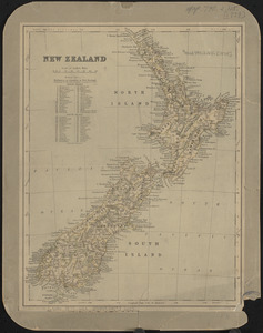
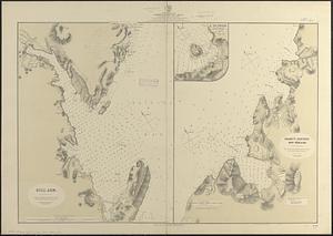
New Zealand
5643.
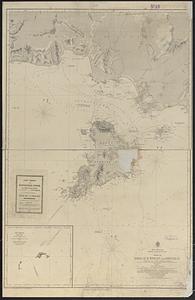
New Zealand, Middle and South Islands
5644.
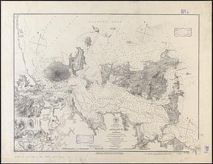
New Zealand, North Island - east coast, Auckland Hr. and approaches : from British surveys in 1849-55 ; republication of Brit....
5645.
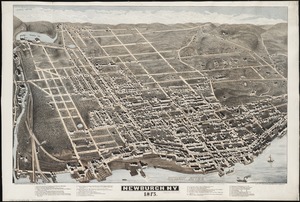
Newburgh, N.Y : 1875
5646.
Newburyport, Mass
5647.
Newcastle : New Brunswick
5648.
New-England
5649.
Newfoundland - east coast - Canada Bay with adjacent anchorages : from a French government survey ; 1862-3
5650.
Newfoundland - east coast, Hare Bay, How Harbor (Outarde or Bustard Bay)
5651.
Newfoundland - north coast, Pistolet Bay : from a French survey in 1861
5652.
Newfoundland - north west coast, St. Genevieve Bay : from a survey of Captain G. Cloué, French navy, in 1861
5653.
Newfoundland - south coast, Duck Island to Ship Rock Shoal, including Port Basque : from British surveys ; Port Basque : on an...
5654.
Newfoundland - west coast, St. John I., Good Bay & St. John Hr.
5655.
Newfoundland, east coast, Broyle Hr. to Renewse Hr. including Caplin Bay, Ferryland Hr., Aquafort Hr. & Fermeuse Hr.
5656.
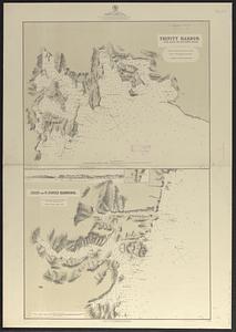
Newfoundland, east coast, harbors in Trinity Bay : from British surveys in 1864 & 1865, corrected to 1874
5657.
Newfoundland, east coast, harbors in Trinity Bay, sheet II : from British surveys, corrected to 1874
5658.
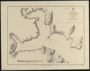
Newfoundland, east coast, Orange Bay or Great Harbor Deep : from a French survey in 1870
5659.
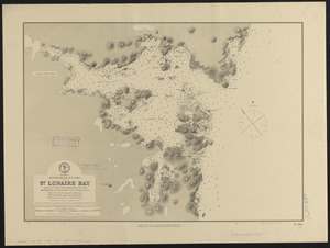
Newfoundland, n. e. coast, St. Lunaire Bay
5660.
Newfoundland--east coast, Conception Bay, Carbonear to Brigus Bay including Harbor Grace : from a Brit. survey in 1866,...
‹ Prev
Next ›
1
2
…
279
280
281
282
283
284
285
286
287
…
443
444