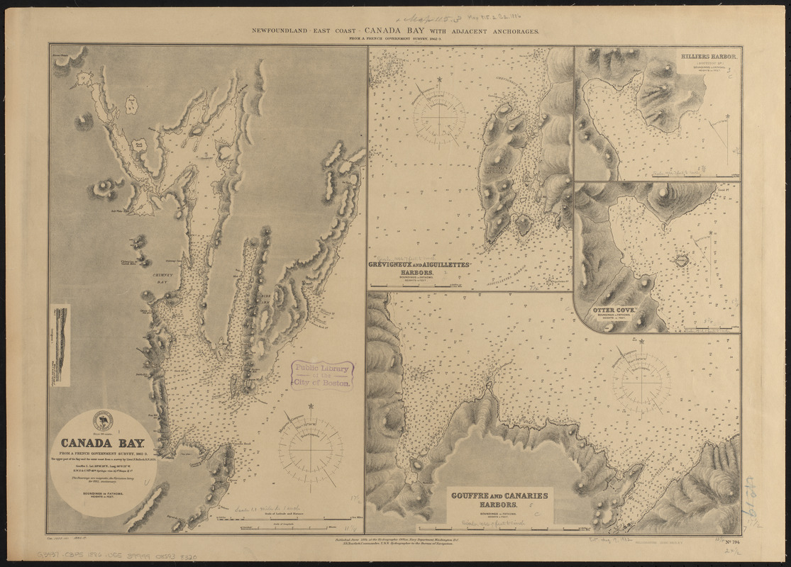
Newfoundland - east coast - Canada Bay with adjacent anchorages : from a French government survey ; 1862-3
Item Information
- Title:
- Newfoundland - east coast - Canada Bay with adjacent anchorages : from a French government survey ; 1862-3
- Title (alt.):
-
Canada Bay : from a French government survey, 1862-3
Grévigneux and Aigullettes Harbors
Hilliers Harbor (Boutitou Hr)
Otter Cove
Gouffre and Canaries Harbors
- Issuing body:
- United States. Hydrographic Office
- Printer:
- Leggo Bros. & Co.
- Date:
-
1886
- Format:
-
Maps/Atlases
- Location:
-
Boston Public Library
Norman B. Leventhal Map & Education Center - Collection (local):
-
Norman B. Leventhal Map & Education Center Collection
- Subjects:
-
Nautical charts--Newfoundland and Labrador--Canada Bay
Canada Bay (N.L.)--Maps
Grévigneux Harbour (N.L.)--Maps
Aiguillettes Harbour (N.L.)--Maps
Hilliers Harbor (N.L.)--Maps
Otter Cove (N.L.)--Maps
Gouffre Harbor (N.L.)--Maps
Canaries Harbor (N.L.)--Maps
- Places:
-
CanadaNewfoundland and Labrador (province)
Grevigneux Harbour
Aiguillettes Rock
Hilliers Harbour
Otter Cove
Canaries Harbour
- Extent:
- 5 maps on 1 sheets ; 45 x 63 cm
- Terms of Use:
-
No known copyright restrictions.
No known restrictions on use.
- Publisher:
-
Washington, D.C. :
Hydrographic Office
- Scale:
-
Scales differ
- Language:
-
English
- Table of Contents:
-
Canada Bay
Grévigneux and Aiguillettes Harbors
Hilliers Harbor
Otter Cove
Gouffre and Canaries Harbors.
- Notes:
-
Relief shown by hachures and spot heights. Depths shown by soundings.
Includes view of Grévigneux I.
"Cor. 1885.161 1886.17."
- Identifier:
-
06_01_015565
- Call #:
-
G9096.P5 svar .U55
- Barcode:
-
39999085938320


