Newburyport, Mass
Item Information
- Title:
- Newburyport, Mass
- Description:
-
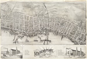
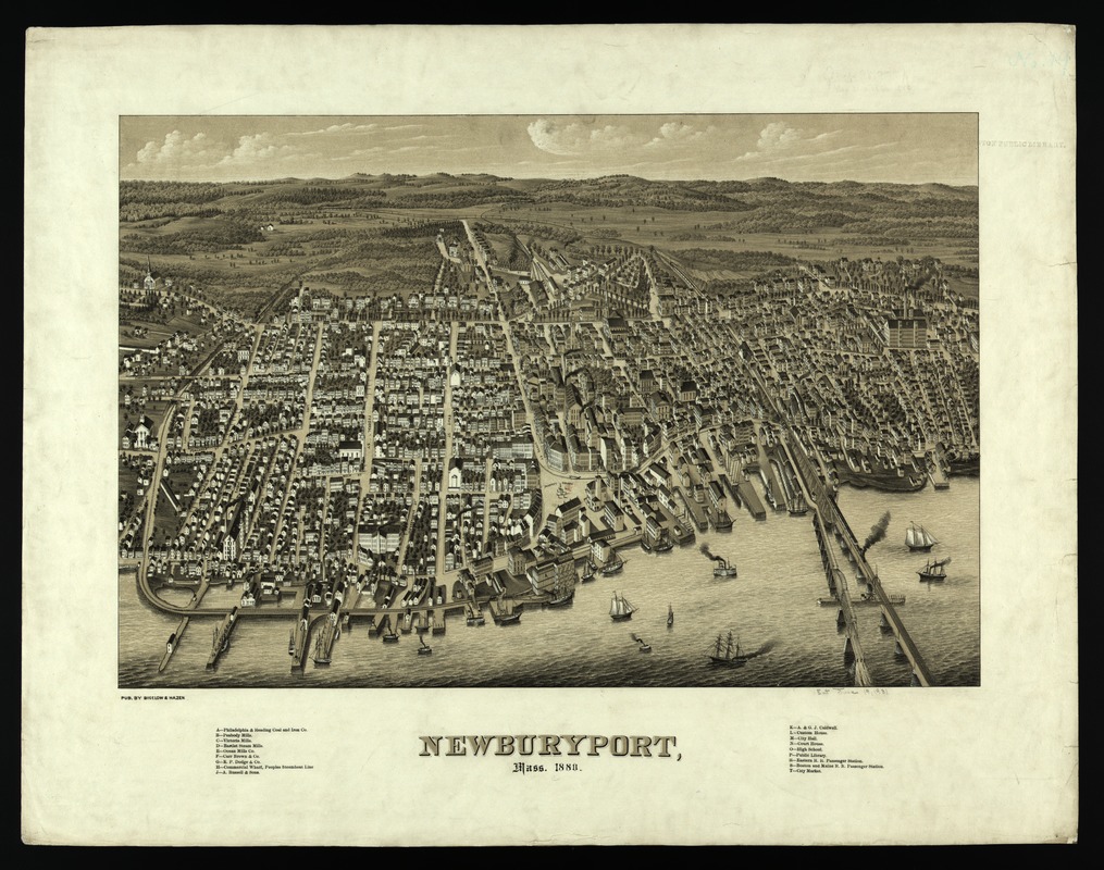
Incorporated as a town in 1763, Newburyport is located near the mouth of the Merrimack River. It flourished as a center for shipping, shipbuilding, and whaling during the colonial period and as a port for privateering during the Revolutionary War and the War of 1812. During the 19th century, shipbuilding continued to be an important, but declining, activity with the last clipper ship launched in 1883. In the 1830s and 1840s, the towns economy became more industrialized with the establishment of four textile mills, a distillery, an iron foundry, and several other factories which produced shoes and combs. The town had a population of approximately 13,000 when this view was made. The artists observe the town as if overlooking it from the north shore of the Merrimack River, looking slightly southwest at the community and its rural hinterland. This perspective highlights the towns waterfront, suggesting its former reliance on maritime activities. Although a few ships and smaller vessel are pictured in the river, it is not the bustling seaport of former times. As the legend indicates, the view also depicts the four major textile mills (Peabody, Victoria, Bartlett, and Ocean Mills, identified with letters B-E) and the other manufacturing plants that are scattered throughout the town. The artists have also used significant vertical exaggeration to accentuate the height and importance of the industrial buildings, the churches, and other public buildings.
- Creator:
- Bigelow, E. H.
- Name on Item:
-
by E.H. Bigelow, J.C. Hazen.
- Date:
-
1880
- Format:
-
Maps/Atlases
- Location:
-
Boston Public Library
Norman B. Leventhal Map & Education Center - Collection (local):
-
Norman B. Leventhal Map & Education Center Collection
- Subjects:
-
Newburyport (Mass.)--Aerial views
- Places:
-
MassachusettsEssex (county)Newburyport
- Extent:
- 1 view ; 55 x 72 cm.
- Terms of Use:
-
No known copyright restrictions.
No known restrictions on use.
- Publisher:
-
Boston :
[s.n.]
- Scale:
-
Nor drawn to scale.
- Language:
-
English
- Notes:
-
Bird's-eye view.
Includes index to points of interest.
Appears in J.G. Garver's Surveying the shore, historic maps of coastal Massachusetts, 1600-1930. Beverly, MA. 2006.
- Notes (exhibitions):
-
Exhibited: "Boston & Beyond: A Bird’s Eye View of New England" organized by the Norman B. Leventhal Map Center at the Boston Public Library, 2008.
- Identifier:
-
05_04_000082
- Call #:
-
G3764.N48A3 1880.B5
- Barcode:
-
39999052509039