Toggle navigation
LMEC Home
Exhibitions
Georeferencing
Tools for Teachers
Collections
My Favorites
Sign Up / Log In
Search
Search the map portal
Map Collection
Map Collection
Map Sets
Search
Search
Search for
Search In
All Fields
Creator
Title
Subject
Place
Search All Digital Collections
Advanced Search
8807 Results
My Search
Start Over
More Like
commonwealth:8049g949n
Remove constraint More Like: commonwealth:8049g949n
Filter your Search
Place
North and Central America
6,025
United States
4,900
Massachusetts
2,079
Europe
1,396
Suffolk (county)
1,046
Boston
1,019
Canada
510
Asia
438
more
Place
»
Topic
Boston (Mass.)--Maps
586
United States--Maps
330
Real property--Massachusetts--Boston--Maps
175
Massachusetts--Maps
162
Landowners--Massachusetts--Boston--Maps
133
North America--Maps--Early works to 1800
103
New England--Maps
102
Europe--Maps
79
more
Topic
»
Date
Date range begin
–
Date range end
Current results range from
1482
to
2023
View distribution
Creator
United States. Hydrographic Office
595
O.H. Bailey & Co
148
Des Barres, Joseph F. W. (Joseph Frederick Wallet), 1722-1824
123
United States. Post Office Dept
120
Ptolemy, 2nd cent
100
Jefferys, Thomas, -1771
99
Walling, Henry Francis, 1825-1888
94
Geological Survey (U.S.)
87
more
Creator
»
Format
Maps/Atlases
8,747
Manuscripts
216
Prints
56
Books
36
Objects/Artifacts
10
Drawings/Illustrations
8
Posters
5
Georeferenced
Yes
871
No
7,936
Collection
Norman B. Leventhal Map & Education Center Collection
8,700
Boston and New England Maps
2,233
Urban Maps
2,023
Maritime Charts and Atlases
1,083
American Revolutionary War-Era Maps
721
Boston Redevelopment Authority Collection
87
William L. Clements Library Collection
56
Maps from AAS
22
more
Collection
»
Available to use
No known restrictions
8,556
Creative Commons license
53
Search Constraints
Sort by relevance
relevance
title
date (asc)
date (desc)
Number of results to display per page
20 per page
10
per page
20
per page
50
per page
100
per page
View results as:
grid view
map view
Search Results
361.
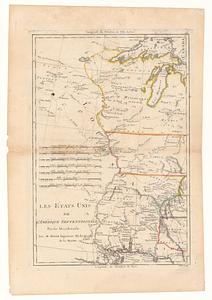
Les Etats Unis de l'Amérique Septentrional partie occidentale ; les Etats Unis de l'Amérique Septentrional partie orientale
362.
A General map of North America; : from the latest observations
363.
Karte von den seen in Canada
364.
A Map of the British dominions in North America as settled by the late treaty of Peace 1763
365.
A map of the British empire, in North America
366.
A Map of the present seat of war in North America
367.
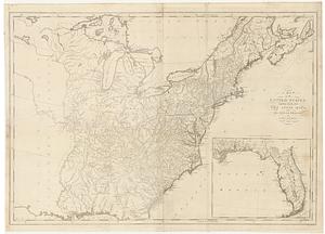
A map of the United States
368.
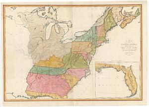
A Map of the United States
369.
A map of the United States: compiled chiefly from the state maps, and other authentic information
370.
A map of the United States: compiled chiefly from the state maps, and other authentic information
371.
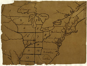
A map of the United States east of the Mississippi River in which the land ceded by the Treaty of Paris is divided by parallels...
372.
A map of the United States east of the Mississippi River in which the land ceded by the Treaty of Paris is divided by parallels...
373.
Map of the United States, exhibiting the post-roads, the situations, connections & distances of the post-offices stage roads,...
374.
Map of the United States of America : including Canada and a large portion of Texas showing the base meridian and township...
375.
A map of the United States of America as settled by the peace of 1783
376.
Map of United States showing drainage areas and index numbers
377.
Map showing Indian reservations within the limits of the United States
378.
A new & accurate map of Louisiana, with part of Florida and Canada, : and the adjacent countries drawn from surveys assisted by...
379.
A New & accurate map of North America, : including the British acquisitions gain'd by the late war, 1763
380.
A new map of the British empire in Nth. America
‹ Prev
Next ›
1
2
…
15
16
17
18
19
20
21
22
23
…
440
441