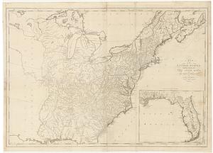
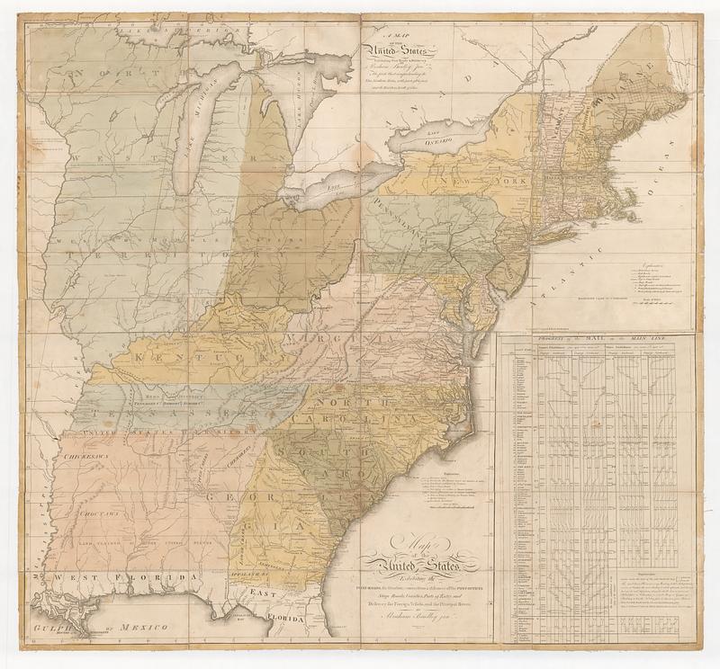
Map of the United States, exhibiting the post-roads, the situations, connections & distances of the post-offices stage roads, counties, ports of entry and delivery for foreign vessels, and the principal rivers
This map is also available in American Revolutionary Geographies Online (ARGO), a collections portal especially built for material relating to the American Revolutionary War Era. Visit ARGO to learn more about this item and explore the historical geography of North America in the late eighteenth century.
Item Information
- Title:
- Map of the United States, exhibiting the post-roads, the situations, connections & distances of the post-offices stage roads, counties, ports of entry and delivery for foreign vessels, and the principal rivers
- Title (alt.):
-
A map of the United States exhibiting post roads & distances : the first sheet comprehending the nine northern states, with parts of Virginia and the territory north of Ohio
- Publisher:
- Bradley, Abraham, 1767-1838
- Name on Item:
-
by Abraham Bradley jun.r ; W: Harrison jun.r sc. ; W. Barker sculp. Philad.a ; J. Smither sculp.
- Date:
-
1800
- Format:
-
Maps/Atlases
- Location:
- MacLean Collection Map Library
- Collection (local):
-
MacLean Collection Map Library
- Subjects:
-
United States--Maps
Post roads--United States--Maps--Early works to 1800
Transportation--United States--Maps--Early works to 1800
- Places:
-
United States
- Extent:
- 1 map ; 254 x 127 mm
- Terms of Use:
-
Public Domain/No known restrictions on use. Contact host institution to download image.
Contact host institution for more information.
- Publisher:
-
Philadelphia :
Bradley, Abraham Jr.
- Language:
-
English
- Identifier:
-
MC_332
- Call #:
-
332