Toggle navigation
LMEC Home
Exhibitions
Georeferencing
Tools for Teachers
Collections
My Favorites
Sign Up / Log In
Search
Search the map portal
Map Collection
Map Collection
Map Sets
Search
Search
Search for
Search In
All Fields
Creator
Title
Subject
Place
Search All Digital Collections
Advanced Search
522 Results
My Search
Start Over
More Like
commonwealth:7h14cx215
Remove constraint More Like: commonwealth:7h14cx215
Filter your Search
Place
North and Central America
519
United States
516
Suffolk (county)
509
Boston
508
Massachusetts
209
South End
55
Roxbury
48
Back Bay
44
more
Place
»
Topic
City planning--Massachusetts--Boston--Maps
418
Urban renewal--Massachusetts--Boston--Maps
253
Boston (Mass.)--Maps
160
Land use--Massachusetts--Boston--Maps
101
Buildings--Massachusetts--Boston--Maps
82
Real property--Massachusetts--Boston--Maps
54
South End (Boston, Mass.)--Maps
48
Back Bay (Boston, Mass.)--Maps
46
more
Topic
»
Date
Date range begin
–
Date range end
Current results range from
1835
to
2020
View distribution
Creator
Boston Redevelopment Authority
373
Massachusetts Bay Transportation Authority
15
Downtown Waterfront Corporation
10
Victor Gruen Associates
10
Boston (Mass.). Parks and Recreation Department
8
Boston Elevated Railway Company
8
General Drafting Company
8
Sasaki Associates
6
more
Creator
»
Format
Maps/Atlases
521
Drawings/Illustrations
3
Manuscripts
1
Prints
1
Georeferenced
Yes
6
No
516
Collection
Boston and New England Maps
485
Urban Maps
467
Boston Redevelopment Authority Collection
440
Norman B. Leventhal Map & Education Center Collection
136
Applied Geographics, Inc. Records
1
Available to use
No known restrictions
519
Creative Commons license
2
Search Constraints
Sort by relevance
relevance
title
date (asc)
date (desc)
Number of results to display per page
20 per page
10
per page
20
per page
50
per page
100
per page
View results as:
grid view
map view
Search Results
41.
T system map : 1978-1979
42.
T system map
43.
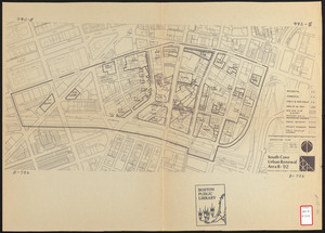
South Cove urban renewal area R-92 : disposition plan
44.
Boylston Street improvements
45.
John Hancock office and parking garage complex, Boston, Massachusetts
46.
Proposed improvement of Back Bay
47.
Boston Elevated Railway lines 1921
48.
Boston Elevated Railway lines operated 1925
49.
Boston Elevated Railway system
50.
Boston Elevated Railway track lengths of surface lines and subway
51.
Boston Elevated Railway track lengths of surface lines and subway
52.
Boston Subway, East Boston Tunnel, Washington St. Tunnel, tunnel for Cambridge connection & proposed Riverbank Subway
53.
Central part of Boston Elevated Railway system showing connections
54.
Central part of Boston Elevated Railway system showing connections
55.
Central part of Boston Elevated Railway system showing connections 1903
56.
Central part of Boston Elevated Railway system showing connections 1904
57.
Map of Boston
58.
Map of Boston and vicinity, showing tracks operated by the Boston Elevated Railway Co. January, 1910
59.
Map of Boston proper
60.
[Map of Boston, showing surface lines, proposed elevated lines, connecting surface lines and route of subway
‹ Prev
Next ›
1
2
3
4
5
6
7
…
26
27