Toggle navigation
LMEC Home
Exhibitions
Georeferencing
Tools for Teachers
Collections
My Favorites
Sign Up / Log In
Search
Search the map portal
Map Collection
Map Collection
Map Sets
Search
Search
Search for
Search In
All Fields
Creator
Title
Subject
Place
Search All Digital Collections
Advanced Search
1111 Results
My Search
Start Over
More Like
commonwealth:7h14cw120
Remove constraint More Like: commonwealth:7h14cw120
Filter your Search
Place
North and Central America
1,107
United States
1,102
Suffolk (county)
1,086
Boston
1,085
Massachusetts
777
Roxbury
60
South End
56
Fens
42
more
Place
»
Topic
Boston (Mass.)--Maps
752
City planning--Massachusetts--Boston--Maps
418
Urban renewal--Massachusetts--Boston--Maps
253
Real property--Massachusetts--Boston--Maps
136
Land use--Massachusetts--Boston--Maps
102
Buildings--Massachusetts--Boston--Maps
94
Landowners--Massachusetts--Boston--Maps
79
Local transit--Massachusetts--Boston--Maps
59
more
Topic
»
Date
Date range begin
–
Date range end
Current results range from
1743
to
2023
View distribution
Creator
Boston Redevelopment Authority
386
Geo. H. Walker & Co
27
Boynton, George W., d. 1884
21
Sampson, Davenport & Co
21
Sampson, Murdock & Co
20
Bromley, George Washington
18
Bromley, Walter Scott
17
Lufkin, Richard F. (Richard Friend)
17
more
Creator
»
Format
Maps/Atlases
1,110
Manuscripts
9
Drawings/Illustrations
3
Prints
1
Georeferenced
Yes
100
No
1,011
Collection
Boston and New England Maps
928
Urban Maps
825
Norman B. Leventhal Map & Education Center Collection
690
Boston Redevelopment Authority Collection
450
American Revolutionary War-Era Maps
25
Mapping Boston Collection
20
Massachusetts Real Estate Atlases
12
William L. Clements Library Collection
10
more
Collection
»
Available to use
No known restrictions
1,043
Creative Commons license
34
Search Constraints
Sort by relevance
relevance
title
date (asc)
date (desc)
Number of results to display per page
20 per page
10
per page
20
per page
50
per page
100
per page
View results as:
grid view
map view
Search Results
221.
Campus High School urban renewal area Mass. r-129 : property map
222.
Charles River embankment, section A
223.
Maps from General plan for Boston : preliminary report, December, 1950
224.
Outline map of Boston
225.
A plan for the Central Artery
226.
Rose F. Kennedy Garden
227.
Rose Kennedy Garden : contract documents August 1986 : prepared for City of Boston ; Parks & Recreations Department ; Boston...
228.
Major transportation system : Boston region MAPC area
229.
Shipyard Park phase 3 : Boston Naval Shipyard at Charlestown : schematic design
230.
The regional open space system : [Boston, Massachusetts metropolitan area]
231.
Blue Hill Avenue commercial strip
232.
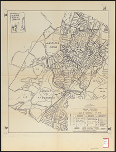
Zoning districts city of Boston map 9 Jamaica Plain
233.
Back Bay park
234.
Map of Arnold Arboretum showing location of the trees and shrubs
235.
Map of Arnold Arboretum showing location of the trees and shrubs
236.
Map of the Boston Metropolitan District showing park reservations and holdings of the Metropolitan District Commission and...
237.
Plan of portion of park system from Common to Franklin Park : including Charles River Basin, Charlesbank, Commonwealth Avenue,...
238.
Plan of the Arnold Arboretum Jamaica Plain Mass
239.
Topographical map of Cedar Square, Roxbury
240.
Topographical map of West Roxbury park
‹ Prev
Next ›
1
2
…
8
9
10
11
12
13
14
15
16
…
55
56