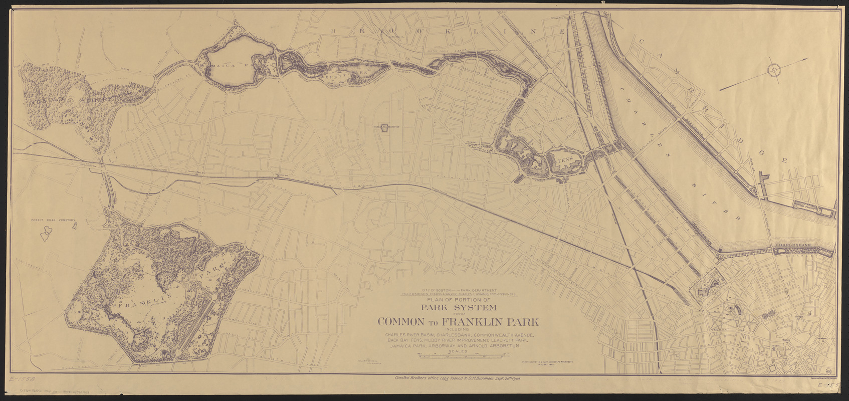
Plan of portion of park system from Common to Franklin Park : including Charles River Basin, Charlesbank, Commonwealth Avenue, Back Bay Fens, Muddy River Improvement, Leverett Park, Jamaica Park, Arborway and Arnold Arboretum
Item Information
- Title:
- Plan of portion of park system from Common to Franklin Park : including Charles River Basin, Charlesbank, Commonwealth Avenue, Back Bay Fens, Muddy River Improvement, Leverett Park, Jamaica Park, Arborway and Arnold Arboretum
- Cartographer:
- Jackson, William
- Cartographer:
- Olmsted, Olmsted, and Eliot
- Printer:
- Heliotype Printing Co.
- Publisher:
- Boston (Mass.). Department of Parks
- Name on Item:
-
City of Boston - Park Department, Paul H. Kendricken, Francis A. Walker, Charles F. Sprague, commissioners ; William Jackson, City Engineer ; Olmsted, Olmsted & Eliot, Landscape Architects
- Date:
-
1894
- Format:
-
Maps/Atlases
- Location:
-
Boston Public Library
Norman B. Leventhal Map & Education Center - Collection (local):
-
Norman B. Leventhal Map & Education Center Collection
- Subjects:
-
Parks--Massachusetts--Boston--Maps
Outdoor recreation--Massachusetts--Boston--Maps
- Places:
-
MassachusettsSuffolk (county)Boston
- Extent:
- 1 map : photocopy ; 67 x 153 cm
- Terms of Use:
-
No known copyright restrictions.
No known restrictions on use.
- Publisher:
-
[Boston] :
[The Dept.]
- Scale:
-
Scale approximately 1:5,940
- Language:
-
English
- Notes:
-
Photocopy.
Oriented with north towards the upper right.
"Olmsted, Olmsted & Eliot, Landscape Architects, January 1894."
At foot outside neat line: "Olmsted Brothers office copy loaned to D.H. Burnham, Sept. 20, 1904."
Manuscript in lower margin of original: E-1558 -- City of Boston base map -- Historical map - park system - Boston Common, Back Bay Fens, Franklin Park, Arnold Arboretum -- 1"=500' -- 1894.
- Identifier:
-
06_01_016150
- Call #:
-
G3764.B6G52 1894 .P4
- Barcode:
-
39999085944138


