Toggle navigation
LMEC Home
Exhibitions
Georeferencing
Tools for Teachers
Collections
My Favorites
Sign Up / Log In
Search
Search the map portal
Map Collection
Map Collection
Map Sets
Search
Search
Search for
Search In
All Fields
Creator
Title
Subject
Place
Search All Digital Collections
Advanced Search
8814 Results
My Search
Start Over
More Like
commonwealth:7h149w35z
Remove constraint More Like: commonwealth:7h149w35z
Filter your Search
Place
North and Central America
6,013
United States
4,892
Massachusetts
2,079
Europe
1,396
Suffolk (county)
1,046
Boston
1,019
Canada
463
Asia
438
more
Place
»
Topic
Boston (Mass.)--Maps
586
United States--Maps
330
Real property--Massachusetts--Boston--Maps
175
Massachusetts--Maps
162
Landowners--Massachusetts--Boston--Maps
133
North America--Maps--Early works to 1800
103
New England--Maps
102
North America--Maps
85
more
Topic
»
Date
Date range begin
–
Date range end
Current results range from
1482
to
2023
View distribution
Creator
United States. Hydrographic Office
595
O.H. Bailey & Co
148
Des Barres, Joseph F. W. (Joseph Frederick Wallet), 1722-1824
123
United States. Post Office Dept
120
Ptolemy, 2nd cent
100
Walling, Henry Francis, 1825-1888
94
Jefferys, Thomas, -1771
88
Geological Survey (U.S.)
87
more
Creator
»
Format
Maps/Atlases
8,754
Manuscripts
216
Prints
56
Books
36
Objects/Artifacts
10
Drawings/Illustrations
8
Posters
5
Georeferenced
Yes
876
No
7,938
Collection
Norman B. Leventhal Map & Education Center Collection
8,702
Boston and New England Maps
2,233
Urban Maps
2,023
Maritime Charts and Atlases
1,085
American Revolutionary War-Era Maps
725
Boston Redevelopment Authority Collection
87
Maps from AAS
54
William L. Clements Library Collection
32
more
Collection
»
Available to use
No known restrictions
8,558
Creative Commons license
61
Search Constraints
Sort by relevance
relevance
title
date (asc)
date (desc)
Number of results to display per page
20 per page
10
per page
20
per page
50
per page
100
per page
View results as:
grid view
map view
Search Results
401.
Carte de l'Amerique Septentrionale depuis le 28 degré de latitude jusqu'au 72
402.
Carte des colonies anglaises dans l'Amerique Septentrionale terminée par le r.e Ohio
403.
Carte des parties nord et ouest de l'Amérique dressée d'apres les relations les plus authentique par M... en 1764 : nouvelle...
404.
Carte nouvelle des posséssions angloises en Amérique dressée pour l'intelligence de la guerre présente et divisée suivant les...
405.
General karte von Nord America samt den Westindischen Inseln
406.
A General map of North America
407.
A general map of North America
408.
A general map of North America drawn from the best surveys 1795
409.
Karte des nordens von America, zur beurtheilung der wahrscheinlichkeit einer north=westlichen durchfahrt
410.
A map of North America and the West Indies
411.
A Map of North America from the latest discoveries 1798
412.
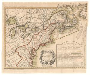
[Map of Spanish Louisiana and the American colonies]
413.
[Map of Spanish Louisiana and the American colonies]
414.
Map of the European settlements in North America
415.
Mapa de America sujecto à las observaciones astronomicas
416.
N. America
417.
A new and accurate map of North America laid down according to the latest and most approved observations, and discoveries
418.
A New map of North America : with the West India Islands. : Divided according to the preliminary articles of Peace, signed at...
419.
A New map of the whole continent of America, divided into North and South and West Indies. : With a descriptive account of the...
420.
A New map of the whole continent of America, divided into North and South and West Indies. : Wherein are exactly described the...
‹ Prev
Next ›
1
2
…
17
18
19
20
21
22
23
24
25
…
440
441


![[Map of Spanish Louisiana and the American colonies]](https://bpldcassets.blob.core.windows.net/derivatives/images/commonwealth:z603vq85r/image_thumbnail_300.jpg)
![[Map of Spanish Louisiana and the American colonies]](https://bpldcassets.blob.core.windows.net/derivatives/images/commonwealth:z603vp210/image_thumbnail_300.jpg)


