Toggle navigation
LMEC Home
Exhibitions
Georeferencing
Tools for Teachers
Collections
My Favorites
Sign Up / Log In
Search
Search the map portal
Map Collection
Map Collection
Map Sets
Search
Search
Search for
Search In
All Fields
Creator
Title
Subject
Place
Search All Digital Collections
Advanced Search
9053 Results
My Search
Start Over
More Like
commonwealth:7940bf647
Remove constraint More Like: commonwealth:7940bf647
Filter your Search
Place
North and Central America
6,284
United States
5,202
Massachusetts
2,152
Suffolk (county)
1,404
Europe
1,396
Boston
1,377
Canada
449
Asia
438
more
Place
»
Topic
Boston (Mass.)--Maps
679
City planning--Massachusetts--Boston--Maps
418
United States--Maps
282
Urban renewal--Massachusetts--Boston--Maps
253
Real property--Massachusetts--Boston--Maps
217
Massachusetts--Maps
162
Landowners--Massachusetts--Boston--Maps
135
North America--Maps--Early works to 1800
103
more
Topic
»
Date
Date range begin
–
Date range end
Current results range from
1482
to
2023
View distribution
Creator
United States. Hydrographic Office
595
Boston Redevelopment Authority
392
O.H. Bailey & Co
148
Des Barres, Joseph F. W. (Joseph Frederick Wallet), 1722-1824
123
United States. Post Office Dept
120
Ptolemy, 2nd cent
100
Walling, Henry Francis, 1825-1888
94
Geological Survey (U.S.)
86
more
Creator
»
Format
Maps/Atlases
8,993
Manuscripts
215
Prints
56
Books
36
Objects/Artifacts
10
Drawings/Illustrations
8
Posters
5
Georeferenced
Yes
870
No
8,183
Collection
Norman B. Leventhal Map & Education Center Collection
8,696
Boston and New England Maps
2,591
Urban Maps
2,377
Maritime Charts and Atlases
1,083
American Revolutionary War-Era Maps
616
Boston Redevelopment Authority Collection
443
Applied Geographics, Inc. Records
1
Available to use
No known restrictions
8,911
Creative Commons license
47
Search Constraints
Sort by relevance
relevance
title
date (asc)
date (desc)
Number of results to display per page
20 per page
10
per page
20
per page
50
per page
100
per page
View results as:
grid view
map view
Search Results
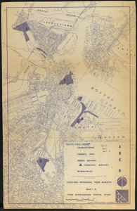
361.
Food distribution center study : Food distribution site study
362.
FPIR/FEIR Olmsted Plaza : a redevelopment of the Sears property, 309 Park Drive/201 Brookline Avenue in the Fenway
363.
General plan : Government Center - Boston - 1959
364.
General plan of Franklin Park
365.
Hancock Woods : as of right plan
366.
Hancock Woods EGA
367.
The Harbor Park system
368.
Herald Street improvements
369.
Inner belt, Southwest Expressway
370.
Long Wharf DEM/BRA master plan : master plan scheme
371.
Long Wharf DEM/BRA master plan : proposed dredging scheme
372.
Long Wharf phase II illustrative plan
373.
Longwood Medical Area
374.
Map of Boston naval shipyard, Boston, Mass. showing conditions on Jan. 1, 1966
375.
Marketplace Center : topographical survey plan
376.
Mass pike air rights study
377.
Mattapan project : existing zoning
378.
McConnell Park
379.
McConnell Park Dorchester : site plan
380.
NASA Electronic Research Center : evaluation of proposed sites in Boston
‹ Prev
Next ›
1
2
…
15
16
17
18
19
20
21
22
23
…
452
453