General plan : Government Center - Boston - 1959
Item Information
- Title:
- General plan : Government Center - Boston - 1959
- Description:
-
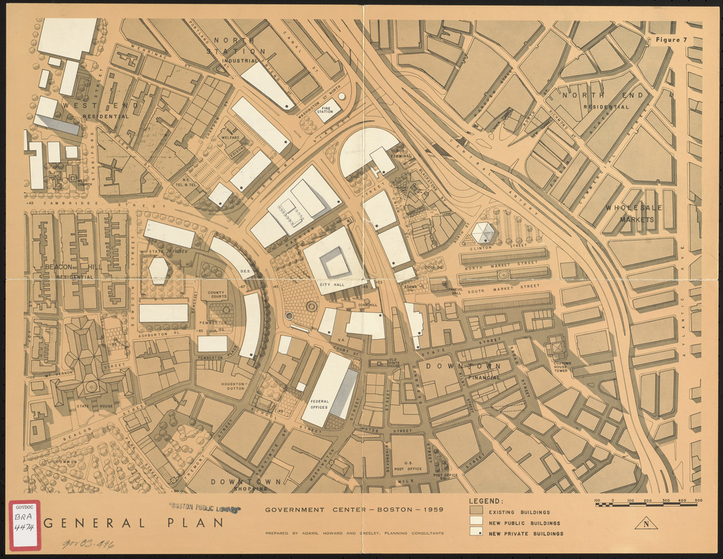
Site plan is from the Boston City Planning Board report "Government Center Project." Depicts the footprints of existing buildings, proposed new public buildings and proposed new private buildings in downtown Boston's Government Center urban renewal area. Includes parts of Beacon Hill, the North End, wholesale markets, downtown shopping, North Station and the West End (with footprint of proposed new residential buildings). Also includes name or use of some existing buildings.
- Cartographer:
- Adams, Howard, and Greeley
- Publisher:
- Boston (Mass.). City Planning Board
- Name on Item:
-
prepared by Adams, Howard and Greeley
- Date:
-
1959
- Format:
-
Maps/Atlases
- Location:
-
Boston Public Library
Central Library in Copley Square - Collection (local):
-
Boston Public Library Collection
- Subjects:
-
Government Center (Boston, Mass.)--Maps
City planning--Massachusetts--Boston--Maps
Buildings--Massachusetts--Boston--Maps
- Places:
-
Suffolk (county)Boston
Government Center
- Extent:
- 1 map : color ; 41 x 54 cm
- Terms of Use:
-
No known copyright restrictions.
No known restrictions on use.
- Publisher:
-
[Boston] :
[Boston City Planning Board]
- Scale:
-
Scale approximately 1:2,400
- Language:
-
English
- Catalog Record:
-
http://bpl.bibliocommons.com/item/show/1013057075
- Identifier:
-
06_01_017184
- Call #:
-
BRA/4474
- Barcode:
-
39999065845925


