Map of Boston naval shipyard, Boston, Mass. showing conditions on Jan. 1, 1966
Item Information
- Title:
- Map of Boston naval shipyard, Boston, Mass. showing conditions on Jan. 1, 1966
- Description:
-
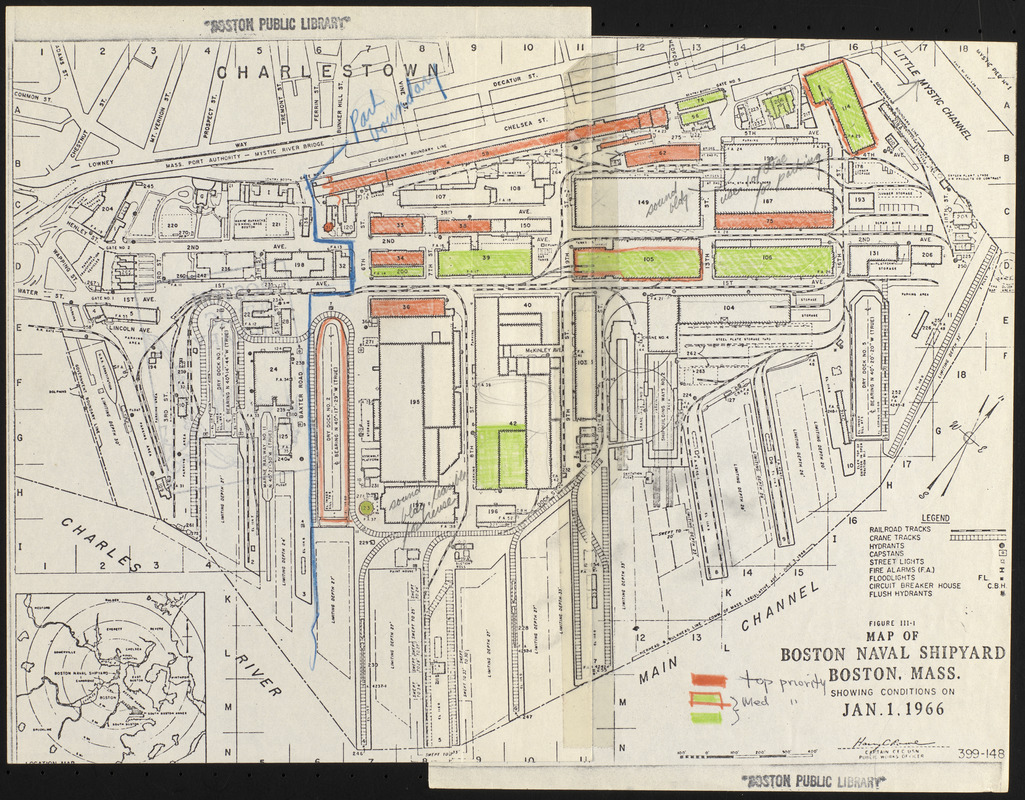
Depicts the footprints of all structures at Boston's Charlestown Navy Yard. Also indicates use and building number, railroad tracks, crane tracks, hydrants, capstans, street lights, fire alarms, floodlights, circuit breaker house and flush hydrants. Includes manuscript annotations assigning priorities to certain buildings/areas, presumably for future development uses.
- Publisher:
- United States. Navy. Civil Engineer Corps
- Date:
-
January 1, 1966
- Format:
-
Maps/Atlases
- Location:
-
Boston Public Library
Central Library in Copley Square - Collection (local):
-
Boston Public Library Collection
- Subjects:
-
Charlestown (Boston, Mass.)--Maps
City planning--Massachusetts--Boston--Maps
Charlestown Navy Yard (Mass.)
- Places:
-
MassachusettsSuffolk (county)BostonCharlestown
- Extent:
- 1 map : hand colored ; 29 x 38 cm
- Terms of Use:
-
No known copyright restrictions.
No known restrictions on use.
- Publisher:
-
[Place of publication not given] :
C.E.C. USN
- Scale:
-
Scale approximately 1:3,100
- Language:
-
English
- Catalog Record:
-
http://bpl.bibliocommons.com/item/show/1032768075
- Notes:
-
Oriented with north to the upper right.
Inset: [Area map].
"Figure III-I."
- Identifier:
-
06_01_017211
- Call #:
-
BRA/4008
- Barcode:
-
39999063544553


