Toggle navigation
LMEC Home
Exhibitions
Georeferencing
Tools for Teachers
Collections
My Favorites
Sign Up / Log In
Search
Search the map portal
Map Collection
Map Collection
Map Sets
Search
Search
Search for
Search In
All Fields
Creator
Title
Subject
Place
Search All Digital Collections
Advanced Search
8904 Results
My Search
Start Over
More Like
commonwealth:6t053n87v
Remove constraint More Like: commonwealth:6t053n87v
Filter your Search
Place
North and Central America
6,060
United States
4,927
Massachusetts
2,079
Europe
1,396
Suffolk (county)
1,046
Boston
1,019
Canada
472
Asia
441
more
Place
»
Topic
Boston (Mass.)--Maps
586
United States--Maps
282
North America--Maps--Early works to 1800
240
Real property--Massachusetts--Boston--Maps
175
Massachusetts--Maps
162
Landowners--Massachusetts--Boston--Maps
133
United States--Maps--Early works to 1800
103
New England--Maps
102
more
Topic
»
Date
Date range begin
–
Date range end
Current results range from
1482
to
2023
View distribution
Creator
United States. Hydrographic Office
595
O.H. Bailey & Co
148
Des Barres, Joseph F. W. (Joseph Frederick Wallet), 1722-1824
123
United States. Post Office Dept
120
Ptolemy, 2nd cent
100
Jefferys, Thomas, -1771
94
Walling, Henry Francis, 1825-1888
94
Sayer, Robert, 1725-1794
87
more
Creator
»
Format
Maps/Atlases
8,844
Manuscripts
217
Prints
56
Books
36
Objects/Artifacts
10
Drawings/Illustrations
8
Posters
5
Georeferenced
Yes
874
No
8,030
Collection
Norman B. Leventhal Map & Education Center Collection
8,706
Boston and New England Maps
2,234
Urban Maps
2,023
Maritime Charts and Atlases
1,083
American Revolutionary War-Era Maps
808
MacLean Collection Map Library
102
Boston Redevelopment Authority Collection
87
New York Public Library Collection
46
more
Collection
»
Available to use
No known restrictions
8,558
Creative Commons license
136
Search Constraints
Sort by relevance
relevance
title
date (asc)
date (desc)
Number of results to display per page
20 per page
10
per page
20
per page
50
per page
100
per page
View results as:
grid view
map view
Search Results
21.
A Map of the British and French settlements in North America
22.
A new and accurate map of the English empire in North America : representing their rightful claim as confirm'd by charters, and...
23.
A new and correct map of North America; with the West India Islands : divided according to the last treaty of peace, concluded...
24.
North America from the French of Mr. D'Anville, improved with the back settlements of Virginia and course of Ohio, illustrated...
25.
L'Amerique Septentrionale, ou se remarquent les Etats Unis
26.
BOWLES'S NEW POCKET MAP OF THE UNITED STATES OF AMERICA : WITH THE BRITISH POSSESSIONS OF CANADA, NOVA SCOTIA, AND OF...
27.
A map of the British and French dominions in North America : with the roads, distances, limits, and extent of the settlements,...
28.
A new and correct map of North America, with the West India islands, divided according to the preliminary articles of peace,...
29.
A New map of North America with the West India Islands : divided according to the preliminary articles of peace, signed at...
30.
Carte du Canada ou de la Nouvelle France et des decouvertes qui y ont été faites
31.
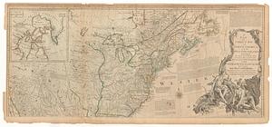
A general map of the middle British colonies in America, viz. Virginia, Maryland, Delaware, Pensilvania, New-Jersey, New York,...
32.
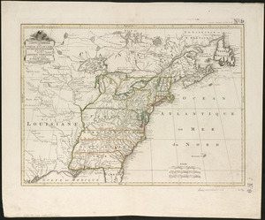
An accurate map of the United States of America, with part of the surrounding provinces agreeable to the Treaty of Peace of 1783
33.
Amplissimae regionis Mississipi seu provinciae Ludovicianae â R.P. Ludovico Hennepin Francisc. Miss. in America septentrionali...
34.
Amplissimae regionis Mississipi seu Provinciae Ludovicianae â R.P. Ludovico Hennepin Francisc Miss in America Septentrionali...
35.
Bowles's new one-sheet map of the independent states of Virginia, Maryland, Delaware, Pensylvania, New Jersey, New York,...
36.
Carte de la Louisiane cours du Mississipi et pais voisins : dediée à M. le Comte de Maurepas, ministre et secretaire d'etat...
37.
Carte de la Louisiane et du cours de Mississipi
38.
Carte du Mexique et des Etats Unis d'Amérique, partie meridionale
39.
Carte generale des treize Etats Unis, de l'Amerique septentrionale
40.
Carte minéralogique, où l'on voit la nature des terreins du Canada et de la Louisiane
‹ Prev
Next ›
1
2
3
4
5
6
…
445
446