Toggle navigation
LMEC Home
Exhibitions
Georeferencing
Tools for Teachers
Collections
My Favorites
Sign Up / Log In
Search
Search the map portal
Map Collection
Map Collection
Map Sets
Search
Search
Search for
Search In
All Fields
Creator
Title
Subject
Place
Search All Digital Collections
Advanced Search
621 Results
My Search
Start Over
More Like
commonwealth:6q188644j
Remove constraint More Like: commonwealth:6q188644j
Filter your Search
Place
North and Central America
491
United States
249
North America
240
Canada
76
West Indies
60
New York
26
Asia
19
Pennsylvania
18
more
Place
»
Topic
North America--Maps--Early works to 1800
240
West Indies--Maps--Early works to 1800
63
United States--Maps--Early works to 1800
58
Canada--Maps--Early works to 1800
50
Great Britain--Colonies--America--Maps--Early works to 1800
22
Caribbean Area--Maps--Early works to 1800
17
Great Lakes Region (North America)--Maps--Early works to 1800
14
Northeastern States--Maps--Early works to 1800
12
more
Topic
»
Date
Date range begin
–
Date range end
Current results range from
1528
to
1999
View distribution
Creator
Jefferys, Thomas, -1771
32
Sayer, Robert, 1725-1794
23
Mitchell, John, 1711-1768
22
Gibson, J. (John), active 1750-1792
18
Anville, Jean Baptiste Bourguignon d', 1697-1782
17
Bellin, Jacques Nicolas, 1703-1772
17
Moll, Herman, d. 1732
15
Robert Sayer and John Bennett (Firm)
15
more
Creator
»
Format
Maps/Atlases
619
Manuscripts
8
Paintings
3
Ephemera
1
Objects/Artifacts
1
Prints
1
Georeferenced
Yes
14
No
607
Collection
American Revolutionary War-Era Maps
475
MacLean Collection Map Library
379
Norman B. Leventhal Map & Education Center Collection
166
New York Public Library Collection
34
Richard H. Brown Revolutionary War Map Collection at Mount Vernon
20
Maritime Charts and Atlases
12
Mapping Boston Collection
10
Sidney R. Knafel Map Collection at Phillips Academy
8
more
Collection
»
Available to use
No known restrictions
160
Creative Commons license
69
Search Constraints
Sort by relevance
relevance
title
date (asc)
date (desc)
Number of results to display per page
20 per page
10
per page
20
per page
50
per page
100
per page
View results as:
grid view
map view
Search Results
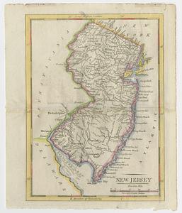
501.
New Jersey
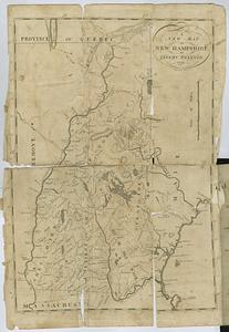
502.
A new map of New Hampshire
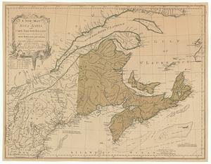
503.
A new map of Nova Scotia, and Cape Breton Island with the adjacent parts of New England and Canada, composed from a great...
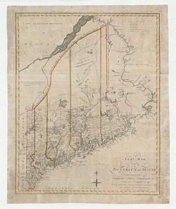
504.
A new map of the district of Maine taken from the original map compiled by Osgood Carleton esqr. from the actual surveys that...
505.
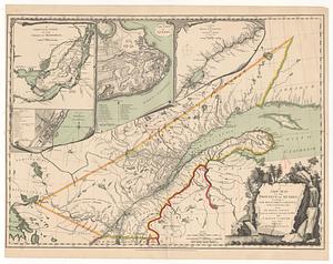
A new map of the province of Quebec, according to the royal proclamation, of the 7.th of October 1763 : from the French surveys...
506.
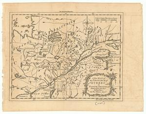
A new map of the province of Quebec in North America : drawn from the best authorities
507.
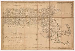
A new map of the state of Massachusetts : from the original map compiled by Osgood Carleton esq.r from the actual surveys that...
508.
A new map of the United States of America : drawn from the latest authorities
509.
A new map of the United States of America including part of Louisiana : part of Canada & of East Florida and the whole of West...
510.
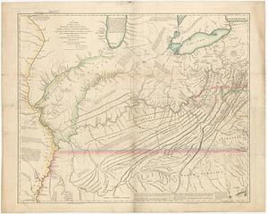
A new map of the western parts of Virginia, Pennsylvania, Maryland and North Carolina : comprehending the river Ohio, and all...
511.
A new map of the western parts of Virginia, Pennsylvania, Maryland and North Carolina comprehending the river Ohio, and all the...
512.
New York
513.
Nouveau plan routier de la ville et faubourgs de Paris avec ses principaux édifices et nouvelles barrières
514.
Nova tabvla geographica complectens borealiorem americæ partem; in qua exacte delineatæ sunt Canada sive Nova Francia, Nova...
515.
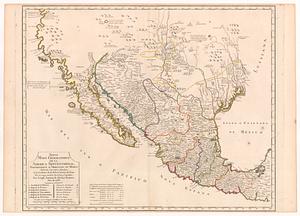
Nuevo mapa geografico de la America Septentrional, perteneciente al virreynato de Mexico dedicado à los sabios miembros de la...
516.
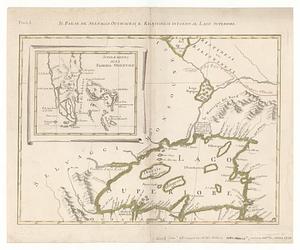
Il paese de' selvaggi Outauacesi, e Kilistinesi intorno al Lago Superiore
517.
Painting of Adaidvipa
518.
Painting of Ahaidvipa
519.
Painting of Jambudvipa
520.
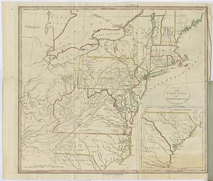
Part of the United States of North America
‹ Prev
Next ›
1
2
…
22
23
24
25
26
27
28
29
30
31
32