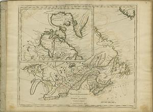
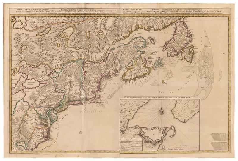
Nova tabvla geographica complectens borealiorem americæ partem; in qua exacte delineatæ sunt Canada sive Nova Francia, Nova Scotia, Nova Anglia, Novum Belgium, Pensylvania, Virginia, Carolina, et terra nova, cum omnibus littorum, pulvinorum profunditatibus = Carte nouvelle contenant la partie d'Amerique la plus septentrionale, ou sont exactement décrites les provinces suivantes comme le Canada ou Nouvelle France, la Nouvelle Escosse, la Nouvelle Angleterre, les Nouveaux Païs Bas, la Pensilvanie, la Virginie, la Caroline et l'ile de Terre Neuve avec les profundeuis le long des côtes et sur les bancs
This map is also available in American Revolutionary Geographies Online (ARGO), a collections portal especially built for material relating to the American Revolutionary War Era. Visit ARGO to learn more about this item and explore the historical geography of North America in the late eighteenth century.
Item Information
- Title:
- Nova tabvla geographica complectens borealiorem americæ partem; in qua exacte delineatæ sunt Canada sive Nova Francia, Nova Scotia, Nova Anglia, Novum Belgium, Pensylvania, Virginia, Carolina, et terra nova, cum omnibus littorum, pulvinorum profunditatibus = Carte nouvelle contenant la partie d'Amerique la plus septentrionale, ou sont exactement décrites les provinces suivantes comme le Canada ou Nouvelle France, la Nouvelle Escosse, la Nouvelle Angleterre, les Nouveaux Païs Bas, la Pensilvanie, la Virginie, la Caroline et l'ile de Terre Neuve avec les profundeuis le long des côtes et sur les bancs
- Creator:
- Visscher, Nicolaes, 1618-1679
- Publisher:
- Schenk, Petrus, 1693-1775
- Name on Item:
-
a Nicolao Visscher ; nunc apud Petrum Schenk iunior ; Luggardus van Anse schulp.
- Date:
-
[ca. 1745]
- Format:
-
Maps/Atlases
- Location:
- MacLean Collection Map Library
- Collection (local):
-
MacLean Collection Map Library
- Subjects:
-
Canada--Maps--Early works to 1800
- Places:
-
Canada
- Extent:
- 1 map ; 562 x 893 mm
- Terms of Use:
-
Public Domain/No known restrictions on use. Contact host institution to download image.
Contact host institution for more information.
- Publisher:
-
Amsterdam :
Schenk, Pieter (II)
- Language:
-
Latin
French
- Identifier:
-
MC_896
- Call #:
-
896