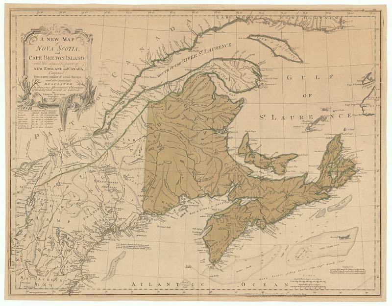
A new map of Nova Scotia, and Cape Breton Island with the adjacent parts of New England and Canada, composed from a great number of actual surveys and other materials regulated by many new astronomical observations of the longitude as well as latitude
This map is also available in American Revolutionary Geographies Online (ARGO), a collections portal especially built for material relating to the American Revolutionary War Era. Visit ARGO to learn more about this item and explore the historical geography of North America in the late eighteenth century.
Item Information
- Title:
- A new map of Nova Scotia, and Cape Breton Island with the adjacent parts of New England and Canada, composed from a great number of actual surveys and other materials regulated by many new astronomical observations of the longitude as well as latitude
- Contributor:
- Green, John, -1757
- Publisher:
- Robert Sayer and John Bennett (Firm)
- Name on Item:
-
by Thomas Jefferys, geographer to the king
- Date:
-
June 15, 1775
- Format:
-
Maps/Atlases
- Location:
- MacLean Collection Map Library
- Collection (local):
-
MacLean Collection Map Library
- Subjects:
-
Nova Scotia--Maps
- Places:
-
CanadaNova Scotia (province)
- Extent:
- 1 map ; 472 x 617 mm
- Terms of Use:
-
Public Domain/No known restrictions on use. Contact host institution to download image.
Contact host institution for more information.
- Publisher:
-
London :
Published according to act of Parliament by Tho.s Jefferys, geographer to the king ; printed & sold by R. Sayer & J. Bennett, n.o 53. in Fleet Street
- Language:
-
English
- Identifier:
-
MC_3451
- Call #:
-
3451