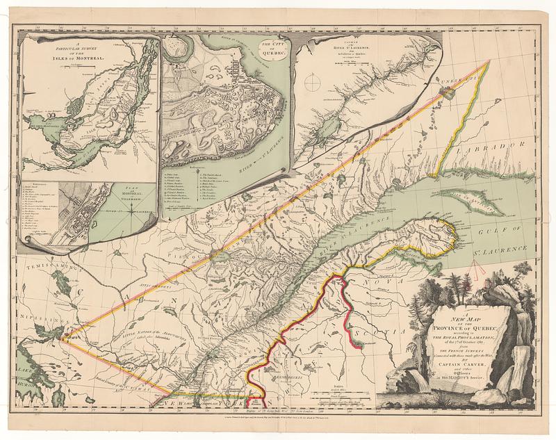
A new map of the province of Quebec, according to the royal proclamation, of the 7.th of October 1763 : from the French surveys connected with those made after the war
This map is also available in American Revolutionary Geographies Online (ARGO), a collections portal especially built for material relating to the American Revolutionary War Era. Visit ARGO to learn more about this item and explore the historical geography of North America in the late eighteenth century.
Item Information
- Title:
- A new map of the province of Quebec, according to the royal proclamation, of the 7.th of October 1763 : from the French surveys connected with those made after the war
- Creator:
- Carver, Jonathan, 1710-1780
- Publisher:
- Robert Sayer and John Bennett (Firm)
- Name on Item:
-
by Captain Carver, and other officers, in His Majesty's service
- Date:
-
February 16, 1776
- Format:
-
Maps/Atlases
- Location:
- MacLean Collection Map Library
- Collection (local):
-
MacLean Collection Map Library
- Subjects:
-
Québec (Province)--Maps
- Places:
-
CanadaQuebec (province)
- Extent:
- 1 map ; 661 x 483 mm
- Terms of Use:
-
Public Domain/No known restrictions on use. Contact host institution to download image.
Contact host institution for more information.
- Publisher:
-
London :
Printed for Rob.t Sayer and John Bennet map and printsellers n.o 53 in Fleet Street
- Edition:
- First state
- Language:
-
English
- Identifier:
-
MC_22314
- Call #:
-
22314


