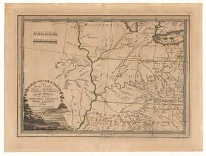
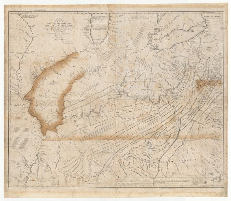
A new map of the western parts of Virginia, Pennsylvania, Maryland and North Carolina comprehending the river Ohio, and all the rivers, which fall into it, part of the river Mississippi, the whole of the Illinois River, Lake Erie part of the lakes Huron, Michigan &c. and all the country bordering on these lakes and rivers
This map is also available in American Revolutionary Geographies Online (ARGO), a collections portal especially built for material relating to the American Revolutionary War Era. Visit ARGO to learn more about this item and explore the historical geography of North America in the late eighteenth century.
Item Information
- Title:
- A new map of the western parts of Virginia, Pennsylvania, Maryland and North Carolina comprehending the river Ohio, and all the rivers, which fall into it, part of the river Mississippi, the whole of the Illinois River, Lake Erie part of the lakes Huron, Michigan &c. and all the country bordering on these lakes and rivers
- Cartographer:
- Hutchins, Thomas, 1730-1789
- Publisher:
- Hutchins, Thomas, 1730-1789
- Name on Item:
-
by Tho.s Hutchins. Captain in the 60 Regiment of Foot ; engrav'd by J. Cheevers
- Date:
-
November 1, 1778
- Format:
-
Maps/Atlases
- Location:
- MacLean Collection Map Library
- Collection (local):
-
MacLean Collection Map Library
- Subjects:
-
Middle West--Maps--Early works to 1800
- Places:
-
Midwest (area)
- Extent:
- 1 map ; 928 x 1105 mm
- Terms of Use:
-
Public Domain/No known restrictions on use. Contact host institution to download image.
Contact host institution for more information.
- Publisher:
-
London :
T. Hutchins
- Edition:
- First state
- Language:
-
English
- Identifier:
-
MC_2655
- Call #:
-
2655