Toggle navigation
LMEC Home
Exhibitions
Georeferencing
Tools for Teachers
Collections
My Favorites
Sign Up / Log In
Search
Search the map portal
Map Collection
Map Collection
Map Sets
Search
Search
Search for
Search In
All Fields
Creator
Title
Subject
Place
Search All Digital Collections
Advanced Search
8704 Results
My Search
Start Over
More Like
commonwealth:4m90fm27p
Remove constraint More Like: commonwealth:4m90fm27p
Filter your Search
Place
North and Central America
5,926
United States
4,844
Massachusetts
2,079
Europe
1,396
Suffolk (county)
1,046
Boston
1,019
Canada
449
Asia
438
more
Place
»
Topic
Boston (Mass.)--Maps
586
United States--Maps
282
Real property--Massachusetts--Boston--Maps
175
Massachusetts--Maps
162
Landowners--Massachusetts--Boston--Maps
133
North America--Maps--Early works to 1800
103
New England--Maps
102
World maps
82
more
Topic
»
Date
Date range begin
–
Date range end
Current results range from
1482
to
2023
View distribution
Creator
United States. Hydrographic Office
595
O.H. Bailey & Co
148
Des Barres, Joseph F. W. (Joseph Frederick Wallet), 1722-1824
123
United States. Post Office Dept
120
Ptolemy, 2nd cent
100
Walling, Henry Francis, 1825-1888
94
Geological Survey (U.S.)
86
Jefferys, Thomas, -1771
85
more
Creator
»
Format
Maps/Atlases
8,644
Manuscripts
218
Prints
56
Books
36
Objects/Artifacts
10
Drawings/Illustrations
8
Posters
5
Georeferenced
Yes
869
No
7,835
Collection
Norman B. Leventhal Map & Education Center Collection
8,701
Boston and New England Maps
2,234
Urban Maps
2,023
Maritime Charts and Atlases
1,083
American Revolutionary War-Era Maps
616
Boston Redevelopment Authority Collection
87
Sidney R. Knafel Map Collection at Phillips Academy
3
Available to use
No known restrictions
8,554
Creative Commons license
50
Search Constraints
Sort by relevance
relevance
title
date (asc)
date (desc)
Number of results to display per page
20 per page
10
per page
20
per page
50
per page
100
per page
View results as:
grid view
map view
Search Results
1.
Tabula I Asiae
2.
Airways of the world on Mercator's projection
3.
American Radiator Company trade card
4.
Bartholomew's chart of the world on Mercator's projection
5.
Caerte van de voornaemste reysen ende ontdeckingen door de Hollanders gedaen, alsook vande landen, plaetsen ende factoriën in...
6.
Carriers of the new black plague
7.
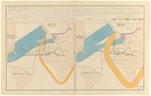
Carte figurative et approximative des quantités de coton en laine importées en Europe en 1858 et en 1861
8.
A chart of the world, according to Mercators projection, shewing the latest discoveries of Capt. Cook
9.
Chart of the world, on Mercator's projection : illustrative of the impolicy of slavery
10.
Chart of the world showing area in the Pacific Ocean having Hawaii as the only base of supplies in transpacific voyages and...
11.
Chikyū bankoku hōzu
12.
Comparative view of the heights of the principal mountains &c. in the world
13.
Diagram to illustrate contrast between British and Chinese Empires
14.
Diqiu quan tu
15.
Eight views of the world
16.
Europe in search of new routes to India and China, 1486-1616 A.D.
17.
Gleason's new standard map of the world : on the projection of J. S. Christopher, Modern College, Blackheath, England ;...
18.
Great circle airways
19.
Imperial Federation, map of the world showing the extent of the British Empire in 1886
20.
Index diagram of sheets for the International map on the scale of 1:1,000,000
‹ Prev
Next ›
1
2
3
4
5
…
435
436