Toggle navigation
LMEC Home
Exhibitions
Georeferencing
Tools for Teachers
Collections
My Favorites
Sign Up / Log In
Search
Search the map portal
Map Collection
Map Collection
Map Sets
Search
Search
Search for
Search In
All Fields
Creator
Title
Subject
Place
Search All Digital Collections
Advanced Search
8553 Results
My Search
Start Over
More Like
commonwealth:4m90fj06h
Remove constraint More Like: commonwealth:4m90fj06h
Filter your Search
Place
North and Central America
5,848
United States
4,770
Massachusetts
2,052
Europe
1,359
Suffolk (county)
1,034
Boston
1,007
Canada
448
Asia
422
more
Place
»
Topic
Boston (Mass.)--Maps
577
United States--Maps
273
Real property--Massachusetts--Boston--Maps
174
Massachusetts--Maps
160
Landowners--Massachusetts--Boston--Maps
132
North America--Maps--Early works to 1800
103
New England--Maps
99
Europe--Maps
78
more
Topic
»
Date
Date range begin
–
Date range end
Current results range from
1482
to
2023
View distribution
Creator
United States. Hydrographic Office
594
O.H. Bailey & Co
148
Des Barres, Joseph F. W. (Joseph Frederick Wallet), 1722-1824
123
United States. Post Office Dept
120
Ptolemy, 2nd cent
100
Walling, Henry Francis, 1825-1888
94
Geological Survey (U.S.)
86
Jefferys, Thomas, -1771
85
more
Creator
»
Format
Maps/Atlases
8,494
Manuscripts
215
Prints
56
Books
36
Objects/Artifacts
10
Drawings/Illustrations
8
Posters
4
Georeferenced
Yes
868
No
7,685
Collection
Norman B. Leventhal Map & Education Center Collection
8,551
Boston and New England Maps
2,204
Urban Maps
1,936
Maritime Charts and Atlases
1,081
American Revolutionary War-Era Maps
618
Boston Redevelopment Authority Collection
87
William L. Clements Library Collection
2
Applied Geographics, Inc. Records
1
Available to use
No known restrictions
8,410
Creative Commons license
46
Search Constraints
Sort by relevance
relevance
title
date (asc)
date (desc)
Number of results to display per page
20 per page
10
per page
20
per page
50
per page
100
per page
View results as:
grid view
map view
Search Results
21.
Map of the United States of America, Mexico, Central America, and the West India Islands
22.
Map of the United States of America, the British Provinces, Mexico, the West Indies and Central America, with part of New...
23.
Map of the United States of America, the British provinces, Mexico, the West Indies and Central America, with part of New...
24.
Map of the United States of North America, upper & lower Canada, New Brunswick, Nova Scotia & British Columbia, Mexico, Cuba,...
25.
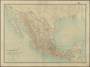
Mexico : from official Mexican and other sources
26.
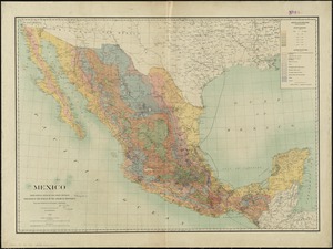
Mexico : from official Mexican and other sources
27.
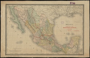
Mexico : showing lines of the Mexican Central Railway Co., Limited
28.
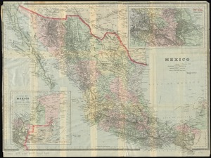
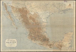
Mexico
29.
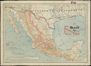
Mexico, mapa de las lineas del Ferrocarril Central Mexicano y conecciones
30.
The National Geographic Magazine map of Mexico
31.
A new map of Mexico and adjacent provinces compiled from original documents
32.
Nuevo mapa de Mexico
33.
Pictorial map of Mexico
34.
The Rand-McNally new commercial atlas map of Mexico
35.
The southwestern railroad system United States and Mexico
36.
Transportation lines between the United States and Mexico, showing differences of elevation
37.
Map of explorations and surveys in New Mexico and Utah made under the direction of the Secretary of War by Capt. J. N. Macomb...
38.
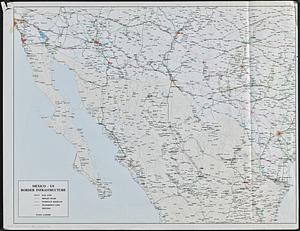
Mexico - US border infrastructure
39.
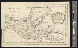
Carte des provinces de Tabasco, Chiapa, Verapaz, Guatimala, Honduras et Yucatan situées dans l'Amérique Meridionale : pour...
40.
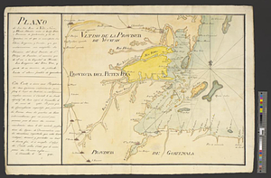
Plano de los Tres Rios de Valiz, Nuevo, y Hondo, situados entre et Golfo Dulce o provincia de Goatemala y de la Yucatan en et...
‹ Prev
Next ›
1
2
3
4
5
6
…
427
428