Toggle navigation
LMEC Home
Exhibitions
Georeferencing
Tools for Teachers
Collections
My Favorites
Sign Up / Log In
Search
Search the map portal
Map Collection
Map Collection
Map Sets
Search
Search
Search for
Search In
All Fields
Creator
Title
Subject
Place
Search All Digital Collections
Advanced Search
8702 Results
My Search
Start Over
More Like
commonwealth:4m90fh41w
Remove constraint More Like: commonwealth:4m90fh41w
Filter your Search
Place
North and Central America
5,933
United States
4,845
Massachusetts
2,079
Europe
1,396
Suffolk (county)
1,046
Boston
1,019
Canada
456
Asia
438
more
Place
»
Topic
Boston (Mass.)--Maps
586
United States--Maps
282
Real property--Massachusetts--Boston--Maps
175
Massachusetts--Maps
162
Landowners--Massachusetts--Boston--Maps
133
North America--Maps--Early works to 1800
103
New England--Maps
102
Europe--Maps
79
more
Topic
»
Date
Date range begin
–
Date range end
Current results range from
1482
to
2023
View distribution
Creator
United States. Hydrographic Office
595
O.H. Bailey & Co
148
Des Barres, Joseph F. W. (Joseph Frederick Wallet), 1722-1824
123
United States. Post Office Dept
120
Ptolemy, 2nd cent
100
Walling, Henry Francis, 1825-1888
94
Geological Survey (U.S.)
86
Jefferys, Thomas, -1771
85
more
Creator
»
Format
Maps/Atlases
8,642
Manuscripts
215
Prints
56
Books
36
Objects/Artifacts
10
Drawings/Illustrations
8
Posters
5
Georeferenced
Yes
869
No
7,833
Collection
Norman B. Leventhal Map & Education Center Collection
8,694
Boston and New England Maps
2,233
Urban Maps
2,023
Maritime Charts and Atlases
1,083
American Revolutionary War-Era Maps
624
Boston Redevelopment Authority Collection
87
William L. Clements Library Collection
4
Library and Archives Canada Collection
3
more
Collection
»
Available to use
No known restrictions
8,552
Creative Commons license
47
Search Constraints
Sort by relevance
relevance
title
date (asc)
date (desc)
Number of results to display per page
20 per page
10
per page
20
per page
50
per page
100
per page
View results as:
grid view
map view
Search Results
1.
Government map of part of the Huron and Ottawa Territory, Ontario
2.
Map of Ontario and Quebec showing location and capacity of flour mills and elevators
3.
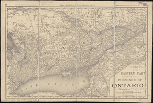
Map of the eastern part of the Province of Ontario
4.
Map of the northern part of the state of New York
5.
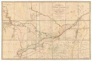
A map of the province of Upper Canada, describing all the new settlements, townships, & cc. with the countries adjacent, from...
6.
A map of Upper and Lower Canada : with part of the United States adjoining, comprising the present seat of war
7.
Scarborough's map of Ontario : with an index of all cities, villages, post-offices and railway stations and population...
8.
Topographical plan of the north shore of Lake Huron shewing recent surveys
9.
A map of the lakes & Hudsons Bay
10.
A map of the lakes & Hudsons Bay
11.
A map of the province of upper Canada, describing all the new settlements, townships, &c. with the countries adjacent, from...
12.
Posts of the Hudson's Bay Company 1790
13.
Proposed division line for Upper and Lower Canada
14.
Sketch of a route from Yorktown on Lake Ontario to Penatangasheen on Lake Huron - Upper Canada
15.
Sketch of a route from Yorktown on Lake Ontario to Penatangasheen on Lake Huron - Upper Canada
16.
Sketch of the seven dangerous rappids with their true channel : also the appearance the river makes at those places between...
17.
The 100th anniversary map of Abraham Lincoln's visit to Massachusetts, September 11-23, 1848
18.
1630 shoreline
19.
1879. Progress map of the U.S. Geographical Surveys west of the 100th Meridian : prepared under the direction of 1st Lieut....
20.
1903 Map of Salem and surrounding places
‹ Prev
Next ›
1
2
3
4
5
…
435
436