Toggle navigation
LMEC Home
Exhibitions
Georeferencing
Tools for Teachers
Collections
My Favorites
Sign Up / Log In
Search
Search the map portal
Map Collection
Map Collection
Map Sets
Search
Search
Search for
Search In
All Fields
Creator
Title
Subject
Place
Search All Digital Collections
Advanced Search
8549 Results
My Search
Start Over
More Like
commonwealth:3f4639492
Remove constraint More Like: commonwealth:3f4639492
Filter your Search
Place
North and Central America
5,844
United States
4,768
Massachusetts
2,051
Europe
1,359
Suffolk (county)
1,034
Boston
1,007
Canada
448
Asia
422
more
Place
»
Topic
Boston (Mass.)--Maps
577
United States--Maps
273
Real property--Massachusetts--Boston--Maps
174
Massachusetts--Maps
160
Landowners--Massachusetts--Boston--Maps
132
North America--Maps--Early works to 1800
103
New England--Maps
99
Europe--Maps
78
more
Topic
»
Date
Date range begin
–
Date range end
Current results range from
1482
to
2023
View distribution
Creator
United States. Hydrographic Office
594
O.H. Bailey & Co
148
Des Barres, Joseph F. W. (Joseph Frederick Wallet), 1722-1824
122
United States. Post Office Dept
120
Ptolemy, 2nd cent
100
Walling, Henry Francis, 1825-1888
94
Geological Survey (U.S.)
86
Jefferys, Thomas, -1771
85
more
Creator
»
Format
Maps/Atlases
8,490
Manuscripts
215
Prints
56
Books
36
Objects/Artifacts
10
Drawings/Illustrations
8
Posters
4
Georeferenced
Yes
869
No
7,680
Collection
Norman B. Leventhal Map & Education Center Collection
8,549
Boston and New England Maps
2,203
Urban Maps
1,936
Maritime Charts and Atlases
1,080
American Revolutionary War-Era Maps
615
Boston Redevelopment Authority Collection
87
Available to use
No known restrictions
8,408
Creative Commons license
46
Search Constraints
Sort by relevance
relevance
title
date (asc)
date (desc)
Number of results to display per page
20 per page
10
per page
20
per page
50
per page
100
per page
View results as:
grid view
map view
Search Results
7441.
The Spainish Netherlands, vulgarly called Flanders, devided into its X provinces, wherein are delineated the fortified towns...
7442.
Spain--south coast, Port Málaga : from the Spanish government survey of 1872
7443.
Spain--west coast, Arosa and Pontevedra Bays : from the latest Spanish surveys : republication of Brit. Admty. chart no. 1756
7444.
Spanish North America
7445.
Spanish North America, southern part
7446.
Spartanburg, South Carolina : the city of success ; city map and street directory
7447.
Special map of Rossland, British Columbia
7448.
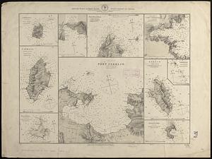
Special plan to chart no. 565 : harbors and anchorages on the N.E. coast of Madagascar : from British and French surveys,...
7449.
Special plans to chart no. 318
7450.
Special plans to chart no. 320, west-coast of Italy
7451.
Special plans to chart no. 394, western shore of the Caribbean Sea : from British surveys, corrected to 1872
7452.
Special plans to chart no. 565 : harbors and anchorages on the N.W. coast of Madagascar : from British surveys in 1824,...
7453.
Special plans to chart no. 565, harbors and anchorages on the north coast of Madagascar : from British and French surveys,...
7454.
Specialkarte der Asiatischen Türkey : oestliches blatt
7455.
Special-karte der eisenbahn-, post- u. dampfschiff-verbindungen Mittel-Europa's mit angabe aller eisenbahn-, post- u....
7456.
Special-karte der Europäischen Türkey
7457.
Special-karte der Fränkischen Schweiz und der umgegend von Nürnberg : (aus Reymann's Special-karte von Central-Europa)
7458.
Specialkarte des Grossen Salzsee's von Utah und Seiner Umgebungen : nach den aufnahmen von Frémont und Stansbury
7459.
Specialkarte vom kriegsschauplatz am Rhein 1870 (Erfurt bis Paris) : Belgien, nordöstliches Frankreich, Luxembourg,...
7460.
Spencer
‹ Prev
Next ›
1
2
…
369
370
371
372
373
374
375
376
377
…
427
428