Toggle navigation
LMEC Home
Exhibitions
Georeferencing
Tools for Teachers
Collections
My Favorites
Sign Up / Log In
Search
Search the map portal
Map Collection
Map Collection
Map Sets
Search
Search
Search for
Search In
All Fields
Creator
Title
Subject
Place
Search All Digital Collections
Advanced Search
8718 Results
My Search
Start Over
More Like
commonwealth:3f462z93c
Remove constraint More Like: commonwealth:3f462z93c
Filter your Search
Place
North and Central America
5,949
United States
4,865
Massachusetts
2,079
Europe
1,396
Suffolk (county)
1,046
Boston
1,019
Canada
454
Asia
438
more
Place
»
Topic
Boston (Mass.)--Maps
586
United States--Maps
282
Real property--Massachusetts--Boston--Maps
175
Massachusetts--Maps
163
Landowners--Massachusetts--Boston--Maps
133
New England--Maps
105
North America--Maps--Early works to 1800
103
Europe--Maps
79
more
Topic
»
Date
Date range begin
–
Date range end
Current results range from
1482
to
2023
View distribution
Creator
United States. Hydrographic Office
595
O.H. Bailey & Co
148
Des Barres, Joseph F. W. (Joseph Frederick Wallet), 1722-1824
123
United States. Post Office Dept
120
Ptolemy, 2nd cent
100
Walling, Henry Francis, 1825-1888
94
Geological Survey (U.S.)
90
Jefferys, Thomas, -1771
85
more
Creator
»
Format
Maps/Atlases
8,658
Manuscripts
218
Prints
56
Books
36
Objects/Artifacts
10
Drawings/Illustrations
8
Posters
5
Georeferenced
Yes
869
No
7,849
Collection
Norman B. Leventhal Map & Education Center Collection
8,699
Boston and New England Maps
2,237
Urban Maps
2,023
Maritime Charts and Atlases
1,083
American Revolutionary War-Era Maps
633
Boston Redevelopment Authority Collection
87
Maps from AAS
8
William L. Clements Library Collection
6
more
Collection
»
Available to use
No known restrictions
8,557
Creative Commons license
48
Search Constraints
Sort by relevance
relevance
title
date (asc)
date (desc)
Number of results to display per page
20 per page
10
per page
20
per page
50
per page
100
per page
View results as:
grid view
map view
Search Results
5501.
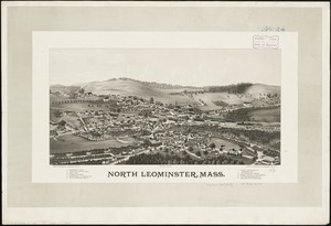
North Leominster, Mass
5502.
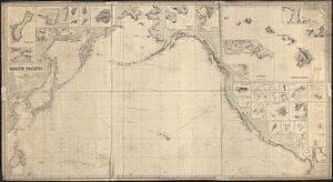
North Pacific
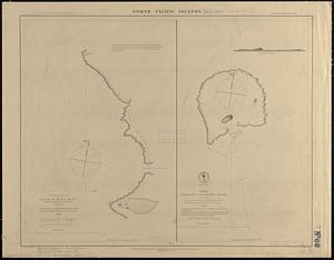
5503.
North Pacific islands
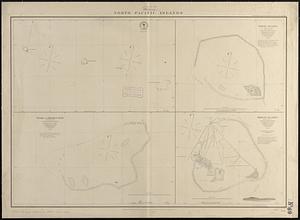
5504.
North Pacific Islands
5505.
North Pacific islands
5506.
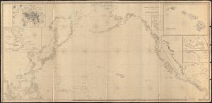
North Pacific Ocean
5507.
North Pacific Ocean
5508.
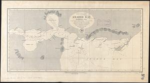
North Pacific Ocean, Anadir Bay, Behring Sea : from a chart by Engineer Bulkley of New York in 1865, with corrections and...
5509.
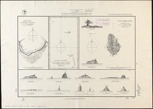
North Pacific Ocean, atolls in the Marshall Group : from an examination by the U.S.S. "Narragansett", Comdr. R.W. Meade, in 1872
5510.
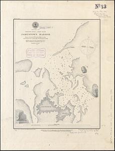
North Pacific Ocean, Caroline Group - Ponapi Island, Jamestown Harbor : from a survey in 1870 by the officers of the U.S.S....
5511.
North Pacific Ocean-- Caroline Is., Ascension I. (Pouinipet or Ponape I.), Kiti Harbor
5512.
North Pacific Ocean, Caroline Islands, Seniavine Islands : from French, Russian and U.S. surveys, corrected to 1873
5513.
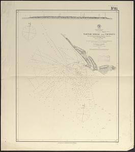
North Pacific Ocean, coast of Mexico, preliminary, Tartar Shoal and vicinity
5514.
North Pacific Ocean, Japan, examination of the islands and dangers south of Fatsizio Sima
5515.
North Pacific Ocean, Loo Choo Archipelago-- Ou-sima, Hancock Bay : from British surveys in 1872 & 1882
5516.
North Pacific Ocean, Marshall Islands, Likieb Group : from a sketch made by Captain J.V. Melander in 1885
5517.
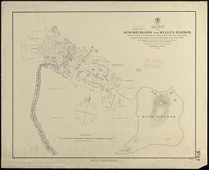
North Pacific Ocean, Midway Islands, Seward Roads and Welles Harbor
5518.
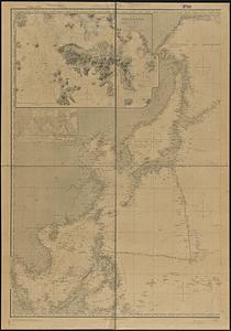
North Pacific Ocean, sheet IV
5519.
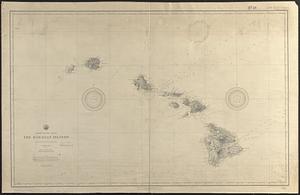
North Pacific Ocean, the Hawaiian Islands : compiled from the latest information
5520.
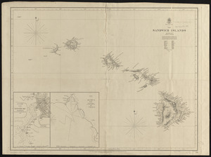
North Pacific Ocean, the Sandwich Islands : from various but imperfect authorities
‹ Prev
Next ›
1
2
…
272
273
274
275
276
277
278
279
280
…
435
436