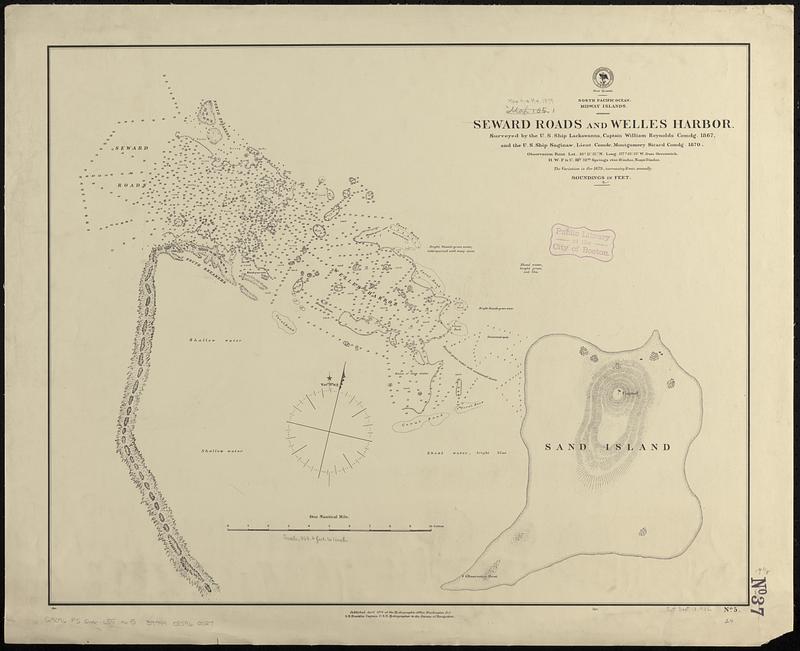
North Pacific Ocean, Midway Islands, Seward Roads and Welles Harbor
Item Information
- Title:
- North Pacific Ocean, Midway Islands, Seward Roads and Welles Harbor
- Issuing body:
- United States. Hydrographic Office
- Name on Item:
-
surveyed by the U.S. Ship Lackawanna, Captain William Reynolds comdg. 1867, and the U.S. Ship Saginaw, Lieut. Comdr. Montgomery Sicard comdg. 1870
- Date:
-
1879
- Format:
-
Maps/Atlases
- Genre:
-
Nautical charts
- Location:
-
Boston Public Library
Norman B. Leventhal Map & Education Center - Collection (local):
-
Norman B. Leventhal Map & Education Center Collection
- Subjects:
-
Midway Islands--Maps
Nautical charts--Midway Islands
- Places:
-
Midway Islands (possession)
- Extent:
- 1 map ; 49 x 61 cm
- Terms of Use:
-
No known copyright restrictions.
No known restrictions on use.
- Publisher:
-
Washington, D.C. :
Hydrographic Office
- Scale:
-
Scale approximately 1:10,400
- Language:
-
English
- Table of Contents:
-
Notske Anchorage
Hana Bay
Hamanaka Bay
Nemoro Anchorage
- Notes:
-
Relief shown by hachures. Depths shown by soundings and pictorially.
- Identifier:
-
06_01_017575
- Call #:
-
G9096.P5 svar .U55 no. 5
- Barcode:
-
39999085960027