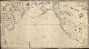
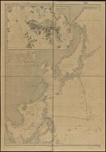
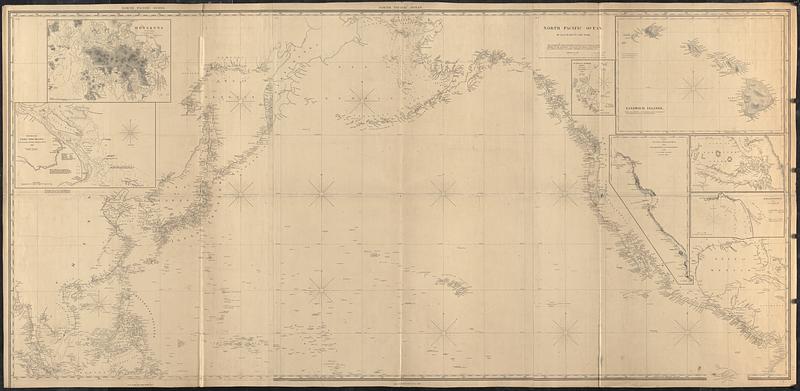
North Pacific Ocean
Item Information
- Title:
- North Pacific Ocean
- Cartographer:
- E. & G.W. Blunt (Firm)
- Name on Item:
-
by E. & G.W. Blunt
- Date:
-
[1865]
- Format:
-
Maps/Atlases
- Genre:
-
Nautical charts
- Location:
-
Boston Public Library
Norman B. Leventhal Map & Education Center - Collection (local):
-
Norman B. Leventhal Map & Education Center Collection
- Subjects:
-
North Pacific Ocean--Maps
Nautical charts--North Pacific Ocean
- Places:
-
North Pacific
- Extent:
- 1 map on 3 sheets : joined ; 94 x 196 cm
- Terms of Use:
-
No known copyright restrictions.
No known restrictions on use.
- Publisher:
-
New York :
E. & G.W. Blunt
- Scale:
-
Scale approximately 1:10,500,000
- Language:
-
English
- Notes:
-
Relief shown by hachures and spot heights. Depths shown by soundings.
"Additions to 1865."
"The authorities were furnished by Sir Francis Beaufort, R.N. Hydrographer to the Admiralty, Sir Edward Belcher, R.N., Captn. F.W. Beechy, R.N., Commr. S.F. Dupont, U.S.N., Captn. J. Rodgers and W.B. Whiting, U.S.N."
"Entered according to Act of Congress, in the year 1849, by E. & G.W. Blunt in the Clerks office of the District Court of the Southern District of New York."
Insets: Hongkong -- Mouths of the Yang-Tse-Kiang -- Guatulco Harbor, Mexico -- Sandwich Islands -- Part of upper California from San Francisco to Pt. Conception -- [Part of Vancouver Island] -- Ipala Roadstead.
- Notes (date):
-
This date is inferred.
- Identifier:
-
06_01_017417
- Call #:
-
G9236.P5 1865 .E22
- Barcode:
-
39999085959904