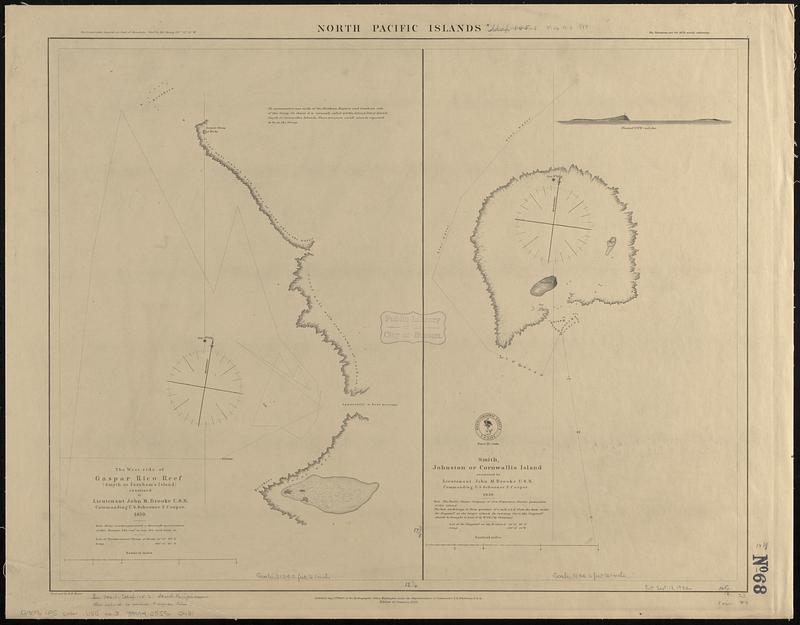
North Pacific islands
Item Information
- Title:
- North Pacific islands
- Issuing body:
- United States. Hydrographic Office
- Draftsman:
- Knorr, E. R. (Ernest Rudolph)
- Name on Item:
-
projected by E.R. Knorr
- Date:
-
1888
- Format:
-
Maps/Atlases
- Genre:
-
Nautical charts
- Location:
-
Boston Public Library
Norman B. Leventhal Map & Education Center - Collection (local):
-
Norman B. Leventhal Map & Education Center Collection
- Subjects:
-
Taongi Atoll (Marshall Islands)--Maps
Johnston Island--Maps
Nautical charts--Marshall Islands--Taongi Atoll
Nautical charts--Johnston Island
- Places:
-
Marshall IslandsTaongi Atoll
Johnston Atoll (territory)Johnston Island (island)
- Extent:
- 2 maps on 1 sheet ; 46 x 59 cm
- Terms of Use:
-
No known copyright restrictions.
No known restrictions on use.
- Publisher:
-
Washington, D.C. :
Hydrographic Office
- Edition:
- Edition of January 1888
- Scale:
-
Scale approximately 1:37,600
Scale approximately 1:37,600
- Language:
-
English
- Table of Contents:
-
Gorgona Island
Capraia Island
Pianosa Island
Elba Id., Campo Bay
Palmajola Channel
Elba Island, Port Ferrajo
Elba Island, Port Longone
Giglio Island
Formiche di Grosseto
Giannutri Isle
- Notes:
-
Depths shown by soundings and pictorially.
Includes coastal view of Flagstaff.
- Identifier:
-
06_01_017531
- Call #:
-
G9096.P5 svar .U55 no. 3
- Barcode:
-
39999085960431


