Toggle navigation
LMEC Home
Exhibitions
Georeferencing
Tools for Teachers
Collections
My Favorites
Sign Up / Log In
Search
Search the map portal
Map Collection
Map Collection
Map Sets
Search
Search
Search for
Search In
All Fields
Creator
Title
Subject
Place
Search All Digital Collections
Advanced Search
8696 Results
My Search
Start Over
More Like
commonwealth:3b595p67x
Remove constraint More Like: commonwealth:3b595p67x
Filter your Search
Place
North and Central America
5,926
United States
4,843
Massachusetts
2,078
Europe
1,396
Suffolk (county)
1,045
Boston
1,018
Canada
451
Asia
438
more
Place
»
Topic
Boston (Mass.)--Maps
586
United States--Maps
282
Real property--Massachusetts--Boston--Maps
175
Massachusetts--Maps
162
Landowners--Massachusetts--Boston--Maps
133
North America--Maps--Early works to 1800
103
New England--Maps
102
Europe--Maps
79
more
Topic
»
Date
Date range begin
–
Date range end
Current results range from
1482
to
2023
View distribution
Creator
United States. Hydrographic Office
595
O.H. Bailey & Co
148
Des Barres, Joseph F. W. (Joseph Frederick Wallet), 1722-1824
123
United States. Post Office Dept
120
Ptolemy, 2nd cent
100
Walling, Henry Francis, 1825-1888
94
Geological Survey (U.S.)
86
Jefferys, Thomas, -1771
85
more
Creator
»
Format
Maps/Atlases
8,636
Manuscripts
215
Prints
56
Books
36
Objects/Artifacts
10
Drawings/Illustrations
8
Posters
5
Georeferenced
Yes
869
No
7,827
Collection
Norman B. Leventhal Map & Education Center Collection
8,693
Boston and New England Maps
2,232
Urban Maps
2,023
Maritime Charts and Atlases
1,082
American Revolutionary War-Era Maps
618
Boston Redevelopment Authority Collection
87
Library and Archives Canada Collection
3
Available to use
No known restrictions
8,551
Creative Commons license
47
Search Constraints
Sort by relevance
relevance
title
date (asc)
date (desc)
Number of results to display per page
20 per page
10
per page
20
per page
50
per page
100
per page
View results as:
grid view
map view
Search Results
1.
Chart of Saint Clair River
2.
General chart of Lake Huron
3.
Harbor of Refuge, Sand Beach, Lake Huron
4.
Saginaw Bay and part of Lake Huron
5.
River S Claire
6.
Thunder Bay, Lake Huron
7.
The fifteenth section no. I. Lake Huron 1820 & 1822
8.
Northwestern part of Lake Huron
9.
Preliminary chart of Tawas Harbor : (harbor of refuge, Lake Huron)
10.
Preliminary chart of Tawas Harbor : (harbor of refuge, Lake Huron)
11.
Topographical plan of the north shore of Lake Huron shewing recent surveys
12.
Sketch of a route from Yorktown on Lake Ontario to Penatangasheen on Lake Huron - Upper Canada
13.
Sketch of a route from Yorktown on Lake Ontario to Penatangasheen on Lake Huron - Upper Canada
14.
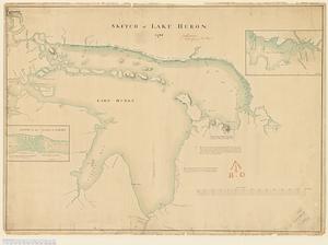
Sketch of Lake Huron
15.
The 100th anniversary map of Abraham Lincoln's visit to Massachusetts, September 11-23, 1848
16.
1630 shoreline
17.
1879. Progress map of the U.S. Geographical Surveys west of the 100th Meridian : prepared under the direction of 1st Lieut....
18.
1903 Map of Salem and surrounding places
19.
19th annual convention of the National Association of Real Estate Boards : at Tulsa, June 7 to June 11 in 1926
20.
2005 significant U.S. hurricane strikes
‹ Prev
Next ›
1
2
3
4
5
…
434
435