Toggle navigation
LMEC Home
Exhibitions
Georeferencing
Tools for Teachers
Collections
My Favorites
Sign Up / Log In
Search
Search the map portal
Map Collection
Map Collection
Map Sets
Search
Search
Search for
Search In
All Fields
Creator
Title
Subject
Place
Search All Digital Collections
Advanced Search
65 Results
My Search
Start Over
More Like
commonwealth:31981j159
Remove constraint More Like: commonwealth:31981j159
Filter your Search
Place
Canada
48
North and Central America
48
New France
25
Nova Scotia
15
Halifax
13
Saint Lawrence River
13
Quebec
9
Québec
9
more
Place
»
Topic
New France--Maps
25
Seven Years' War, 1756-1763--Campaigns--Canada--Maps
21
Saint Lawrence River--Maps
14
Halifax (N.S.)--Maps
13
Canada--Maps--Early works to 1800
8
Fortification--Québec (Province)
8
Québec (Québec)--Maps
8
United States--History--Revolution, 1775-1783--Maps
7
more
Topic
»
Date
Date range begin
–
Date range end
Current results range from
1749
to
1817
View distribution
Creator
Bellin, Jacques Nicolas, 1703-1772
8
Mackellar, Patrick, 1717-1778
7
Montrésor, John, 1736-1799
7
Holland, Samuel, 1728-1801
6
Collins, John, -1795
3
Duberger, Jean-Baptiste, 1767-1821
3
Gale, Samuel, 1747-1826
3
Sproule, Geo. F. (George F.), 1741-1817
3
more
Creator
»
Format
Maps/Atlases
65
Georeferenced
No
65
Collection
American Revolutionary War-Era Maps
65
Library and Archives Canada Collection
52
William L. Clements Library Collection
13
Search Constraints
Sort by relevance
relevance
title
date (asc)
date (desc)
Number of results to display per page
20 per page
10
per page
20
per page
50
per page
100
per page
View results as:
grid view
map view
Search Results
21.
Fortifications on île aux Noix, Québec
22.
A general plan of Annapolis Royal
23.
Golphe de Saint Laurent, contenant l'Isle de Terreneuve, Detroit de Belle-Isle, entrée du Fleuve St. Laurent, Isle Royale, et...
24.
Isle aux Noix
25.
A map of part of Canada for the use of His Majesty's Secretary of State, compiled in the Surveyor Generals Office, pursuant to...
26.
Map of Quebec City with plans of the citadel by Captain Samuel Holland for Report of the government of Quebec and dependencies
27.
Map showing land grants to the east of St. John
28.
[Monongahela] no. 2 : a sketch of the field of battle &c, shewing the disposition of the troops about 2 o'clock when the whole...
29.
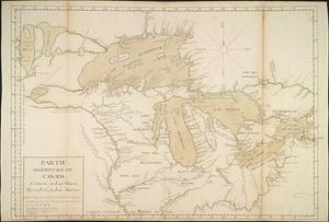
Partie occidentale du Canada contenant les lacs Ontario, Huron, Erié, et Lac Superieur
30.
Plan des forts de Chouaguen avec le débarquement, le camp et les attaques de l'armée commandée par Mr le Marquis de Montcalm,...
31.
Plan des terres de Abénaquis et Sokokis du village St-Francois situé dans le comté Buckinghamshire, district des Trois-Rivières...
32.
A plan of a new road in the parish of Dechambault
33.
Plan of Canada or the province of Quebec from the uppermost settlements to the island of Coudre as surveyed by order of his...
34.
Plan of Louisbourg, the harbour, part of the coast with the French retrenchments along the same and the attack by the British...
35.
Plan of old fort Frontenac and town plot of Kingston
36.
A plan of part of the province of New Brunswick, with the adjacent parts of the province of Lower Canada, and the territory of...
37.
Plan of part of the Province of Nova Scotia or Accadie
38.
Plan of part of the River Mississippi, from the River Yassous to the River Ibberville, shewing the lands granted thereon
39.
Plan of Quebec
40.
A plan of that part of the province of Lower Canada, lying between the rivers Saint Lawrence, Richelieu & the province line
‹ Prev
Next ›
1
2
3
4

![[Monongahela] no. 2 : a sketch of the field of battle &c, shewing the disposition of the troops about 2 o'clock when the whole of the main body had joined the advanced and working partys then beat back from the ground they occupied as in plan no. 1](https://bpldcassets.blob.core.windows.net/derivatives/images/commonwealth:j3863670v/image_thumbnail_300.jpg)
![Plan des forts de Chouaguen avec le débarquement, le camp et les attaques de l'armée commandée par Mr le Marquis de Montcalm, Jean-Nicolas Desandrouins [Oswego]](https://bpldcassets.blob.core.windows.net/derivatives/images/commonwealth:5138nc68v/image_thumbnail_300.jpg)