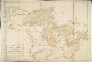
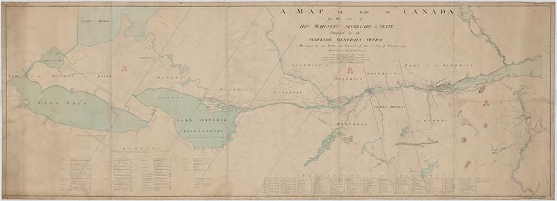
A map of part of Canada for the use of His Majesty's Secretary of State, compiled in the Surveyor Generals Office, pursuant to an Order in Council of the 22nd day of February 1790
This map is also available in American Revolutionary Geographies Online (ARGO), a collections portal especially built for material relating to the American Revolutionary War Era. Visit ARGO to learn more about this item and explore the historical geography of North America in the late eighteenth century.
Item Information
- Title:
- A map of part of Canada for the use of His Majesty's Secretary of State, compiled in the Surveyor Generals Office, pursuant to an Order in Council of the 22nd day of February 1790
- Cartographer:
- Holland, Samuel, 1728-1801
- Cartographer:
- Collins, John, -1795
- Date:
-
1790
- Format:
-
Maps/Atlases
- Genre:
-
Manuscript maps
- Location:
- Library and Archives Canada
- Collection (local):
-
Library and Archives Canada Collection
- Subjects:
-
Canada--Maps--Early works to 1800
Saint Lawrence River--Maps
Great Lakes (North America)--Maps--Early works to 1800
United States--Boundaries--Canada
- Places:
-
Saint Lawrence River
Great Lakes
- Extent:
- 1 manuscript map : hand color ; 49 x 137 cm
- Terms of Use:
-
Copyright expired. Contact host institution to download image.
Contact host institution for more information.
- Place of origin:
-
[Québec]
- Language:
-
English
- Catalog Record:
-
Catalog record
- Notes:
-
Board of Ordnance Stamp.
- Identifier:
-
e010775323
- Barcode:
-
4139944