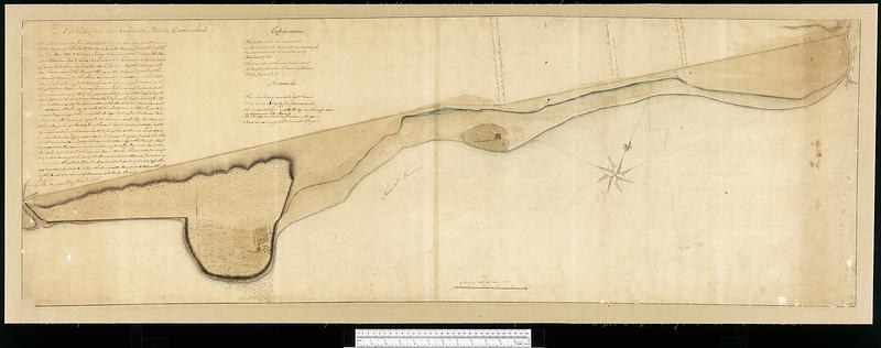
A plan of a new road in the parish of Dechambault
This map is also available in American Revolutionary Geographies Online (ARGO), a collections portal especially built for material relating to the American Revolutionary War Era. Visit ARGO to learn more about this item and explore the historical geography of North America in the late eighteenth century.
Item Information
- Title:
- A plan of a new road in the parish of Dechambault
- Cartographer:
- Collins, John, -1795
- Name on Item:
-
surveyed 22nd May 1767 John Collins, D.S. Genl.
- Date:
-
1767
- Format:
-
Maps/Atlases
- Genre:
-
Manuscript maps
- Location:
- Library and Archives Canada
- Collection (local):
-
Library and Archives Canada Collection
- Subjects:
-
Deschambault (Québec)--Maps
- Places:
-
CanadaDeschambault
- Extent:
- 1 manuscript map : hand color ; 50 x 146 cm
- Terms of Use:
-
Copyright expired. Contact host institution to download image.
Contact host institution for more information.
- Place of origin:
-
[Québec]
- Language:
-
English
- Catalog Record:
-
Catalog record
- Identifier:
-
n0011015k
- Barcode:
-
4127074

![Plan and project, for fortifying the high commanding ground at the church of Deschambeaux as also the island of Richlieu [sic]](https://bpldcassets.blob.core.windows.net/derivatives/metadata/commonwealth-oai:pz50mt24s/image_thumbnail_300.jpg)

![Carte des découvertes qui ont été faites dans la partie occidentale du Canada sur les mémoires de Mr de la Varanderie [Vérendrye]](https://bpldcassets.blob.core.windows.net/derivatives/images/commonwealth:wp98ck41z/image_thumbnail_300.jpg)
