Search Constraints
Search Results


229. P.W.A. in action


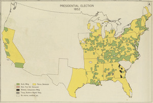
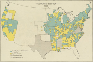
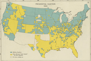
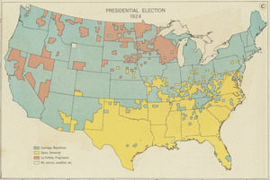
256. United States

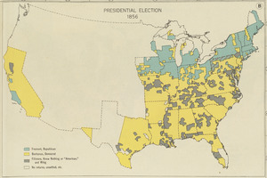
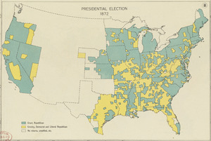
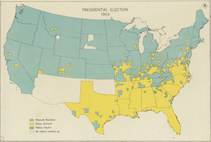
257. United States

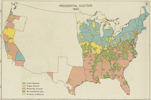
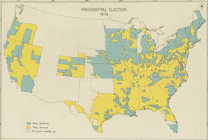
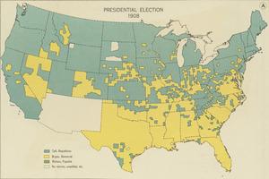
258. United States

![[United States]](https://bpldcassets.blob.core.windows.net/derivatives/images/commonwealth:7h149x55n/image_thumbnail_300.jpg)
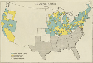
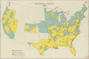
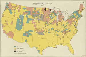
260. [United States]

261. United States

262. United States


264. United States

265. United States


292. Victory map

293. Victory map 1919


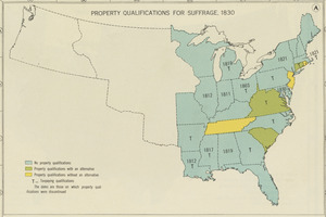
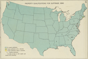
298. Woman suffrage, 1875

299. Woman suffrage, 1900
