The United States of America : including all its newly acquired territory
Item Information
- Title:
- The United States of America : including all its newly acquired territory
- Description:
-
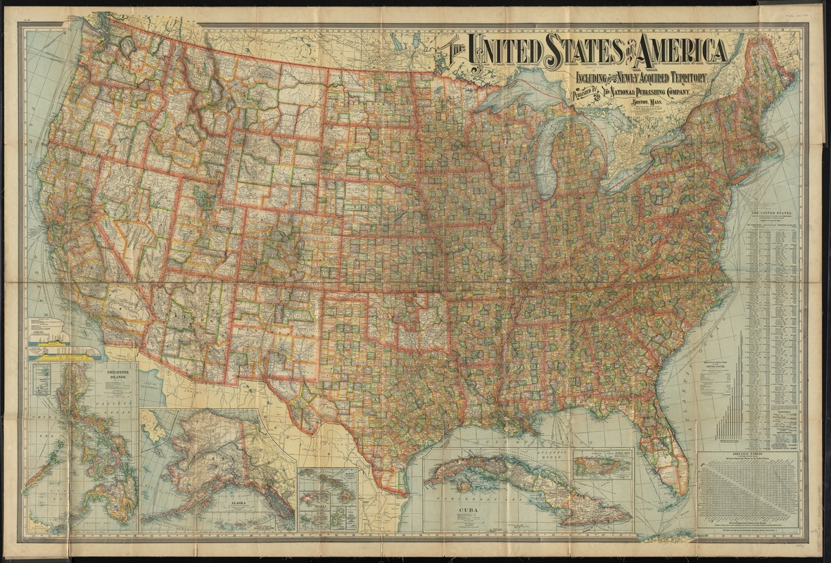
America Transformed: While this information-packed map summarizes the nation’s political geography and population growth after a century of territorial expansion and native removals, it also documents a new arena for empire building beyond the continent. Brightly colored boundaries outline 48 states and organized territories, as well as counties within each. Settlement in the eastern half of the country was denser than the West, which was characterized by much larger states and counties. Graphs and tables demonstrate the growth of population from 3.9 million in 1790 to over 76 million in 1900. Marginal insets depict Alaska and Hawaii (taken by a coordinated overthrow of the Hawaiian Queen just a few year prior), as well as "newly acquired territories" in the Caribbean and across the Pacific.
- Creator:
- National Publishing Company (Boston, Mass.)
- Date:
-
[ca. 1902]
- Format:
-
Maps/Atlases
- Location:
-
Boston Public Library
Norman B. Leventhal Map & Education Center - Collection (local):
-
Norman B. Leventhal Map & Education Center Collection
- Subjects:
-
United States--Maps
- Places:
-
United States
- Extent:
- 1 map : col. ; 96 x 138 cm., folded to 27 x 13 cm.
- Terms of Use:
-
No known copyright restrictions.
No known restrictions on use.
- Publisher:
-
Boston :
The Company
- Scale:
-
Scale [1:3,294,720]. 52 mi. = 1 in.
- Language:
-
English
- Notes:
-
Relief shown by hachures.
Insets: Cuba [and Porto Rico] -- Hawaiian [and South Pacific] Islands -- Alaska -- Philippine Islands.
Includes distance table, population charts, index to cities with population figures, and canal profiles.
- Notes (exhibitions):
-
Exhibited: "America transformed. Part 1: the United States expands westward," organized by the Norman B. Leventhal Map & Education Center at the Boston Public Library, 2019.
- Identifier:
-
06_01_009717
- Call #:
-
G3700 1902 .N37
- Barcode:
-
39999065663484


