Toggle navigation
LMEC Home
Exhibitions
Georeferencing
Tools for Teachers
Collections
My Favorites
Sign Up / Log In
Search
Search the map portal
Map Collection
Map Collection
Map Sets
Search
Search
Search for
Search In
All Fields
Creator
Title
Subject
Place
Search All Digital Collections
Advanced Search
323 Results
My Search
Start Over
More Like
commonwealth:q524nk114
Remove constraint More Like: commonwealth:q524nk114
Place
United States
Remove constraint Place: United States
Filter your Search
Place
United States
[remove]
323
North and Central America
322
New York
30
Mississippi
18
Chatham (county)
16
Louisiana
15
Savannah
14
Alabama
13
more
Place
»
Topic
Manuscript maps--Early works to 1800
67
Manuscript maps
18
Fortification--New York (State)--New York--Maps--Early works to 1800
11
Gulf Coast (U.S.)--Maps, Manuscript--Early works to 1800
10
New York (N.Y.)--Buildings, structures, etc--Maps, Manuscript--Early works to 1800
9
New York (N.Y.)--Maps, Manuscript--Early works to 1800
8
Saratoga Campaign, N.Y., 1777--Maps, Manuscript--Early works to 1800
8
Rhode Island (R.I. : Island)--Defenses--Maps, Manuscript--Early works to 1800
7
more
Topic
»
Date
Date range begin
–
Date range end
Current results range from
1700
to
1899
1700 : 1900
1700
1900
View distribution
Creator
Hills, John, (Surveyor)
16
Montrésor, John, 1736-1799
14
Dumont de Montigny
12
Bingham, William, 1752-1804
10
Adlum, John, 1759-1836
8
Washington, George, 1732-1799
8
Wangenheim, Friedrich Adam Julius von
7
Faden, William, 1749-1836
6
more
Creator
»
Format
Maps/Atlases
321
Manuscripts
319
Objects/Artifacts
2
Georeferenced
Yes
3
No
320
Collection
American Revolutionary War-Era Maps
319
Library of Congress Collection
298
Newberry Library Collection
23
Urban Maps
14
Maritime Charts and Atlases
13
Boston and New England Maps
3
Norman B. Leventhal Map & Education Center Collection
2
Available to use
Creative Commons license
298
No known restrictions
2
Search Constraints
Sort by relevance
relevance
title
date (asc)
date (desc)
Number of results to display per page
20 per page
10
per page
20
per page
50
per page
100
per page
View results as:
grid view
map view
Search Results
1.
20 tracts, Charleston
2.
Armstrong County
3.
Boston & harbour
4.
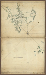
Boston Harbor, Massachusetts
5.
Carte de l'entrée du port et rade de Pensacola
6.
Dotted line map of Washington, D.C., 1791, before Aug. 19th
7.
Draft of roads in New Jersey
8.
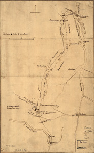
A draught of Lake George, and part of Hudson's River taken September 1756
9.
Fort Edward to Crown Point
10.
Jefferson, Venango & Armstrong
11.
Land ownership map of the William Bingham estate in Potter County, Pennsylvania
12.
Map of part of the city of Washington shewing the situation of the mansion house, grave yard & buildings belonging to Mr....
13.
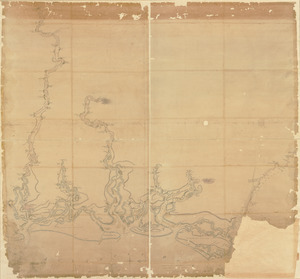
Map of the coast of Georgia, bordering on Camden and Glynn counties : showing also the course and soundings of the Alatamaha,...
14.
New Hampshire
15.
Pansacola o Santta María de Galbe, puerto y presidio del Ry. de España situado en la costa del nortte del Seno Mexicano, los...
16.
Plan of a rout undertaken in winter, Jany. 26th : from Quebec, the capital of Canada, to the frontier settlements of the...
17.
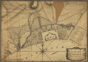
A plan of Pensacola and its environs in its present state : from an actual survey in 1778
18.
Plan of the attack on Fort William Henry and Ticonderoga : showing the road from Fort Edward, Montcalm's camp and wharf of...
19.
A Plan of the Battle of Bunker Hill
20.
Plan of the city intended for the permanent seat of the government of t[he] United States : projected agreeable to the...
+
-
Redo search here
Search when I move the map
Leaflet
| ©
OpenStreetMap
contributors, ©
CartoDB
‹ Prev
Next ›
1
2
3
4
5
…
16
17


![Plan of the city intended for the permanent seat of the government of t[he] United States](https://bpldcassets.blob.core.windows.net/derivatives/images/commonwealth:q524nf917/image_thumbnail_300.jpg)
