Toggle navigation
LMEC Home
Exhibitions
Georeferencing
Tools for Teachers
Collections
My Favorites
Sign Up / Log In
Search
Search the map portal
Map Collection
Map Collection
Map Sets
Search
Search
Search for
Search In
All Fields
Creator
Title
Subject
Place
Search All Digital Collections
Advanced Search
627 Results
My Search
Start Over
More Like
commonwealth:6t053q461
Remove constraint More Like: commonwealth:6t053q461
Collection
American Revolutionary War-Era Maps
Remove constraint Collection: American Revolutionary War-Era Maps
Filter your Search
Place
North and Central America
577
United States
362
Canada
109
Massachusetts
82
North America
71
New York
52
Nova Scotia
50
Suffolk (county)
47
more
Place
»
Topic
North America--Maps--Early works to 1800
55
Nova Scotia--Maps--Early works to 1800
35
Coasts--Nova Scotia--Maps--Early works to 1800
27
Nautical charts--Nova Scotia--Early works to 1800
24
Boston (Mass.)--Maps--Early works to 1800
23
New England--Maps--Early works to 1800
20
Atlantic Coast (Me.)--Maps--Early works to 1800
19
United States--Maps--Early works to 1800
19
more
Topic
»
Date
Date range begin
–
Date range end
Current results range from
1720
to
1973
1720 : 1974
1720
1974
1725
1750
1775
1800
1825
1850
1875
1900
1925
1950
Creator
Des Barres, Joseph F. W. (Joseph Frederick Wallet), 1722-1824
120
Jefferys, Thomas, -1771
54
Sayer, Robert, 1725-1794
47
Jefferys, Thomas, d. 1771
25
Bellin, Jacques Nicolas, 1703-1772
21
Carey, Mathew, 1760-1839
15
Faden, William, 1749-1836
15
Kitchin, Thomas, d. 1784
14
more
Creator
»
Format
Maps/Atlases
627
Manuscripts
15
Objects/Artifacts
1
Georeferenced
Yes
35
No
592
Collection
American Revolutionary War-Era Maps
[remove]
627
Norman B. Leventhal Map & Education Center Collection
614
Maritime Charts and Atlases
181
Boston and New England Maps
126
Urban Maps
44
Richard H. Brown Revolutionary War Map Collection at Mount Vernon
6
New York Public Library Collection
3
New-York Historical Society Collection
2
more
Collection
»
Available to use
No known restrictions
614
Creative Commons license
11
Search Constraints
Sort by relevance
relevance
title
date (asc)
date (desc)
Number of results to display per page
20 per page
10
per page
20
per page
50
per page
100
per page
View results as:
grid view
map view
Search Results
1.
Particular draughts and plans of some of the principal towns and harbours belonging to the English, French, and Spaniards, in...
2.
Plan de New-York et des environs
3.
A plan of the city and environs of New York in North America
4.
The provinces of New York and New Jersey : with part of Pensilvania, and the Province of Quebec
5.
An accurate map of Staten Island : with that part of New York, Long Island and the Jerseys, which is the rendesvous of the two...
6.
Attaque de l'armée des provinciaux dans Long Island du 27. Aoust 1776 : dessin de l'isle de New-York et des Etats
7.
Carte d'un partie de l'Amerique Septentrionale : ou est tracée notre route d'Halifax à New York, par Quebec, Montreal, le Lac...
8.
A new & accurate plan of the city of New York in the state of New York in North America
9.
A new & accurate plan of the city of New York in the state of New York in North America
10.
Plan of the city of New York in North America : surveyed in the years 1766 & 1767
11.
Plan of the city of New York in North America : surveyed in the years 1766 & 1767
12.
PLAN of the CITY of NEW YORK, in North America : Surveyed in the Years 1766 & 1767
13.
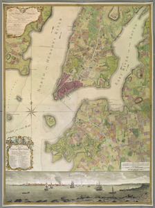
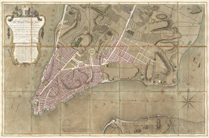
A plan of the city of New-York & its environs to Greenwich, on the North or Hudsons River, and to Crown Point, on the East or...
14.
A south east view of the city of New York, in North America = Vue de sud est de la ville de New York, dans l'Amerique...
15.
A south west view of the city of New York, in North America = Vue de sud ouest de la ville de New York, dans l'Amerique...
16.
To His Excellency Sr. Henry Moore, Bart., captain general and governour in chief in & over the province of New York & the...
17.
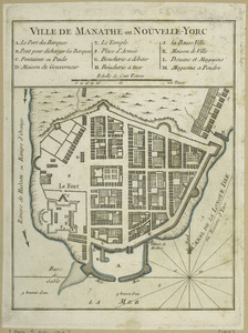
Ville de Manathe ou Nouvelle-Yorc
18.
[A chart of Boston Bay and vicinity]
19.
[A chart of New York Island & North River : East River, passage through Hell Gate, Flushing Bay, Hampstead Bay, Oyster,...
20.
An accurate map of Cuba, and the adjacent islands
+
-
Redo search here
Search when I move the map
Leaflet
| ©
OpenStreetMap
contributors, ©
CartoDB
‹ Prev
Next ›
1
2
3
4
5
…
31
32


![A plan of the city of New-York & its environs to Greenwich, on the North or Hudsons River, and to Crown Point, on the East or Sound River, shewing the several streets, publick buildings, docks, fort & battery, with the true form & course of the commanding grounds, with and without the town : survey'd in the winter, 1775 [i.e. 1766]](https://bpldcassets.blob.core.windows.net/derivatives/images/commonwealth:z603vs09b/image_thumbnail_300.jpg)


![[A chart of Boston Bay and vicinity]](https://bpldcassets.blob.core.windows.net/derivatives/images/commonwealth:cj82m2976/image_thumbnail_300.jpg)


