Toggle navigation
LMEC Home
Exhibitions
Georeferencing
Tools for Teachers
Collections
My Favorites
Sign Up / Log In
Search
Search the map portal
Map Collection
Map Collection
Map Sets
Search
Search
Search for
Search In
All Fields
Creator
Title
Subject
Place
Search All Digital Collections
Advanced Search
13680 Results
Filter your Search
Place
North and Central America
10,344
United States
8,475
Massachusetts
2,789
Suffolk (county)
1,677
Boston
1,633
Europe
1,415
Canada
950
New York
649
more
Place
»
Topic
Boston (Mass.)--Maps
747
City planning--Massachusetts--Boston--Maps
418
United States--History--Revolution, 1775-1783--Maps
329
United States--Maps
322
Real property--Massachusetts--Boston--Maps
254
Urban renewal--Massachusetts--Boston--Maps
254
Massachusetts--Maps
231
Insurance surveys
197
more
Topic
»
Date
Date range begin
–
Date range end
Current results range from
1482
to
2023
View distribution
Creator
United States. Hydrographic Office
597
Boston Redevelopment Authority
404
Des Barres, Joseph F. W. (Joseph Frederick Wallet), 1722-1824
247
Royal United Services Institute for Defence and Security Studies
160
Jefferys, Thomas, -1771
154
George, III, King of Great Britain, 1738-1820
152
George, IV, King of Great Britain, 1762-1830
151
O.H. Bailey & Co
148
more
Creator
»
Format
Maps/Atlases
13,499
Manuscripts
985
Prints
102
Books
49
Drawings/Illustrations
44
Photographs
15
Objects/Artifacts
13
Documents
7
more
Format
»
Georeferenced
Yes
979
No
12,701
Collection
Norman B. Leventhal Map & Education Center Collection
9,096
American Revolutionary War-Era Maps
3,305
Boston and New England Maps
2,915
Urban Maps
2,471
Maritime Charts and Atlases
1,169
William L. Clements Library Collection
910
Library of Congress Collection
618
Boston Redevelopment Authority Collection
475
more
Collection
»
Available to use
No known restrictions
10,246
Creative Commons license
1,678
Search Constraints
Sort by relevance
relevance
title
date (asc)
date (desc)
Number of results to display per page
20 per page
10
per page
20
per page
50
per page
100
per page
View results as:
grid view
map view
Search Results
5381.
Map of North River from Stoney Point to Peeks Kill
5382.
Map of northern Georgia
5383.
Map of northern Luzon
5384.
Map of northern Luzon, showing a portion of the field of operations of the 8th Army Corps, Major General Elwell S. Otis commanding
5385.
Map of northern part of New York City
5386.
Map of Nova Scotia, or Acadia : with the islands of Cape Breton and St. John's, from actual surveys
5387.
Map of Nova Scotia, or Acadia : with the islands of Cape Breton and St. John's, from actual surveys
5388.
Map of Oklahoma Territory
5389.
Map of old Reading, Massachusetts Bay Colony, 1647
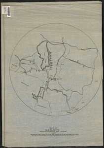
5390.
Map of old Reading, Massachusetts Bay Colony, 1651
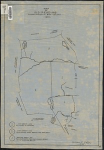
5391.
Map of Ontario and Quebec showing location and capacity of flour mills and elevators
5392.
Map of Ontario County, New York : from actual surveys
5393.
Map of Orange and Rockland counties area of New York
5394.
Map of Oregon and upper California, from the surveys of John Charles Frémont and other authorities
5395.
Map of Oshkosh
5396.
Map of Palestine and all Bible lands, containing the ancient and modern names of all known places, a table of seasons, weather,...
5397.
Map of part of Boston, Mass
5398.
Map of part of Cambridge, Mass
5399.
A map of part of Canada for the use of His Majesty's Secretary of State, compiled in the Surveyor Generals Office, pursuant to...
5400.
A map of part of New-York Island showing a plan of Fort Washington : now call'd Ft. Kniphausen with the rebels lines on the...
‹ Prev
Next ›
1
2
…
266
267
268
269
270
271
272
273
274
…
683
684