Toggle navigation
LMEC Home
Exhibitions
Georeferencing
Tools for Teachers
Collections
My Favorites
Sign Up / Log In
Search
Search the map portal
Map Collection
Map Collection
Map Sets
Search
Search
Search for
Search In
All Fields
Creator
Title
Subject
Place
Search All Digital Collections
Advanced Search
13494 Results
Filter your Search
Place
North and Central America
10,209
United States
8,344
Massachusetts
2,768
Suffolk (county)
1,670
Boston
1,626
Europe
1,386
Canada
949
New York
640
more
Place
»
Topic
Boston (Mass.)--Maps
743
City planning--Massachusetts--Boston--Maps
418
United States--History--Revolution, 1775-1783--Maps
329
United States--Maps
316
Urban renewal--Massachusetts--Boston--Maps
254
Real property--Massachusetts--Boston--Maps
253
Massachusetts--Maps
230
Insurance surveys
197
more
Topic
»
Date
Date range begin
–
Date range end
Current results range from
1482
to
2023
View distribution
Creator
United States. Hydrographic Office
596
Boston Redevelopment Authority
404
Des Barres, Joseph F. W. (Joseph Frederick Wallet), 1722-1824
247
Royal United Services Institute for Defence and Security Studies
160
Jefferys, Thomas, -1771
154
George, III, King of Great Britain, 1738-1820
152
George, IV, King of Great Britain, 1762-1830
151
O.H. Bailey & Co
148
more
Creator
»
Format
Maps/Atlases
13,313
Manuscripts
985
Prints
102
Books
49
Drawings/Illustrations
44
Photographs
15
Objects/Artifacts
13
Documents
7
more
Format
»
Georeferenced
Yes
979
No
12,515
Collection
Norman B. Leventhal Map & Education Center Collection
9,000
American Revolutionary War-Era Maps
3,305
Boston and New England Maps
2,887
Urban Maps
2,415
Maritime Charts and Atlases
1,167
William L. Clements Library Collection
910
Library of Congress Collection
618
Boston Redevelopment Authority Collection
475
more
Collection
»
Available to use
No known restrictions
10,061
Creative Commons license
1,677
Search Constraints
Sort by relevance
relevance
title
date (asc)
date (desc)
Number of results to display per page
20 per page
10
per page
20
per page
50
per page
100
per page
View results as:
grid view
map view
Search Results
13161.
Washington Park urban renewal area r-24 : proposed treatment section boundaries
13162.
Washington Park urban renewal area r-24 : zone district changes plan
13163.
Washington Park urban renewal area r-24 : property map
13164.
Washington Park urban renewal area r-24 : buildings with deficiencies
13165.
Washington Park urban renewal area r-24 : building condition
13166.
Washington Park urban renewal area r-24 : proposed zoning plan
13167.
Washington Park urban renewal area r-24 : existing zoning
13168.
Washington, Rhode Island : 1888
13169.
Washington Sound and approaches, Washington Territory, 1866
13170.
Washington Street boulevard study : generalized land use - proposed
13171.
Washington Street boulevard study : proposed fabric
13172.
Washington Street boulevard study : corridor wide urban design strategy
13173.
Washington Street corridor : South Cove to Forest Hills
13174.
Washington Territory
13175.
Washingtons position at Morristown 1780 : headquarters at Fords house
13176.
Wastewater system map, Boston proper, sheet no. 21h
13177.
Wastewater system map, Boston proper, sheet no. 23h
13178.
Water distribution system map, Boston proper, sheet no. 21h
13179.
Water distribution system map, Boston proper, sheet no. 22h
13180.
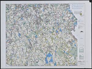
Water resources in southeastern Massachusetts
‹ Prev
Next ›
1
2
…
655
656
657
658
659
660
661
662
663
…
674
675