Toggle navigation
LMEC Home
Exhibitions
Georeferencing
Tools for Teachers
Collections
My Favorites
Sign Up / Log In
Search
Search the map portal
Map Collection
Map Collection
Map Sets
Search
Search
Search for
Search In
All Fields
Creator
Title
Subject
Place
Search All Digital Collections
Advanced Search
58 Results
My Search
Start Over
1963
Remove constraint 1963
Filter your Search
Place
North and Central America
56
United States
54
Boston
47
Suffolk (county)
47
Fens
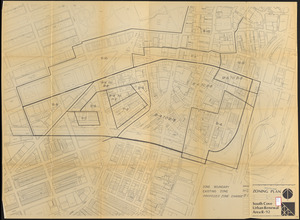
19
Mission Hill
14
Roxbury
8
Chinatown
7
more
Place
»
Topic
City planning--Massachusetts--Boston--Maps
46
Urban renewal--Massachusetts--Boston--Maps
32
Fenway (Boston, Mass.)--Maps
19
Mission Hill (Boston, Mass.)--Maps
14
Land use--Massachusetts--Boston--Maps
10
Longwood Medical Area (Boston, Mass.)--Maps
10
Chinatown (Boston, Mass.)--Maps
8
Roxbury (Boston, Mass.)--Maps
8
more
Topic
»
Date
Date range begin
–
Date range end
Current results range from
1735
to
1979
View distribution
Creator
Boston Redevelopment Authority
43
Charles A. Maguire and Associates
5
George, III, King of Great Britain, 1738-1820
2
Baltimore, Charles Calvert, Baron, 1699-1751
1
Campbell and Aldrich
1
Cooley, Banjamin
1
Cooley, Benjamin
1
Du Bois, W. E. B. (William Edward Burghardt), 1868-1963
1
more
Creator
»
Format
Maps/Atlases
57
Drawings/Illustrations
1
Manuscripts
1
Georeferenced
Yes
2
No
56
Collection
Boston and New England Maps
48
Urban Maps
47
Boston Redevelopment Authority Collection
46
Norman B. Leventhal Map Center Collection
8
American Revolutionary War-Era Maps
2
British Library Collection
2
Town plans, 1830
2
Lucius Beebe Memorial Library Historic Maps
1
Available to use
No known restrictions
56
Creative Commons license
2
Search Constraints
Sort by relevance
relevance
title
date (asc)
date (desc)
Number of results to display per page
50 per page
10
per page
20
per page
50
per page
100
per page
View results as:
grid view
map view
Search Results
1.
Plan of Whately made by Benjamin Cooley, dated 1830
2.
Maps with a moral
3.
New Orleans
4.
Building deficiencies map : Government Center project no. Mass. R-35
5.
A nation of immigrants
6.
The Seventh Ward of Philadelphia : the distribution of Negro inhabitants throughout the ward, and their social conditions
7.
Proposed Maryland / Pennsylvania Boundary
8.
Town of Wakefield Mass. stormwater drainage report : general plan showing street layout and surface topography
9.
PLAN DU FORT AUGUSTA
10.
Map of Ho-De-No-Sau-Nee-Ga or the people of the long house : compiled 1851 by Lewis H. Morgan & Ely S. Parker a Seneca sachem...
11.
A map of the state of Maine
12.
Charlestown urban renewal area r-55 : building deficiencies
13.
Charlestown urban renewal area r-55 : existing land use
14.
Fenway urban renewal area : major thoroughfares
15.
Fenway urban renewal area : blighted areas
16.
Fenway urban renewal area : locality map
17.
Fenway urban renewal area : existing land use
18.
Fenway urban renewal area : building conditions
19.
Fenway urban renewal area : treatment areas
20.
Land use New York streets - South Cove 1953
21.
Parcel 10 : Sears Crescent, Government Center
22.
Plan for construction of a new city hall in Boston
23.
Relationship of TNEMC development plan area to New York streets land assembly and redevelopment project
24.
Roxbury-N. Dorchester G.N.R.P. r-50 : existing & proposed community facilities
25.
Roxbury-N. Dorchester G.N.R.P. r-50 : existing circulation
26.
Roxbury-N. Dorchester G.N.R.P. r-50 : proposed treatment and title I projects
27.
Roxbury-N. Dorchester G.N.R.P. r-50 : proposed circulation
28.
Roxbury-N. Dorchester G.N.R.P. r-50 : proposed land use
29.
Roxbury-N. Dorchester G.N.R.P. r-50 : existing building conditions
30.
Roxbury-N. Dorchester G.N.R.P. r-50 : existing population density
31.
Sketches of a building to be constructed in City Hall Plaza north of Boston City Hall
32.
South Cove project no Mass r- : locality map 2
33.
South Cove project no Mass r- : locality map 1
34.
South Cove property ownership 1950
35.
South Cove property ownership 1962
36.
South Cove proposed land use
37.
T-N.E.M.C. development area existing building condition
38.
T-N.E.M.C. properties acquired 1945-58
39.
Columbia Point feasibility survey area
40.
South Cove urban renewal area R-92 : zoning plan
41.
Back Bay project no. Mass R-47
42.
Back Bay project no. Mass. R-47 : police signal system, fire alarm system and M.T.A. facilities
43.
Cooperative housing : Whitney Street
44.
Parker Hill-Fenway project no. Mass. R-48 : police signal system, fire alarm system and M.T.A. facilities
45.
Parker Hill-Fenway project no. Mass. R-48 : sewer and storm drain system
46.
Parker Hill-Fenway project no. Mass. R-48 : water distribution system
47.
Parker Hill-Fenway urban renewal area r-48 : building conditions
48.
Parker Hill-Fenway urban renewal area r-48 : existing building coverage
49.
Parker Hill-Fenway urban renewal area r-48 : existing and proposed community facilities
50.
Parker Hill-Fenway urban renewal area r-48 : proposed circulation
‹ Prev
Next ›
1
2