Parker Hill-Fenway project no. Mass. R-48 : sewer and storm drain system

Item Information
- Title:
- Parker Hill-Fenway project no. Mass. R-48 : sewer and storm drain system
- Description:
-
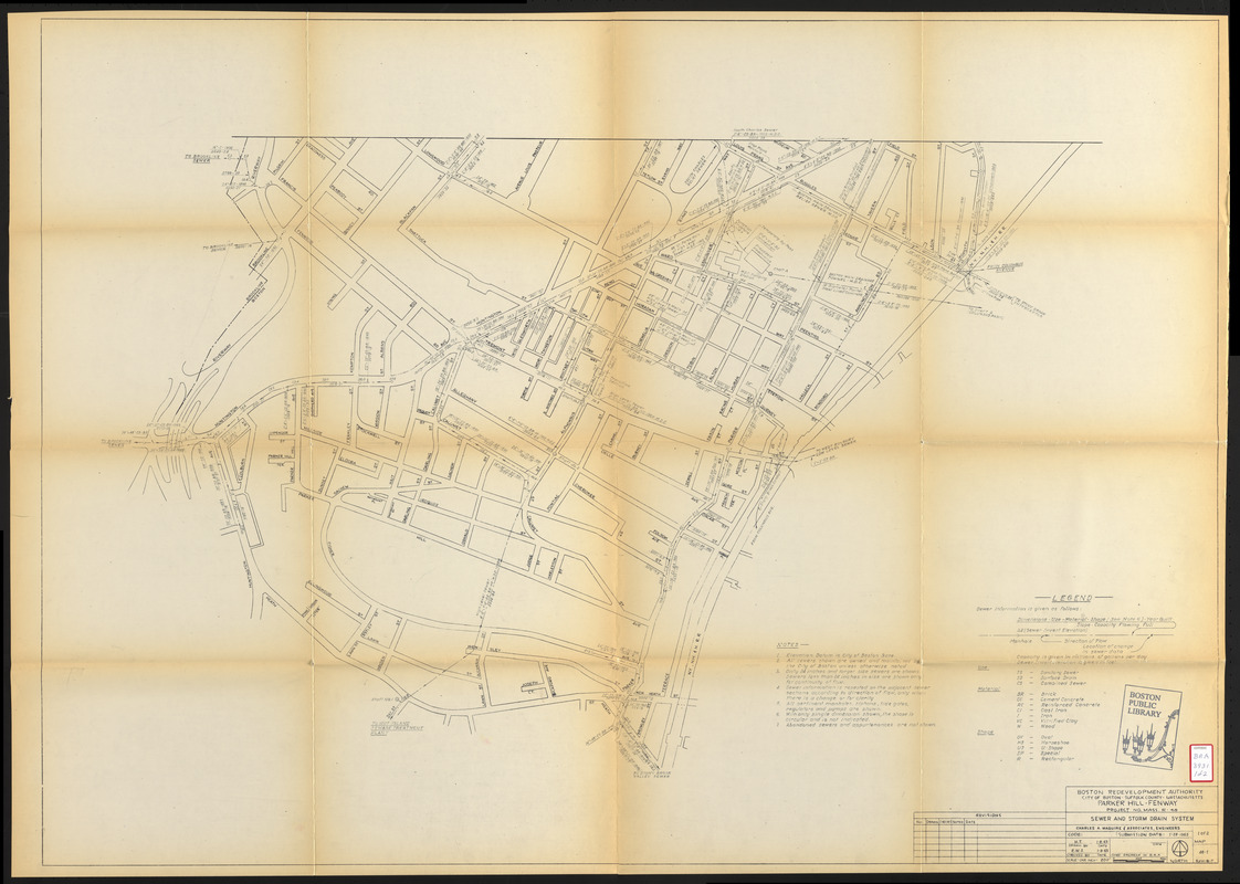
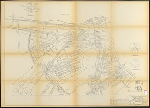
Maps of Boston's Parker Hill/Fenway neighborhood urban renewal area depicting the sewer and storm drain system. Includes the following: dimensions, use, material of which built, shape, year built, slope, capacity flowing full, invert elevation, direction of flow and manhole locations.
- Cartographer:
- Charles A. Maguire and Associates
- Publisher:
- Boston Redevelopment Authority
- Date:
-
January 28, 1963
- Format:
-
Maps/Atlases
- Location:
-
Boston Public Library
Central Library in Copley Square - Collection (local):
-
Boston Public Library Collection
- Subjects:
-
Storm sewers--Massachusetts--Boston--Maps
Sewerage--Massachusetts--Boston--Maps
Fenway (Boston, Mass.)--Maps
Mission Hill (Boston, Mass.)--Maps
City planning--Massachusetts--Boston--Maps
- Places:
-
Suffolk (county)BostonFens
Mission Hill
- Extent:
- 2 maps ; 84 x 117 cm
- Terms of Use:
-
No known copyright restrictions.
No known restrictions on use.
- Publisher:
-
[Boston] :
Boston Revelopment Authority
- Scale:
-
Scale 1:2,400
- Language:
-
English
- Table of Contents:
-
Map 1
Map 2
- Catalog Record:
-
http://bpl.bibliocommons.com/item/show/1031839075
- Notes:
-
Map 2 includes 2 sections showing flow and 1 detail of the intersection of Commonwealth Ave and St. Mary's St.
- Identifier:
-
06_01_017212A
06_01_017212B
- Call #:
-
BRA/3931
- Barcode:
-
mq6328511


