Toggle navigation
LMEC Home
Exhibitions
Georeferencing
Tools for Teachers
Collections
My Favorites
Sign Up / Log In
Search
Search the map portal
Map Collection
Map Collection
Map Sets
Search
Search
Search for
Search In
All Fields
Creator
Title
Subject
Place
Search All Digital Collections
Advanced Search
202 Results
My Search
Start Over
1877
Remove constraint 1877
Filter your Search
Place
North and Central America
95
United States
73
Oceania
37
Massachusetts
29
Europe
27
South America
23
Asia
16
Chile
14
more
Place
»
Topic
United States Exploring Expedition (1838-1842)
16
Canada--Boundaries--United States--Maps
13
United States--Boundaries--Canada--Maps
13
United States--History--War of 1812--Territorial questions--Maps
13
Balkan Peninsula--Maps
7
Tuamotu Archipelago (French Polynesia)--Maps
7
Turkey--Maps
7
Coasts--Chile--Maps
4
more
Topic
»
Date
Date range begin
–
Date range end
Current results range from
1755
to
1952
View distribution
Creator
United States. Hydrographic Office
42
Wilkes, Charles, 1798-1877
38
United States Exploring Expedition (1838-1842)
35
Sherman & Smith
21
Barclay, Anthony, 1792-1877
13
Porter, Peter B. (Peter Buell), 1773-1844
13
United States. Light-House Board
13
Thompson, David, 1770-1857
11
more
Creator
»
Format
Maps/Atlases
201
Manuscripts
1
Photographs
1
Georeferenced
Yes
10
No
192
Collection
Norman B. Leventhal Map & Education Center Collection
191
Maritime Charts and Atlases
81
Urban Maps
46
Boston and New England Maps
42
American Antiquarian Society Collection
4
American Revolutionary War-Era Maps
4
Town plans, 1830
4
American Textile History Museum Image Collection
2
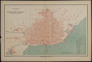
more
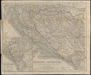
Collection
»
Available to use
No known restrictions
192
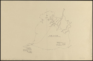
Creative Commons license
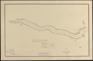
2
Search Constraints
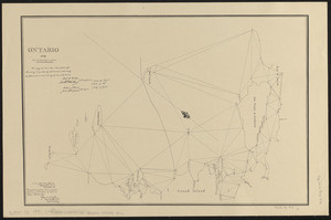
Sort by relevance
relevance
title
date (asc)
date (desc)
Number of results to display per page
20 per page
10
per page
20
per page
50
per page
100
per page
View results as:
grid view
map view
Search Results
121.
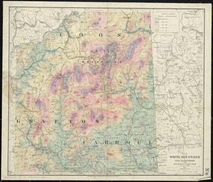
Map of the White Mountains of New Hampshire from Walling's large map of the state, 1881
122.
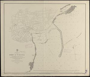
Mediterranean Sea, east coast of Sicily, Port of Catania
123.
City of Boston improved sewerage : plan showing location of main and secondary intercepting sewers
124.
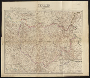
Serbien : nach Österreichischen und Russischen aufnahmen und ortsbestimmungen, und den karten von Viquesnel und Bugarski
125.
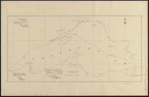
Lake Superior
126.
View of Dedham, Mass. in 1876
127.
Plan of the Inner Harbor of Boston
128.
Plan de Buenos-Ayres (Confédération Argentine)
129.
Bosnien und Dalmatien : vorzüglich nach österreichischen aufnahmen, mit benutzung von a Boués reisen (Montenegro nach...
130.
Deans, Krusensterns, and Lazareff Islands
131.
Detroit 1820
132.
The fifteenth section no. I. Lake Huron 1820 & 1822
133.
Iroquois or St. Lawrence
134.
Lake St. Clair
135.
Niagara 1819
136.
Northwestern part of Lake Huron
137.
Ontario 1819
138.
River S Claire
139.
The second section of the survey of 1819
140.
South west end of Lake Erie
‹ Prev
Next ›
1
2
3
4
5
6
7
8
9
10
11