Toggle navigation
LMEC Home
Exhibitions
Georeferencing
Tools for Teachers
Collections
My Favorites
Sign Up / Log In
Search
Search the map portal
Map Collection
Map Collection
Map Sets
Search
Search
Search for
Search In
All Fields
Creator
Title
Subject
Place
Search All Digital Collections
Advanced Search
136 Results
My Search
Start Over
1895
Remove constraint 1895
Filter your Search
Place
North and Central America
129
United States
116
Massachusetts
35
Boston
18
Suffolk (county)
18
Michigan
17
Middlesex (county)
8
New York
7
more
Place
»
Topic
Boston (Mass.)--Maps
15
Huron, Lake (Mich. and Ont.)--Maps
5
Nautical charts--Superior, Lake
5
Chicago (Ill.)--Maps
4
Chicago (Ill.)--Salaries, etc--Maps
4
Ethnology--Illinois--Chicago--Maps
4
Michigan, Lake--Maps
4
Nautical charts--Huron, Lake (Mich. and Ont.)
4
more
Topic
»
Date
Date range begin
–
Date range end
Current results range from
1830
to
1963
View distribution
Creator
Dougal, William H., 1822-1895
29
U.S. Lake Survey
26
United States. Post Office Dept
23
Macomb, J. N. (John N.), 1810 or 1811-1889
15
Meade, George Gordon, 1815-1872
13
United States. Topographical Bureau
11
Mueller, J. U. (John U.)
10
Raynolds, W. F. (William Franklin), 1820-1894
10
more
Creator
»
Format
Maps/Atlases
135
Books
2
Manuscripts
1
Photographs
1
Prints
1
Georeferenced
Yes
31
No
105
Collection
Norman B. Leventhal Map & Education Center Collection
127
Boston and New England Maps
38
Urban Maps
32
Maritime Charts and Atlases
22
Massachusetts Real Estate Atlases
5
Robert E. Diefenbach Map Collection at Phillips Academy
3
Mapping Boston Collection
1
Town plans, 1830
1
Available to use
No known restrictions
130
Creative Commons license
1
Search Constraints
Sort by relevance
relevance
title
date (asc)
date (desc)
Number of results to display per page
20 per page
10
per page
20
per page
50
per page
100
per page
View results as:
grid view
map view
Search Results
81.
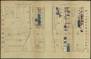
Nationalities map no. 3 - Polk Street to Twelfth, Beach Street to Pacific Avenue, Chicago ; Nationalities map no. 4 - Polk...
82.
Wage map no. 1 - Polk Street to Twelfth, Halsted Street to Jefferson, Chicago ; Wage map no. 2 - Polk Street to Twelfth,...
83.
Wage map no. 3 - Polk Street to Twelfth, Beach Street to Pacific Avenue, Chicago ; Wage map no. 4 - Polk Street to Twelfth,...
84.
Kelley's and Bass Islands showing the harbors of refuge in their vicinity being an extract from the survey of the west end of...
85.
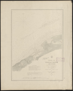
Preliminary chart of Eagle River, Lake Superior
86.
Chart of Saint Clair River
87.
North end of Lake Michigan including Green Bay and the straits of Mackinac
88.
Thunder Bay, Lake Huron
89.
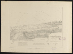
Preliminary chart of Agate Harbor, Lake Superior
90.
Preliminary chart of Agate Harbor, Lake Superior
91.
Head of Green Bay and entrance to Fox River, Wisconsin : from surveys under the direction of the Bureau of Topographical...
92.
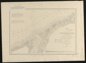
Preliminary chart of Ontonagon Harbor, Lake Superior : from surveys under the direction of the Topographical Bureau of the War...
93.
Map of the state of Alabama
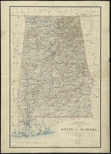
94.
Map of the state of Ohio
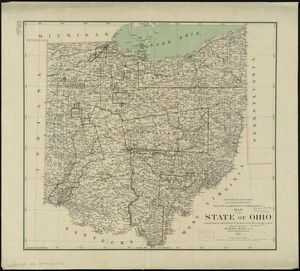
95.
Map of the state of Wisconsin
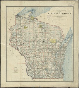
96.
Rand, McNally & Co.'s indexed atlas of the world map of Quebec
97.
Atlas of the city of Boston : Boston proper and Roxbury : from actual surveys and official plans
98.
Atlas of the city of Newton, Massachusetts : from actual surveys and official plans
99.
Atlas of the city of Northampton and the town of Easthampton, Hampshire County, Massachusetts
100.
Atlas of the city of Somerville, Massachusetts : from actual surveys and official plans
‹ Prev
Next ›
1
2
3
4
5
6
7